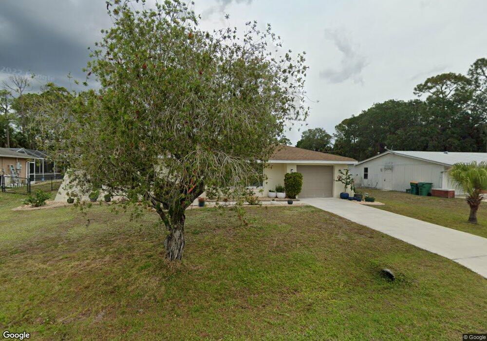
1485 Atlas St Port Charlotte, FL 33952
Estimated Value: $197,000 - $226,000
2
Beds
2
Baths
1,069
Sq Ft
$198/Sq Ft
Est. Value
About This Home
This home is located at 1485 Atlas St, Port Charlotte, FL 33952 and is currently estimated at $211,458, approximately $197 per square foot. 1485 Atlas St is a home located in Charlotte County with nearby schools including Neil Armstrong Elementary School, Murdock Middle School, and Port Charlotte High School.
Ownership History
Date
Name
Owned For
Owner Type
Purchase Details
Closed on
Jun 28, 2016
Sold by
Ciarcia Gerald and Ciarcia Elaine N
Bought by
Ciarcia Gerald and Ciarcia Elaine N
Current Estimated Value
Purchase Details
Closed on
Jun 25, 2008
Sold by
Furlong Lee E
Bought by
Furlong Marion P
Purchase Details
Closed on
Jun 17, 2008
Sold by
Furlong Jay L
Bought by
Furlong Marion P
Purchase Details
Closed on
Apr 19, 2001
Sold by
Furlong Lawrence H
Bought by
Furlong Lawrence H
Purchase Details
Closed on
Nov 28, 1995
Sold by
Furlong Jean W
Bought by
Furlong Larry H
Create a Home Valuation Report for This Property
The Home Valuation Report is an in-depth analysis detailing your home's value as well as a comparison with similar homes in the area
Home Values in the Area
Average Home Value in this Area
Purchase History
| Date | Buyer | Sale Price | Title Company |
|---|---|---|---|
| Ciarcia Gerald | -- | None Available | |
| Furlong Marion P | $32,000 | Attorney | |
| Furlong Marion P | $32,000 | Attorney | |
| Furlong Lawrence H | -- | -- | |
| Furlong Larry H | -- | -- |
Source: Public Records
Tax History Compared to Growth
Tax History
| Year | Tax Paid | Tax Assessment Tax Assessment Total Assessment is a certain percentage of the fair market value that is determined by local assessors to be the total taxable value of land and additions on the property. | Land | Improvement |
|---|---|---|---|---|
| 2023 | $1,092 | $57,974 | $0 | $0 |
| 2022 | $1,114 | $56,285 | $0 | $0 |
| 2021 | $1,110 | $54,646 | $0 | $0 |
| 2020 | $1,077 | $53,892 | $0 | $0 |
| 2019 | $1,011 | $52,680 | $0 | $0 |
| 2018 | $933 | $51,698 | $0 | $0 |
| 2017 | $920 | $49,844 | $0 | $0 |
| 2016 | $905 | $48,819 | $0 | $0 |
| 2015 | $882 | $48,480 | $0 | $0 |
| 2014 | $857 | $48,095 | $0 | $0 |
Source: Public Records
Map
Nearby Homes
- 1469 Proper St
- 20352 Astoria Ave
- 20310 Lorenzo Ave
- 20190 Rutherford Ave
- 20296 Rutherford Ave
- 20390 Lorenzo Ave
- 20297 Kinderkemac Ave
- 20246 Hamilton Ave
- 20237 Astoria Ave
- 20246 Rutherford Ave
- 1573 Faraday St
- 1525 Hinton St
- 20221 Astoria Ave
- 1381 Fargo St
- 20214 Hamilton Ave
- 1357 Nimrod St
- 20246 Blaine Ave
- 20191 Gladstone Ave
- 1358 Fargo St
- 20191 Rutherford Ave