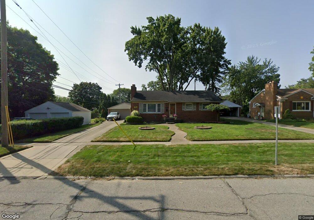
1485 Farmer St Plymouth, MI 48170
Estimated Value: $369,000 - $404,497
3
Beds
1
Bath
1,010
Sq Ft
$387/Sq Ft
Est. Value
About This Home
This home is located at 1485 Farmer St, Plymouth, MI 48170 and is currently estimated at $391,124, approximately $387 per square foot. 1485 Farmer St is a home located in Wayne County with nearby schools including Canton High School, Bird Elementary School, and West Middle School.
Ownership History
Date
Name
Owned For
Owner Type
Purchase Details
Closed on
Dec 18, 2009
Sold by
Dawkins Marie
Bought by
Dawkins Gregory S
Current Estimated Value
Purchase Details
Closed on
Jul 29, 1994
Sold by
Est Kanstancija Brokas
Bought by
Gregory S Dawkins
Home Financials for this Owner
Home Financials are based on the most recent Mortgage that was taken out on this home.
Original Mortgage
$84,000
Interest Rate
8.62%
Mortgage Type
New Conventional
Create a Home Valuation Report for This Property
The Home Valuation Report is an in-depth analysis detailing your home's value as well as a comparison with similar homes in the area
Home Values in the Area
Average Home Value in this Area
Purchase History
| Date | Buyer | Sale Price | Title Company |
|---|---|---|---|
| Dawkins Gregory S | -- | Minnesota Title Agency | |
| Gregory S Dawkins | $93,365 | -- |
Source: Public Records
Mortgage History
| Date | Status | Borrower | Loan Amount |
|---|---|---|---|
| Closed | Gregory S Dawkins | $84,000 |
Source: Public Records
Tax History Compared to Growth
Tax History
| Year | Tax Paid | Tax Assessment Tax Assessment Total Assessment is a certain percentage of the fair market value that is determined by local assessors to be the total taxable value of land and additions on the property. | Land | Improvement |
|---|---|---|---|---|
| 2025 | $4,435 | $221,300 | $0 | $0 |
| 2024 | $4,435 | $213,000 | $0 | $0 |
| 2023 | $4,320 | $196,500 | $0 | $0 |
| 2022 | $4,579 | $186,600 | $0 | $0 |
| 2021 | $4,437 | $184,700 | $0 | $0 |
| 2020 | $4,426 | $179,100 | $0 | $0 |
| 2019 | $3,896 | $165,800 | $0 | $0 |
| 2018 | $3,784 | $163,500 | $0 | $0 |
| 2017 | $802 | $162,900 | $0 | $0 |
| 2016 | $4,123 | $158,100 | $0 | $0 |
| 2015 | $9,443 | $150,020 | $0 | $0 |
| 2013 | $9,148 | $129,360 | $0 | $0 |
| 2011 | -- | $114,120 | $0 | $0 |
Source: Public Records
Map
Nearby Homes
- 432 N Sheldon Rd
- 416 N Sheldon Rd
- 500 Provincetown Ln
- 1330 Junction St
- 1320 Junction St
- 199 Arthur St
- 396 Blunk St
- 1046 Church St
- 12260 High Meadow Ct
- 443 N Harvey St
- 13150 Hidden Creek Dr
- 12427 Woodgate Dr
- 324 N Harvey St
- 12372 Pinecrest Dr
- 188 N Harvey St
- 13507 Westbrook Rd
- 12607 Vintage Ln
- 644 Karmada St
- 42384 Gateway Dr
- 553 Jener Place
- 1495 Farmer St
- 448 N Sheldon Rd
- 550 N Sheldon Rd
- 499 Sunset St
- 481 Sunset St
- 465 Sunset St
- 551 Sunset St
- 449 Sunset St
- 590 N Sheldon Rd
- 481 N Sheldon Rd Unit Bldg-Unit
- 481 N Sheldon Rd
- 575 Sunset St
- 499 N Sheldon Rd
- 465 N Sheldon Rd
- 529 N Sheldon Rd
- 449 N Sheldon Rd
- 601 Sunset St
- 650 N Sheldon Rd
- 405 Sunset St
- 559 N Sheldon Rd