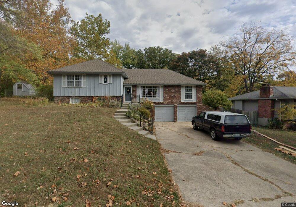
1485 Hemlock Ct Liberty, MO 64068
Estimated Value: $344,023 - $365,000
3
Beds
3
Baths
1,488
Sq Ft
$237/Sq Ft
Est. Value
About This Home
This home is located at 1485 Hemlock Ct, Liberty, MO 64068 and is currently estimated at $352,756, approximately $237 per square foot. 1485 Hemlock Ct is a home located in Clay County with nearby schools including Lewis And Clark Elementary School, Heritage Middle School, and Liberty North High School.
Ownership History
Date
Name
Owned For
Owner Type
Purchase Details
Closed on
Jul 22, 2025
Sold by
Schirmann Deborah and Dickey Sean R
Bought by
Quinn Phillip and Quinn Jillian
Current Estimated Value
Home Financials for this Owner
Home Financials are based on the most recent Mortgage that was taken out on this home.
Original Mortgage
$315,000
Outstanding Balance
$314,466
Interest Rate
6.84%
Mortgage Type
New Conventional
Estimated Equity
$38,290
Purchase Details
Closed on
Oct 8, 2021
Sold by
Thorn Carole Beth and Thom James Nicholas
Bought by
Dickey Sean R and Schirmann Deborah
Purchase Details
Closed on
Jul 29, 1997
Sold by
Smith Robert J and Smith Wendy S
Bought by
Thorn James Nicholas and Thorn Carole Beth
Home Financials for this Owner
Home Financials are based on the most recent Mortgage that was taken out on this home.
Original Mortgage
$110,250
Interest Rate
7.46%
Create a Home Valuation Report for This Property
The Home Valuation Report is an in-depth analysis detailing your home's value as well as a comparison with similar homes in the area
Home Values in the Area
Average Home Value in this Area
Purchase History
| Date | Buyer | Sale Price | Title Company |
|---|---|---|---|
| Quinn Phillip | -- | Alliance Title Company | |
| Quinn Phillip | -- | Alliance Title Company | |
| Dickey Sean R | -- | Atc | |
| Thorn James Nicholas | -- | -- |
Source: Public Records
Mortgage History
| Date | Status | Borrower | Loan Amount |
|---|---|---|---|
| Open | Quinn Phillip | $315,000 | |
| Previous Owner | Thorn James Nicholas | $110,250 |
Source: Public Records
Tax History Compared to Growth
Tax History
| Year | Tax Paid | Tax Assessment Tax Assessment Total Assessment is a certain percentage of the fair market value that is determined by local assessors to be the total taxable value of land and additions on the property. | Land | Improvement |
|---|---|---|---|---|
| 2025 | $3,243 | $48,450 | -- | -- |
| 2024 | $3,243 | $42,160 | -- | -- |
| 2023 | $3,298 | $42,160 | $0 | $0 |
| 2022 | $3,000 | $37,870 | $0 | $0 |
| 2021 | $2,976 | $37,867 | $5,700 | $32,167 |
| 2020 | $2,802 | $33,480 | $0 | $0 |
| 2019 | $2,802 | $33,478 | $5,700 | $27,778 |
| 2018 | $2,649 | $31,080 | $0 | $0 |
| 2017 | $2,624 | $31,080 | $3,800 | $27,280 |
| 2016 | $2,624 | $31,080 | $3,800 | $27,280 |
| 2015 | $2,625 | $31,080 | $3,800 | $27,280 |
| 2014 | $2,546 | $29,910 | $3,990 | $25,920 |
Source: Public Records
Map
Nearby Homes
- 1484 Hemlock Dr
- 1487 Spruce Dr
- 900 Wildbriar Dr
- 523 Lancelot Dr
- 527 Lancelot Dr
- 417 Locust St
- 1107 Wildbriar Dr
- 815 Kings Ridge
- 1575 Oakwood Ln
- 194 Camelot Dr
- 1304 Nashua Rd
- 1548 Timber Ridge Dr
- 9623 NE 89th St
- 1207 Linden Rd
- 1208 Linden Rd
- 412 N Fairview Ave
- 1541 N Withers Rd
- 9105 N Evanston Ave
- 1014 N Forest Ln
- 1408 Telford Dr