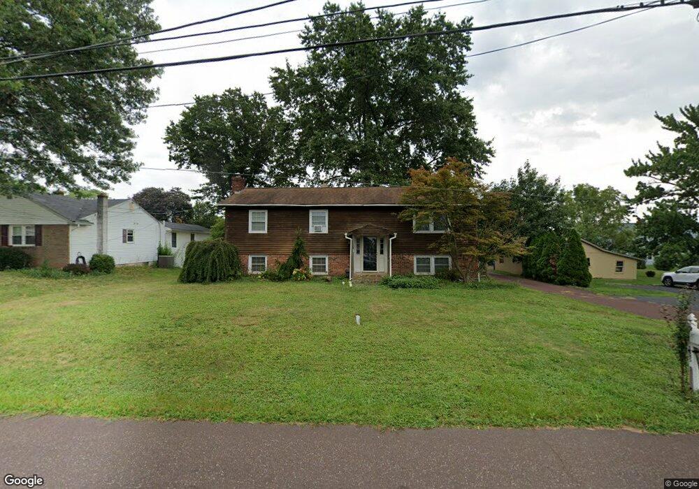
1485 Reiff Rd Lansdale, PA 19446
Estimated Value: $504,361 - $614,000
3
Beds
3
Baths
2,288
Sq Ft
$244/Sq Ft
Est. Value
About This Home
This home is located at 1485 Reiff Rd, Lansdale, PA 19446 and is currently estimated at $558,590, approximately $244 per square foot. 1485 Reiff Rd is a home located in Montgomery County with nearby schools including Walton Farm El School, Pennfield Middle School, and North Penn Senior High School.
Ownership History
Date
Name
Owned For
Owner Type
Purchase Details
Closed on
Apr 30, 1999
Sold by
Barnett Mark J and Barnett Robin L
Bought by
Magee Michael P and Magee Carol L
Current Estimated Value
Purchase Details
Closed on
Oct 23, 1998
Sold by
Barnett Mark J and Barnett Robin L
Bought by
Barnett Mark J and Barnett Robin L
Purchase Details
Closed on
Apr 28, 1995
Sold by
Repasky Gerald M and Karen Repasky M
Bought by
Barnett Mark J and Youpa Robin L
Create a Home Valuation Report for This Property
The Home Valuation Report is an in-depth analysis detailing your home's value as well as a comparison with similar homes in the area
Home Values in the Area
Average Home Value in this Area
Purchase History
| Date | Buyer | Sale Price | Title Company |
|---|---|---|---|
| Magee Michael P | $165,000 | -- | |
| Barnett Mark J | -- | -- | |
| Barnett Mark J | $156,000 | -- |
Source: Public Records
Tax History Compared to Growth
Tax History
| Year | Tax Paid | Tax Assessment Tax Assessment Total Assessment is a certain percentage of the fair market value that is determined by local assessors to be the total taxable value of land and additions on the property. | Land | Improvement |
|---|---|---|---|---|
| 2025 | $6,080 | $150,070 | $47,500 | $102,570 |
| 2024 | $6,080 | $150,070 | $47,500 | $102,570 |
| 2023 | $5,822 | $150,070 | $47,500 | $102,570 |
| 2022 | $5,464 | $150,070 | $47,500 | $102,570 |
| 2021 | $5,306 | $150,070 | $47,500 | $102,570 |
| 2020 | $5,065 | $150,070 | $47,500 | $102,570 |
| 2019 | $4,977 | $150,070 | $47,500 | $102,570 |
| 2018 | $978 | $150,070 | $47,500 | $102,570 |
| 2017 | $4,779 | $150,070 | $47,500 | $102,570 |
| 2016 | $4,720 | $150,070 | $47,500 | $102,570 |
| 2015 | $4,523 | $150,070 | $47,500 | $102,570 |
| 2014 | $4,523 | $150,070 | $47,500 | $102,570 |
Source: Public Records
Map
Nearby Homes
- 1348 Michael Way
- 502 Clarella Ct
- 25 Chestnut Ct E
- 10 Bentwood Ct W
- 109 Durham Ct
- 103 Newport Ct
- 113 Clemens Ct
- 11 Elder Ct
- 2212 Mulberry Ct
- 2415 Hillock Ct
- 705 Continental Dr
- 102 Ridgewood Way
- 510 Greenwood Ct
- 2 Newbury Way
- 1512 Tennis Cir
- 1825 Flintlock Cir
- 1653 Bridle Path Dr
- 405 Militia Dr
- 144 Oberlin Terrace Unit 15-B
- 134 Oberlin Terrace Unit 15-H
- 1475 Reiff Rd
- 1575 Sumneytown Pike
- 1465 Reiff Rd
- 1480 Reiff Rd
- 1587 Sumneytown Pike
- 1579 Sumneytown Pike
- 1470 Reiff Rd
- 1445 Reiff Rd
- 1605 Sumneytown Pike
- 1460 Reiff Rd
- 1440 Reiff Rd
- 1563 Sumneytown Pike
- 1435 Reiff Rd
- 1420 Reiff Rd Unit 69
- 1570 Sumneytown Pike Unit B
- 1586 Sumneytown Pike
- 1375 Reiff Rd
- 1380 Reiff Rd Unit 71
- 1365 Reiff Rd
- 1360 Reiff Rd