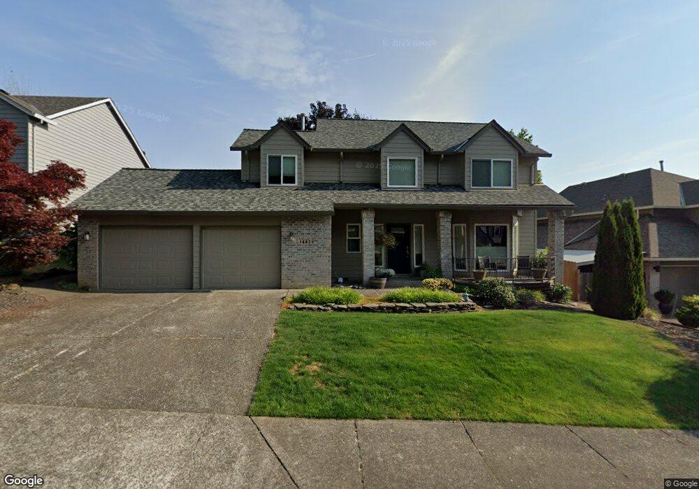
14851 SW Michael Ct Sherwood, OR 97140
Estimated Value: $646,724 - $726,000
4
Beds
3
Baths
2,090
Sq Ft
$331/Sq Ft
Est. Value
About This Home
This home is located at 14851 SW Michael Ct, Sherwood, OR 97140 and is currently estimated at $692,431, approximately $331 per square foot. 14851 SW Michael Ct is a home located in Washington County with nearby schools including Archer Glen Elementary School, Sherwood Middle School, and Sherwood High School.
Ownership History
Date
Name
Owned For
Owner Type
Purchase Details
Closed on
May 9, 2001
Sold by
Thomas Robert B and Thomas Barbara J
Bought by
Johnson Todd K and Johnson Michelle A
Current Estimated Value
Home Financials for this Owner
Home Financials are based on the most recent Mortgage that was taken out on this home.
Original Mortgage
$170,000
Outstanding Balance
$63,478
Interest Rate
7.03%
Estimated Equity
$628,953
Create a Home Valuation Report for This Property
The Home Valuation Report is an in-depth analysis detailing your home's value as well as a comparison with similar homes in the area
Home Values in the Area
Average Home Value in this Area
Purchase History
| Date | Buyer | Sale Price | Title Company |
|---|---|---|---|
| Johnson Todd K | $220,000 | -- |
Source: Public Records
Mortgage History
| Date | Status | Borrower | Loan Amount |
|---|---|---|---|
| Open | Johnson Todd K | $170,000 |
Source: Public Records
Tax History Compared to Growth
Tax History
| Year | Tax Paid | Tax Assessment Tax Assessment Total Assessment is a certain percentage of the fair market value that is determined by local assessors to be the total taxable value of land and additions on the property. | Land | Improvement |
|---|---|---|---|---|
| 2025 | $7,218 | $378,670 | -- | -- |
| 2024 | $7,045 | $367,650 | -- | -- |
| 2023 | $7,045 | $356,950 | $0 | $0 |
| 2022 | $6,304 | $356,950 | $0 | $0 |
| 2021 | $6,221 | $336,470 | $0 | $0 |
| 2020 | $6,119 | $326,670 | $0 | $0 |
| 2019 | $6,002 | $317,160 | $0 | $0 |
| 2018 | $5,821 | $307,930 | $0 | $0 |
| 2017 | $5,669 | $298,970 | $0 | $0 |
| 2016 | $5,489 | $290,270 | $0 | $0 |
| 2015 | $5,214 | $281,820 | $0 | $0 |
| 2014 | $5,157 | $273,620 | $0 | $0 |
Source: Public Records
Map
Nearby Homes
- 15379 SW Sunset Blvd
- 23861 SW Dewberry Place
- 23705 SW Everest Ct
- 23484 SW Pine St
- 23245 SW Byers Lake Terrace
- 23072 SW Mansfield St
- 23680 SW Robson Terrace
- 15659 SW Hawk Ct
- 23157 SW Curry Ridge Dr
- 15781 SW Highpoint Dr
- 23141 SW Curry Ridge Dr
- 23083 SW Curry Ridge Dr
- 23067 SW Curry Ridge Dr
- 23037 SW Curry Ridge Dr
- 15925 SW Highpoint Dr
- 14300 SW Fairoaks Dr
- 22754 SW Martin Ct
- 14614 SW Willamette St
- 24400 SW Baker Rd
- 22805 SW Highland Dr
- 14877 SW Michael Ct
- 14829 SE Michael Ct (Bonus)
- 14829 SW Michael Ct
- 14854 SE Lowell Ln
- 14832 SE Lowell Ln
- 14880 SE Lowell Ln
- 14880 SW Lowell Ln
- 14901 SW Michael Ct
- 14854 SW Lowell Ln
- 14850 SW Michael Ct
- 2415 SW Michael Ct
- 14817 SW Michael Ct
- 14830 SW Michael Ct
- 14820 SE Lowell Ln
- 14904 SE Lowell Ln
- 14900 SE Michael Ct
- 14900 SW Michael Ct
- 14805 SW Michael Ct
- 14926 SE Lowell Ln
- 14808 SE Lowell Ln