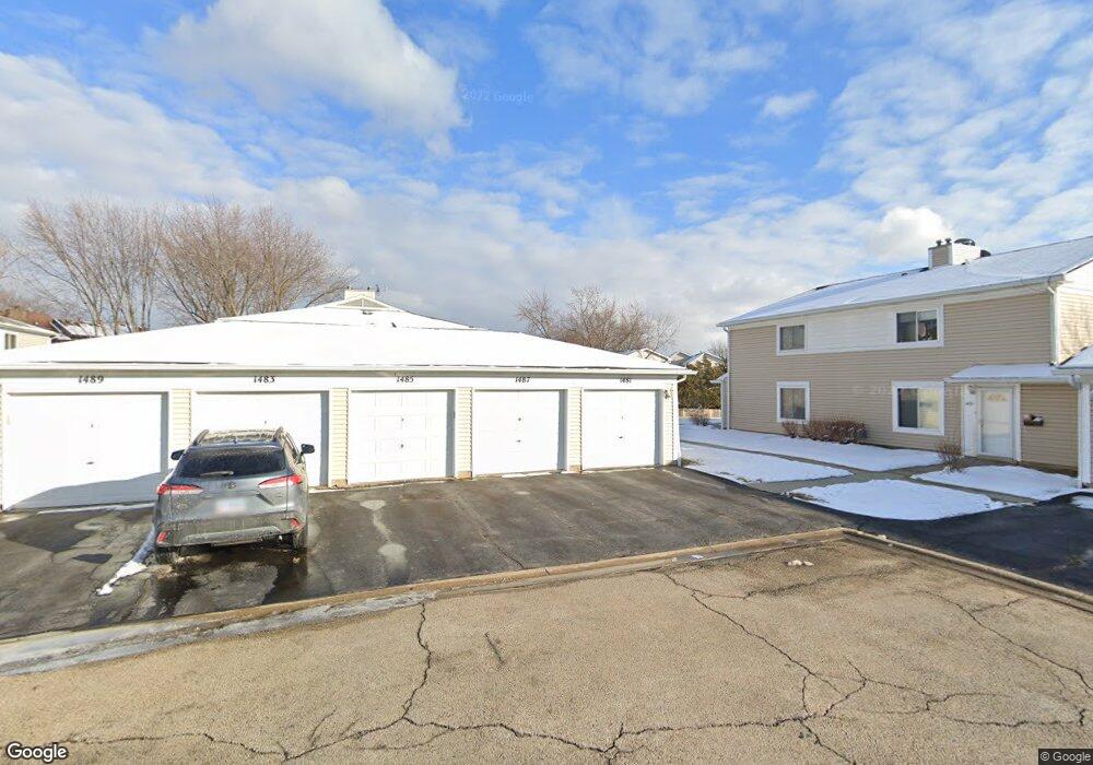
1487 Cornell Ct Unit 4D Hoffman Estates, IL 60169
South Hoffman Estates NeighborhoodEstimated Value: $209,000 - $237,000
2
Beds
--
Bath
1,000
Sq Ft
$224/Sq Ft
Est. Value
About This Home
This home is located at 1487 Cornell Ct Unit 4D, Hoffman Estates, IL 60169 and is currently estimated at $224,477, approximately $224 per square foot. 1487 Cornell Ct Unit 4D is a home located in Cook County with nearby schools including Neil Armstrong Elementary School, Dwight D Eisenhower Junior High School, and Hoffman Estates High School.
Ownership History
Date
Name
Owned For
Owner Type
Purchase Details
Closed on
Nov 6, 2024
Sold by
Godinho Tony D
Bought by
Aranda Marly Villafan and Escobar Omar
Current Estimated Value
Home Financials for this Owner
Home Financials are based on the most recent Mortgage that was taken out on this home.
Original Mortgage
$194,750
Outstanding Balance
$192,153
Interest Rate
6%
Mortgage Type
New Conventional
Estimated Equity
$32,324
Purchase Details
Closed on
Jul 29, 2003
Sold by
Guidici William
Bought by
Godinho Tony D
Home Financials for this Owner
Home Financials are based on the most recent Mortgage that was taken out on this home.
Original Mortgage
$128,000
Interest Rate
5.47%
Mortgage Type
Unknown
Purchase Details
Closed on
Dec 17, 1997
Sold by
Gold Edward S
Bought by
Guidici William
Create a Home Valuation Report for This Property
The Home Valuation Report is an in-depth analysis detailing your home's value as well as a comparison with similar homes in the area
Home Values in the Area
Average Home Value in this Area
Purchase History
| Date | Buyer | Sale Price | Title Company |
|---|---|---|---|
| Aranda Marly Villafan | -- | Saturn Title | |
| Aranda Marly Villafan | -- | Saturn Title | |
| Godinho Tony D | $128,000 | Rtc | |
| Guidici William | $78,000 | -- |
Source: Public Records
Mortgage History
| Date | Status | Borrower | Loan Amount |
|---|---|---|---|
| Open | Aranda Marly Villafan | $194,750 | |
| Closed | Aranda Marly Villafan | $194,750 | |
| Previous Owner | Godinho Tony D | $128,000 |
Source: Public Records
Tax History
| Year | Tax Paid | Tax Assessment Tax Assessment Total Assessment is a certain percentage of the fair market value that is determined by local assessors to be the total taxable value of land and additions on the property. | Land | Improvement |
|---|---|---|---|---|
| 2025 | $4,360 | $20,113 | $4,492 | $15,621 |
| 2024 | $4,360 | $14,210 | $4,083 | $10,127 |
| 2023 | $4,220 | $14,210 | $4,083 | $10,127 |
| 2022 | $4,220 | $14,210 | $4,083 | $10,127 |
| 2021 | $3,636 | $10,853 | $6,431 | $4,422 |
| 2020 | $3,551 | $10,853 | $6,431 | $4,422 |
| 2019 | $3,548 | $12,120 | $6,431 | $5,689 |
| 2018 | $2,842 | $8,715 | $5,614 | $3,101 |
| 2017 | $2,791 | $8,715 | $5,614 | $3,101 |
| 2016 | $2,596 | $8,715 | $5,614 | $3,101 |
| 2015 | $1,826 | $5,684 | $4,899 | $785 |
| 2014 | $1,793 | $5,684 | $4,899 | $785 |
| 2013 | $1,415 | $5,684 | $4,899 | $785 |
Source: Public Records
Map
Nearby Homes
- 1587 Brookside Dr
- 2222 Seaver Ln
- 1659 Islandview Ct
- 1576 Poplar Creek Dr
- 1880 Bonnie Ln Unit 112
- 1792 Williamsburg Dr
- 1500 Robin Cir Unit 314
- 1975 Windsong Dr Unit 333E1
- 1724 Fayette Walk Unit J
- 1769 Sessions Walk Unit C
- 1933 Williamsburg Dr Unit 1
- 1712 Fayette Walk Unit D
- 2051 Kettering Rd Unit 2
- 1708 Southbridge Ct
- 2021 Kensington Ln Unit 3004
- 2027 Kensington Ln Unit 3001
- 2025 Kensington Ln Unit 3002
- 2023 Kensington Ln Unit 3003
- 2267 Briar Ct Unit 65
- 1103 Southbridge Ln
- 1487 Cornell Ct
- 1485 Cornell Ct Unit 4C
- 1489 Cornell Ct Unit 4A
- 1481 Cornell Ct Unit 4E
- 1495 Cornell Ct Unit 5C
- 1499 Cornell Ct Unit 5A
- 1491 Cornell Ct Unit 5E
- 1493 Cornell Ct Unit 5B
- 2070 Greens Ct
- 2060 Greens Ct Unit 2
- 1477 Cornell Ct Unit 3A
- 1471 Cornell Ct Unit 3B
- 1471 Cornell Ct
- 1475 Cornell Ct Unit 3D
- 1478 Brookside Dr
- 1473 Cornell Ct Unit 3C
- 2069 Greens Ct Unit 2
- 1482 Brookside Dr
- 1501 Cornell Ct Unit 6B
- 2050 Greens Ct
Your Personal Tour Guide
Ask me questions while you tour the home.