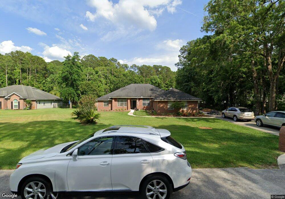
1487 Mallard Landing Blvd Saint Johns, FL 32259
Estimated Value: $605,764 - $710,000
4
Beds
2
Baths
2,328
Sq Ft
$279/Sq Ft
Est. Value
About This Home
This home is located at 1487 Mallard Landing Blvd, Saint Johns, FL 32259 and is currently estimated at $648,691, approximately $278 per square foot. 1487 Mallard Landing Blvd is a home located in St. Johns County with nearby schools including Cunningham Creek Elementary School, Switzerland Point Middle School, and Bartram Trail High School.
Ownership History
Date
Name
Owned For
Owner Type
Purchase Details
Closed on
Dec 4, 2009
Sold by
Bartnick John Michael and Bartnick Sheilla A
Bought by
Allen Thomas D and Allen Roberta
Current Estimated Value
Purchase Details
Closed on
Jan 30, 2007
Sold by
Bartnick John Michael and Bartnick Sheilla A
Bought by
Bartnick John Michael and Bartnick Sheilla A
Home Financials for this Owner
Home Financials are based on the most recent Mortgage that was taken out on this home.
Original Mortgage
$314,000
Interest Rate
6.14%
Mortgage Type
Purchase Money Mortgage
Create a Home Valuation Report for This Property
The Home Valuation Report is an in-depth analysis detailing your home's value as well as a comparison with similar homes in the area
Home Values in the Area
Average Home Value in this Area
Purchase History
| Date | Buyer | Sale Price | Title Company |
|---|---|---|---|
| Allen Thomas D | $305,000 | Lawyers Title | |
| Bartnick John Michael | $151,800 | First Coast Title Svcs Inc |
Source: Public Records
Mortgage History
| Date | Status | Borrower | Loan Amount |
|---|---|---|---|
| Previous Owner | Bartnick John Michael | $314,000 |
Source: Public Records
Tax History Compared to Growth
Tax History
| Year | Tax Paid | Tax Assessment Tax Assessment Total Assessment is a certain percentage of the fair market value that is determined by local assessors to be the total taxable value of land and additions on the property. | Land | Improvement |
|---|---|---|---|---|
| 2025 | $3,255 | $292,236 | -- | -- |
| 2024 | $3,255 | $284,000 | -- | -- |
| 2023 | $3,255 | $275,728 | $0 | $0 |
| 2022 | $3,159 | $267,697 | $0 | $0 |
| 2021 | $3,137 | $259,900 | $0 | $0 |
| 2020 | $3,126 | $256,312 | $0 | $0 |
| 2019 | $3,182 | $250,549 | $0 | $0 |
| 2018 | $3,145 | $245,877 | $0 | $0 |
| 2017 | $3,133 | $240,820 | $0 | $0 |
| 2016 | $3,133 | $240,541 | $0 | $0 |
| 2015 | $3,180 | $239,223 | $0 | $0 |
| 2014 | $3,191 | $232,283 | $0 | $0 |
Source: Public Records
Map
Nearby Homes
- 540 Roberts Rd
- 2407 Hawkcrest Dr E
- 1722 Heatherwood Dr
- 1304 Hideaway Dr S
- 1500 State Road 13 N
- 1242 Wild Turkey Ct
- 1161 Dover Dr
- 129 Hunters Creek Dr
- 284 Queen Victoria Ave
- 1221 Creekwood Way S
- 1145 Dover Dr
- 256 Village Green Ave
- 1192 Perregrine Cir W
- 623 Hampton Downs Ct
- 1433 S Burgandy Trail
- 1837 Fairfax Ct S
- 1128 Mill Creek Dr
- 1290 Cunningham Creek Dr
- 1285 Scott Rd
- 144 Nottingham Dr E
- 1483 Mallard Landing Blvd
- 1491 Mallard Landing Blvd
- 1479 Mallard Landing Blvd
- 1490 Mallard Landing Blvd
- 1494 Mallard Landing Blvd
- 1475 Mallard Landing Blvd
- 1499 Mallard Landing Blvd
- 1528 Pintail Dr
- 1498 Mallard Landing Blvd
- 1503 Mallard Landing Blvd
- 1471 Mallard Landing Blvd
- 159 Lige Branch Ln
- 163 Lige Branch Ln
- 1524 Pintail Dr
- 155 Lige Branch Ln
- 167 Lige Branch Ln
- 1502 Mallard Landing Blvd
- 151 Lige Branch Ln
- 171 Lige Branch Ln
- 1533 Pintail Dr