Estimated Value: $80,000 - $132,000
2
Beds
1
Bath
1,010
Sq Ft
$100/Sq Ft
Est. Value
About This Home
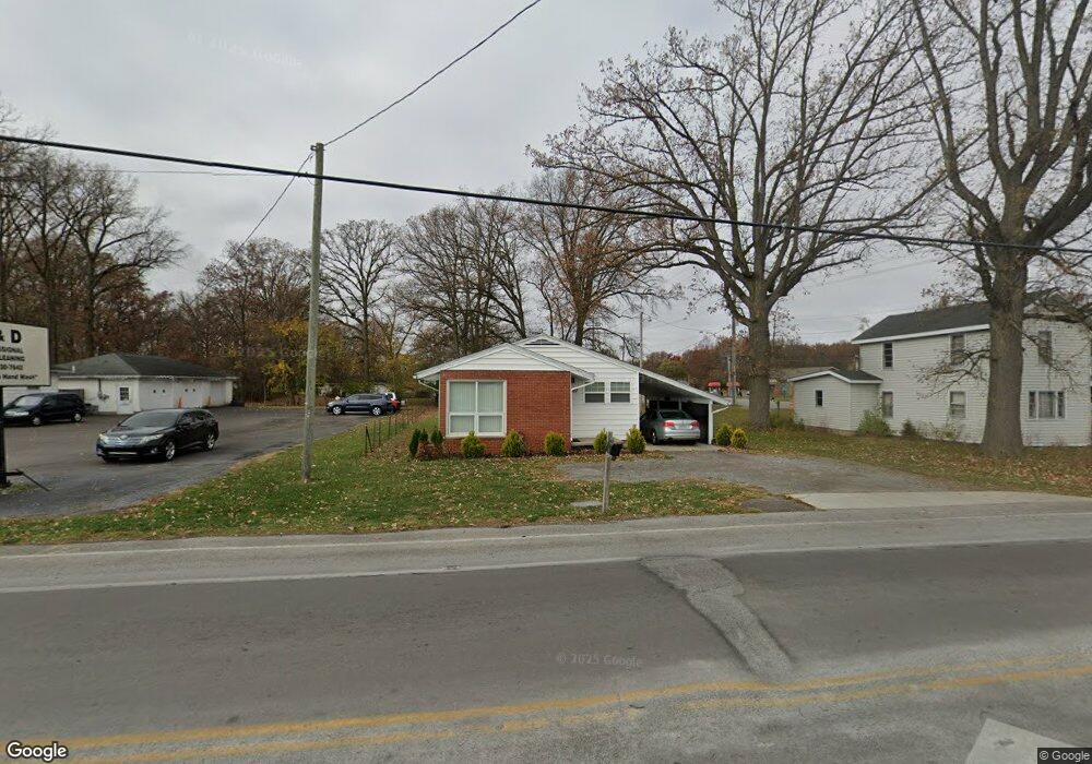
This home is located at 1487 N Cole St, Lima, OH 45801 and is currently estimated at $100,667, approximately $99 per square foot. 1487 N Cole St is a home located in Allen County with nearby schools including Elida Elementary School, Elida Middle School, and Elida High School.
Ownership History
Date
Name
Owned For
Owner Type
Purchase Details
Closed on
Jun 16, 2015
Sold by
Hadding Martha D
Bought by
Main St Homes Lima Llc
Current Estimated Value
Purchase Details
Closed on
Oct 24, 2011
Sold by
Estate Of Sherman Ellsworth Hadding
Bought by
Hadding Martha D
Purchase Details
Closed on
Jan 1, 1990
Bought by
Hadding Sherman E
Create a Home Valuation Report for This Property
The Home Valuation Report is an in-depth analysis detailing your home's value as well as a comparison with similar homes in the area
Home Values in the Area
Average Home Value in this Area
Purchase History
| Date | Buyer | Sale Price | Title Company |
|---|---|---|---|
| Main St Homes Lima Llc | $30,000 | None Available | |
| Hadding Martha D | -- | None Available | |
| Hadding Sherman E | -- | -- |
Source: Public Records
Tax History Compared to Growth
Tax History
| Year | Tax Paid | Tax Assessment Tax Assessment Total Assessment is a certain percentage of the fair market value that is determined by local assessors to be the total taxable value of land and additions on the property. | Land | Improvement |
|---|---|---|---|---|
| 2024 | $808 | $18,000 | $1,860 | $16,140 |
| 2023 | $794 | $15,650 | $1,610 | $14,040 |
| 2022 | $810 | $15,650 | $1,610 | $14,040 |
| 2021 | $812 | $15,650 | $1,610 | $14,040 |
| 2020 | $767 | $13,800 | $1,510 | $12,290 |
| 2019 | $767 | $13,800 | $1,510 | $12,290 |
| 2018 | $768 | $13,800 | $1,510 | $12,290 |
| 2017 | $659 | $12,150 | $1,510 | $10,640 |
| 2016 | $655 | $12,150 | $1,510 | $10,640 |
| 2015 | $208 | $12,150 | $1,510 | $10,640 |
| 2014 | $208 | $12,530 | $1,330 | $11,200 |
| 2013 | $187 | $12,530 | $1,330 | $11,200 |
Source: Public Records
Map
Nearby Homes
- 0 Sherman Ave
- 1580 W Robb Ave
- 1710 Camp Ave
- 849 Runyan Ave
- 765 W O'Connor Ave
- 676 Cortlandt Ave
- 765 Ewing Ave
- 1116 Belvidere Ave
- 102 Charwood Dr
- 1744 Homeward Ave
- 1113 Crestwood Dr
- 1730 Homeward Ave
- 00 Homeward Ave
- 1206 Rice Ave
- 1023 Leland Ave
- 608 W O'Connor Ave
- 610 W Robb Ave
- 576 Cortlandt Ave
- 621 Fairfield Dr
- 2129 Reinell Ave
- 1301 W Robb Ave
- 1455 N Cole St
- 1505 N Cole St
- 1612 N Kenilworth Ave
- 1441 N Cole St
- 1618 N Kenilworth Ave
- 1441 Ncole St
- 1450 N Cole St Unit A
- 1450 N Cole St
- N/A N Cole St
- 1541 N Cole St
- 1404 W Robb Ave
- 1559 N Cole St
- 1401 W Robb Ave
- 1560 N Cole St
- 1617 N Kenilworth Ave
- 1575 N Cole St
- 1408 W Robb Ave
- 1409 W Robb Ave