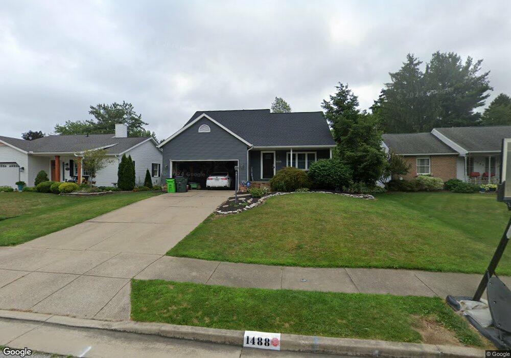
1488 Democracy Dr NW North Canton, OH 44720
Estimated Value: $243,000 - $262,000
3
Beds
2
Baths
1,584
Sq Ft
$158/Sq Ft
Est. Value
About This Home
This home is located at 1488 Democracy Dr NW, North Canton, OH 44720 and is currently estimated at $250,400, approximately $158 per square foot. 1488 Democracy Dr NW is a home located in Stark County with nearby schools including North Canton Middle School, Hoover High School, and St Paul School.
Ownership History
Date
Name
Owned For
Owner Type
Purchase Details
Closed on
Mar 29, 2022
Sold by
Josette Whitacye Linda
Bought by
Whitacre Linda Josette and Whitacre James Robert
Current Estimated Value
Purchase Details
Closed on
Feb 7, 2014
Sold by
Barnhart Linda J and Barnhart Adam Christopher
Bought by
Barnhart Linda J
Home Financials for this Owner
Home Financials are based on the most recent Mortgage that was taken out on this home.
Original Mortgage
$114,641
Interest Rate
4.55%
Mortgage Type
New Conventional
Purchase Details
Closed on
Apr 3, 2009
Sold by
Bank Of New York
Bought by
Houghton Linda
Home Financials for this Owner
Home Financials are based on the most recent Mortgage that was taken out on this home.
Original Mortgage
$122,244
Interest Rate
5.19%
Mortgage Type
FHA
Purchase Details
Closed on
Nov 7, 2008
Sold by
Liu Dat Q
Bought by
Bank Of New York
Purchase Details
Closed on
Jul 12, 2005
Sold by
Meyer Kay Laraine
Bought by
Liu Dat Q
Home Financials for this Owner
Home Financials are based on the most recent Mortgage that was taken out on this home.
Original Mortgage
$133,600
Interest Rate
6.8%
Mortgage Type
New Conventional
Purchase Details
Closed on
Aug 11, 2000
Sold by
Pringle Kenneth W
Bought by
Meyer Kay Laraine
Home Financials for this Owner
Home Financials are based on the most recent Mortgage that was taken out on this home.
Original Mortgage
$106,400
Interest Rate
7.5%
Mortgage Type
Purchase Money Mortgage
Purchase Details
Closed on
Apr 9, 1999
Sold by
Pringle Kellie Jo
Bought by
Pringle Kenneth Wayne
Home Financials for this Owner
Home Financials are based on the most recent Mortgage that was taken out on this home.
Original Mortgage
$86,200
Interest Rate
7.1%
Mortgage Type
Purchase Money Mortgage
Purchase Details
Closed on
Mar 23, 1990
Create a Home Valuation Report for This Property
The Home Valuation Report is an in-depth analysis detailing your home's value as well as a comparison with similar homes in the area
Home Values in the Area
Average Home Value in this Area
Purchase History
| Date | Buyer | Sale Price | Title Company |
|---|---|---|---|
| Whitacre Linda Josette | -- | None Listed On Document | |
| Barnhart Linda J | -- | None Available | |
| Houghton Linda | $124,500 | Attorney | |
| Bank Of New York | $104,000 | None Available | |
| Liu Dat Q | $167,000 | Quest Title Agency Inc | |
| Meyer Kay Laraine | $133,000 | -- | |
| Pringle Kenneth Wayne | -- | -- | |
| -- | $95,900 | -- |
Source: Public Records
Mortgage History
| Date | Status | Borrower | Loan Amount |
|---|---|---|---|
| Previous Owner | Barnhart Linda J | $114,641 | |
| Previous Owner | Houghton Linda | $122,244 | |
| Previous Owner | Liu Dat Q | $133,600 | |
| Previous Owner | Meyer Kay Laraine | $106,400 | |
| Previous Owner | Pringle Kenneth Wayne | $86,200 | |
| Closed | Liu Dat Q | $33,400 |
Source: Public Records
Tax History Compared to Growth
Tax History
| Year | Tax Paid | Tax Assessment Tax Assessment Total Assessment is a certain percentage of the fair market value that is determined by local assessors to be the total taxable value of land and additions on the property. | Land | Improvement |
|---|---|---|---|---|
| 2025 | -- | $78,020 | $14,600 | $63,420 |
| 2024 | -- | $78,020 | $14,600 | $63,420 |
| 2023 | $3,136 | $58,630 | $11,200 | $47,430 |
| 2022 | $3,014 | $58,630 | $11,200 | $47,430 |
| 2021 | $2,907 | $58,630 | $11,200 | $47,430 |
| 2020 | $2,812 | $50,930 | $9,770 | $41,160 |
| 2019 | $2,625 | $50,930 | $9,770 | $41,160 |
| 2018 | $2,721 | $50,930 | $9,770 | $41,160 |
| 2017 | $2,415 | $47,460 | $8,820 | $38,640 |
| 2016 | $2,424 | $47,460 | $8,820 | $38,640 |
| 2015 | $2,433 | $47,460 | $8,820 | $38,640 |
| 2014 | $566 | $46,730 | $8,680 | $38,050 |
| 2013 | $1,287 | $46,730 | $8,680 | $38,050 |
Source: Public Records
Map
Nearby Homes
- 1482 Democracy Dr NW
- 1015 Lois Ave NW
- 1263 Los Angeles Blvd NW
- 3858 Cranwood St NW
- 5948 Shuffel St NW
- 608 Werstler Ave NW
- 404 7th St NW
- 1350 Overland Ave NE
- 742 Portage St NW
- 1171 Terrace Rd NW
- 1060 Park Ave NE
- 455 Royer Ave NW
- 8013 Amberly Cir NW
- 624 Portage St NW
- 140 5th St NE
- 2774 Bridlewood St NW
- 0 W Maple St Unit 5135089
- 2684 Fordham Cir NW
- 2677 Radford St NW
- 1222 W Maple St Unit 6A
- 1494 Democracy Dr NW
- 920 Postiy St NW
- 1478 Democracy Dr NW
- 1487 Democracy Dr NW
- 900 Postiy St NW
- 1508 Democracy Dr NW
- 1473 Democracy Dr NW
- 1472 Democracy Dr NW
- 1507 Barchester Ave NW
- 1505 Barchester Ave NW
- 1505 Democracy Dr NW
- 1516 Democracy Dr NW
- 1495 Democracy Dr NW
- 890 Postiy St NW
- 892 Postiy St NW
- 952 Liberty Ln NW
- 1466 Democracy Dr NW
- 1465 Democracy Dr NW
- 1526 Democracy Dr NW
- 958 Liberty Ln NW