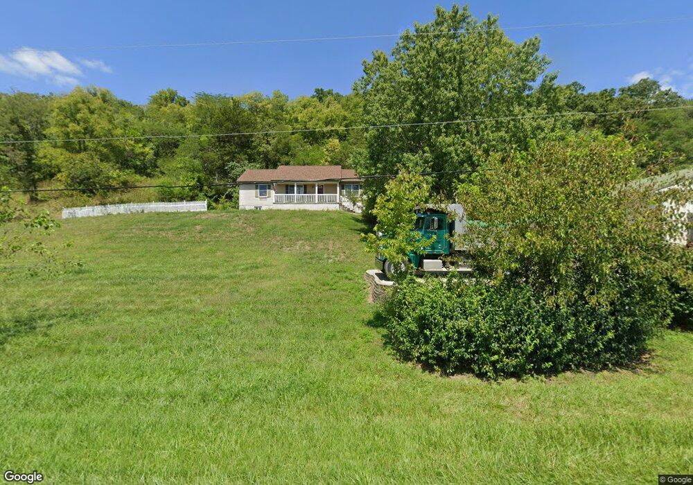
1489 Us Highway 52 Georgetown, OH 45121
Estimated Value: $193,000 - $421,000
3
Beds
2
Baths
1,404
Sq Ft
$223/Sq Ft
Est. Value
About This Home
This home is located at 1489 Us Highway 52, Georgetown, OH 45121 and is currently estimated at $312,421, approximately $222 per square foot. 1489 Us Highway 52 is a home located in Brown County with nearby schools including Ripley Union Lewis Huntington Elementary School, Ripley Union Lewis Huntington Middle School, and Ripley-Union-Lewis-Huntington High School.
Ownership History
Date
Name
Owned For
Owner Type
Purchase Details
Closed on
Jul 31, 2017
Sold by
Caudilli Jennifer G and Mootz Michael
Bought by
Mootz Michael
Current Estimated Value
Purchase Details
Closed on
Sep 27, 1994
Sold by
Raler Clifford
Bought by
Caudill Jennifer G
Home Financials for this Owner
Home Financials are based on the most recent Mortgage that was taken out on this home.
Original Mortgage
$38,800
Interest Rate
8.62%
Mortgage Type
New Conventional
Create a Home Valuation Report for This Property
The Home Valuation Report is an in-depth analysis detailing your home's value as well as a comparison with similar homes in the area
Home Values in the Area
Average Home Value in this Area
Purchase History
| Date | Buyer | Sale Price | Title Company |
|---|---|---|---|
| Mootz Michael | -- | None Available | |
| Caudill Jennifer G | $48,500 | -- |
Source: Public Records
Mortgage History
| Date | Status | Borrower | Loan Amount |
|---|---|---|---|
| Closed | Caudill Jennifer G | $38,800 |
Source: Public Records
Tax History Compared to Growth
Tax History
| Year | Tax Paid | Tax Assessment Tax Assessment Total Assessment is a certain percentage of the fair market value that is determined by local assessors to be the total taxable value of land and additions on the property. | Land | Improvement |
|---|---|---|---|---|
| 2024 | $2,499 | $82,060 | $12,150 | $69,910 |
| 2023 | $2,499 | $59,510 | $8,820 | $50,690 |
| 2022 | $2,048 | $59,510 | $8,820 | $50,690 |
| 2021 | $1,909 | $59,510 | $8,820 | $50,690 |
| 2020 | $1,760 | $51,750 | $7,670 | $44,080 |
| 2019 | $1,748 | $51,750 | $7,670 | $44,080 |
| 2018 | $1,731 | $51,750 | $7,670 | $44,080 |
| 2017 | $1,559 | $45,980 | $8,430 | $37,550 |
| 2016 | $1,529 | $45,980 | $8,430 | $37,550 |
| 2015 | $1,600 | $45,980 | $8,430 | $37,550 |
| 2014 | $1,600 | $45,220 | $7,670 | $37,550 |
| 2013 | $1,481 | $45,220 | $7,670 | $37,550 |
Source: Public Records
Map
Nearby Homes
- 404 E 2nd St
- 414 E 2nd St
- 207 E 3rd St
- 310 E 3rd St
- 305 Bracken St
- 301 Elizabeth St
- 508 E 3rd St
- 401 E 4th St
- 307 Hamilton Ave
- 105 E 4th St
- 114 E 4th St
- Lot 49 Boudes Ferry Rd
- 4900 Mary Ingles Hwy E
- 4465 W Augusta Chatham Rd
- ac Shinkle Ridge Rd
- 1920 Shinkles Ridge
- 5104 Dutch Ridge Rd
- 312 White Oak St
- 1308 Skiffsville Rd
- 2845 Mary Ingles Hwy E
- 1489 Us Highway 52
- 1513 Us Highway 52
- 1535 Us Highway 52
- 1535 Us Rt 52
- 1713 U S Route 52
- 1016 U S Route 52
- 1369 Us Highway 52
- 1369 Us Highway 52
- 1348 Us Highway 52
- 1348 Us Rt 52
- 1356 Us Highway 52
- 1006 Us Rt 52 Unit 1016
- 1275 Us Highway 52 Unit 1A
- 1275 Us Highway 52 Unit 2A
- 101 Frankfort St
- 308 E Riverside Dr
- 222 E Riverside Dr
- 206 E Riverside Dr
- 212 E Riverside Dr
- 218 E Riverside Dr