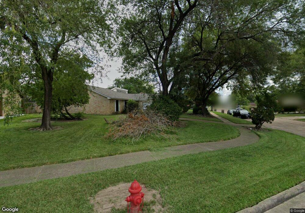
14891 Easingwold Dr Houston, TX 77015
Estimated Value: $216,466 - $232,000
3
Beds
2
Baths
1,695
Sq Ft
$132/Sq Ft
Est. Value
About This Home
This home is located at 14891 Easingwold Dr, Houston, TX 77015 and is currently estimated at $223,867, approximately $132 per square foot. 14891 Easingwold Dr is a home located in Harris County with nearby schools including James B. Havard Elementary School, Cobb 6th Grade Campus, and North Shore Middle School.
Ownership History
Date
Name
Owned For
Owner Type
Purchase Details
Closed on
Jan 21, 1994
Sold by
Va
Bought by
Daniels Vera Le Ann
Current Estimated Value
Home Financials for this Owner
Home Financials are based on the most recent Mortgage that was taken out on this home.
Original Mortgage
$62,759
Interest Rate
7.16%
Mortgage Type
Seller Take Back
Purchase Details
Closed on
Aug 3, 1993
Sold by
Fleet Mtg Corp
Bought by
Va
Create a Home Valuation Report for This Property
The Home Valuation Report is an in-depth analysis detailing your home's value as well as a comparison with similar homes in the area
Home Values in the Area
Average Home Value in this Area
Purchase History
| Date | Buyer | Sale Price | Title Company |
|---|---|---|---|
| Daniels Vera Le Ann | -- | -- | |
| Va | -- | -- |
Source: Public Records
Mortgage History
| Date | Status | Borrower | Loan Amount |
|---|---|---|---|
| Closed | Daniels Vera Le Ann | $62,759 |
Source: Public Records
Tax History
| Year | Tax Paid | Tax Assessment Tax Assessment Total Assessment is a certain percentage of the fair market value that is determined by local assessors to be the total taxable value of land and additions on the property. | Land | Improvement |
|---|---|---|---|---|
| 2025 | $2,696 | $203,405 | $41,208 | $162,197 |
| 2024 | $2,696 | $217,964 | $41,208 | $176,756 |
| 2023 | $2,696 | $226,415 | $41,208 | $185,207 |
| 2022 | $4,165 | $185,758 | $41,208 | $144,550 |
| 2021 | $4,167 | $164,551 | $41,208 | $123,343 |
| 2020 | $4,068 | $141,926 | $41,208 | $100,718 |
| 2019 | $4,009 | $131,975 | $41,208 | $90,767 |
| 2018 | $1,959 | $124,533 | $30,384 | $94,149 |
| 2017 | $2,550 | $104,145 | $18,990 | $85,155 |
| 2016 | $2,318 | $104,145 | $18,990 | $85,155 |
| 2015 | $1,478 | $68,768 | $10,445 | $58,323 |
| 2014 | $1,478 | $64,709 | $10,445 | $54,264 |
Source: Public Records
Map
Nearby Homes
- 1303 Sterling Green Ct
- 14835 Scotter Dr
- 1342 Castle Glen Dr
- 1346 Castle Glen Dr
- 14918 Silver Green Dr S
- 1423 Seafield Dr
- 1510 Chertsey Cir
- 14615 Woodmaple Ct
- 14854 Shottery Dr
- 1343 Littleport Ln
- 14847 Shottery Dr
- 1339 Macclesby Ln
- 234 Wentworth Park Dr
- 1714 Merton Dr
- 14502 Fargo Woods Cir
- 331 Haymarket Ln
- 335 Haymarket Ln
- 111 Ambershadow Dr
- 14527 Duncannon Dr
- 14510 Foxford Way
- 14895 Easingwold Dr
- 14887 Easingwold Dr
- 14854 Beaconsfield Dr
- 14899 Easingwold Dr
- 14858 Beaconsfield Dr
- 14875 Easingwold Dr
- 14850 Beaconsfield Dr
- 14862 Beaconsfield Dr
- 14890 Easingwold Dr
- 14894 Easingwold Dr
- 14871 Easingwold Dr
- 14886 Easingwold Dr
- 14898 Easingwold Dr
- 14846 Beaconsfield Dr
- 14882 Easingwold Dr
- 14878 Easingwold Dr
- 14867 Easingwold Dr
- 14874 Easingwold Dr
- 14903 Easingwold Dr
- 14842 Beaconsfield Dr