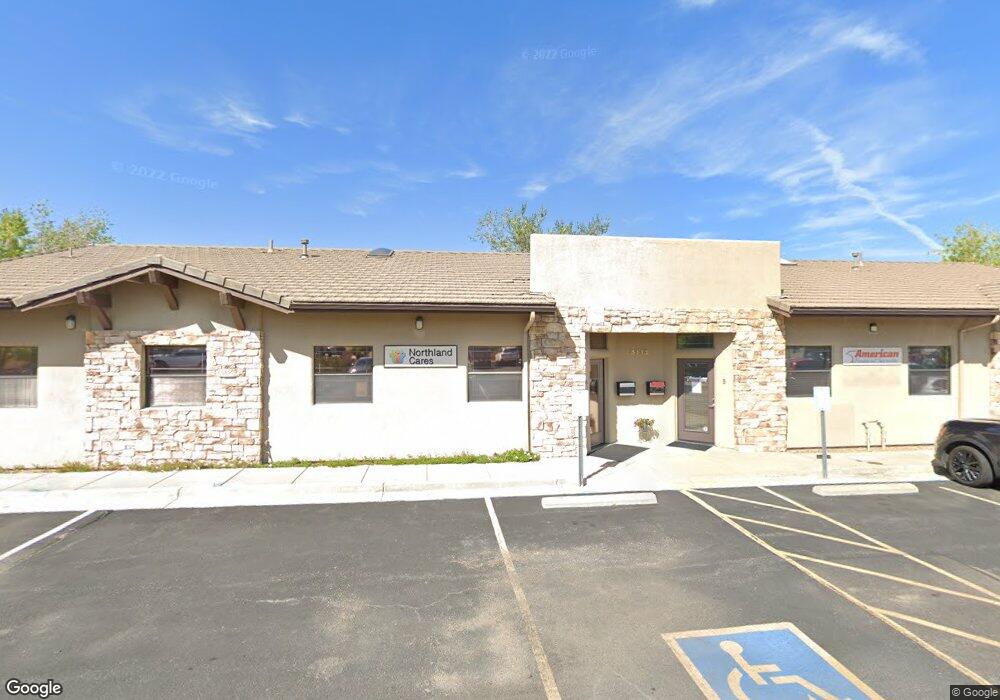
14899 N Burnside Dr Prescott, AZ 86305
Williamson Valley Road NeighborhoodEstimated Value: $978,620 - $1,722,000
--
Bed
--
Bath
3,806
Sq Ft
$324/Sq Ft
Est. Value
About This Home
This home is located at 14899 N Burnside Dr, Prescott, AZ 86305 and is currently estimated at $1,233,905, approximately $324 per square foot. 14899 N Burnside Dr is a home located in Yavapai County.
Ownership History
Date
Name
Owned For
Owner Type
Purchase Details
Closed on
May 21, 2009
Sold by
M & I Marshall & Ilsley Bank
Bought by
Bliss Michael and Bliss Pearl
Current Estimated Value
Purchase Details
Closed on
May 13, 2009
Sold by
M & I Marshall & Ilsley Bank
Bought by
Mcrae David Scott
Purchase Details
Closed on
Apr 3, 2008
Sold by
Beck Bruce D
Bought by
M & I Marshall & Isley Bank
Create a Home Valuation Report for This Property
The Home Valuation Report is an in-depth analysis detailing your home's value as well as a comparison with similar homes in the area
Home Values in the Area
Average Home Value in this Area
Purchase History
| Date | Buyer | Sale Price | Title Company |
|---|---|---|---|
| Bliss Michael | $36,500 | First American Title Ins | |
| Mcrae David Scott | $25,500 | Lawyers Title Of Arizona | |
| M & I Marshall & Isley Bank | $106,659 | First American Title Ins |
Source: Public Records
Tax History Compared to Growth
Tax History
| Year | Tax Paid | Tax Assessment Tax Assessment Total Assessment is a certain percentage of the fair market value that is determined by local assessors to be the total taxable value of land and additions on the property. | Land | Improvement |
|---|---|---|---|---|
| 2026 | $2,192 | $88,466 | -- | -- |
| 2024 | $2,224 | -- | -- | -- |
| 2023 | $2,224 | $46,560 | $4,971 | $41,589 |
| 2022 | $2,112 | $3,988 | $3,988 | $0 |
| 2021 | $2,199 | $11,507 | $3,988 | $7,519 |
| 2020 | $809 | $0 | $0 | $0 |
| 2019 | $814 | $0 | $0 | $0 |
| 2018 | $771 | $0 | $0 | $0 |
| 2017 | $755 | $0 | $0 | $0 |
| 2016 | $720 | $0 | $0 | $0 |
| 2015 | $712 | $0 | $0 | $0 |
| 2014 | -- | $0 | $0 | $0 |
Source: Public Records
Map
Nearby Homes
- 14800 N Deer View Trail
- 15221 N Unbridled
- 7250 W Corn Squeezing Ln
- 0 Tbd Ln Unit PAR1076636
- Lot 83 C N Puntenneny Rd
- 14800 N Puntenney Rd
- 12900 W Cooper Morgan Trail
- 12825 W Cooper Morgan Trail
- 14300 N Puntenney Rd
- 14500 N Puntenney Rd Unit 68A
- 7455 Santa Maria Vista
- 7495 Santa Maria Vista
- 12780 W Cooper Morgan Trail
- 15405 N High Lonesome Way
- 14205 N Warbler Ln
- 15270 N Long View Ln
- 15300 N Long View Ln
- 12250a N Puntenney Rd
- 15225 N Little Diamond Way
- 15175 N Third Mesa Ln
- 14925 N Burnside Dr
- 7480 W Tawa Place
- 14900 N Burnside Dr
- 14980 N Burnside Dr
- 7345 W Hootenanny Rd
- 7425 W Hootenanny Rd
- 7470 W Tawa Place
- 7490 W Tawa Place
- 7405 W Hootenanny Rd
- 7460 W Tawa Place
- 7498 W Tawa Place
- 7400 W Dillon Ln
- 7370 W Hootennanny Rd
- 7310 W Hootenanny Rd
- 7310 W Hootenanny Rd
- 7340 W Hootenanny Rd
- 7340 W Hootenanny Rd Unit 40
- 00 N Unbridled Trail
- 0 Raintree Ln
- 7400 Raintree Ln
