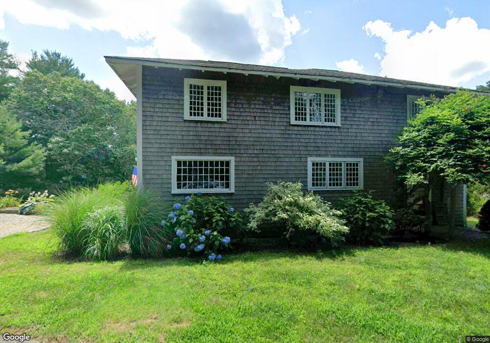
149 Abrams Hill Rd Duxbury, MA 02332
Estimated Value: $990,000 - $1,564,000
3
Beds
3
Baths
2,376
Sq Ft
$580/Sq Ft
Est. Value
About This Home
This home is located at 149 Abrams Hill Rd, Duxbury, MA 02332 and is currently estimated at $1,378,947, approximately $580 per square foot. 149 Abrams Hill Rd is a home located in Plymouth County with nearby schools including Chandler Elementary School, Alden School, and Duxbury Middle School.
Ownership History
Date
Name
Owned For
Owner Type
Purchase Details
Closed on
Jun 22, 2009
Sold by
Doyle Scott V
Bought by
Doyle Scott and Doyle Blake P
Current Estimated Value
Home Financials for this Owner
Home Financials are based on the most recent Mortgage that was taken out on this home.
Original Mortgage
$205,000
Outstanding Balance
$130,497
Interest Rate
4.91%
Mortgage Type
Purchase Money Mortgage
Estimated Equity
$1,248,450
Purchase Details
Closed on
Oct 4, 1994
Sold by
Middleton James W
Bought by
Doyle Scott
Create a Home Valuation Report for This Property
The Home Valuation Report is an in-depth analysis detailing your home's value as well as a comparison with similar homes in the area
Home Values in the Area
Average Home Value in this Area
Purchase History
| Date | Buyer | Sale Price | Title Company |
|---|---|---|---|
| Doyle Scott | -- | -- | |
| Doyle Scott | $150,000 | -- |
Source: Public Records
Mortgage History
| Date | Status | Borrower | Loan Amount |
|---|---|---|---|
| Open | Doyle Scott | $205,000 | |
| Previous Owner | Doyle Scott | $22,000 | |
| Previous Owner | Doyle Scott | $213,500 | |
| Previous Owner | Doyle Scott | $215,000 |
Source: Public Records
Tax History Compared to Growth
Tax History
| Year | Tax Paid | Tax Assessment Tax Assessment Total Assessment is a certain percentage of the fair market value that is determined by local assessors to be the total taxable value of land and additions on the property. | Land | Improvement |
|---|---|---|---|---|
| 2025 | $13,247 | $1,306,400 | $934,000 | $372,400 |
| 2024 | $13,188 | $1,310,900 | $934,000 | $376,900 |
| 2023 | $12,524 | $1,171,600 | $883,600 | $288,000 |
| 2022 | $12,775 | $994,900 | $730,700 | $264,200 |
| 2021 | $12,408 | $856,900 | $616,200 | $240,700 |
| 2020 | $10,318 | $703,800 | $480,000 | $223,800 |
| 2019 | $10,575 | $720,400 | $480,000 | $240,400 |
| 2018 | $10,413 | $686,900 | $456,000 | $230,900 |
| 2017 | $10,531 | $679,000 | $456,000 | $223,000 |
| 2016 | $10,558 | $679,000 | $456,000 | $223,000 |
| 2015 | $9,015 | $577,900 | $354,900 | $223,000 |
Source: Public Records
Map
Nearby Homes
- 74 Abrams Hill Rd
- 387 Lot 2A Old Cove Rd
- 387 Lot 3A Old Cove Rd
- 387 Lot 4A Old Cove Rd
- 39 Bay Pond Rd
- 10 Hawthorn Hill
- 590 Washington St
- Two Railroad Ave Unit 2
- Two Railroad Ave Unit 1
- Two Railroad Ave Unit 8
- 25 Hawthorn Hill
- 535 Washington St
- 236 Powder Point Ave
- 1141 Tremont St
- 9 S Pasture Ln
- 6 Rachael's Ln
- 112 Partridge Brook Cir
- 5 Adelaide Way
- 36 Ocean Rd N
- 20 Possum Run
- 145 Abrams Hill Rd
- 88 Abrams Hill Rd
- 137 Abrams Hill Rd
- 163 Abrams Hill Rd
- 100 Abrams Hill Rd
- 68 Abrams Hill Rd
- 110 Abrams Hill Rd
- 175 Abrams Hill Rd
- 0 Abrams Hill Unit 70123274
- 75 Abrams Hill Rd
- 125 Abrams Hill Rd
- 69 Abrams Hill Rd
- 69 Abrams
- 32 Abrams Hill Rd
- 121 Abrams Hill Rd
- 121 Abrams Hill Rd
- 93 Abrams Hill Rd
- 109 Abrams Hill Rd
- 93 Abrams
- 51 Abrams Hill Rd