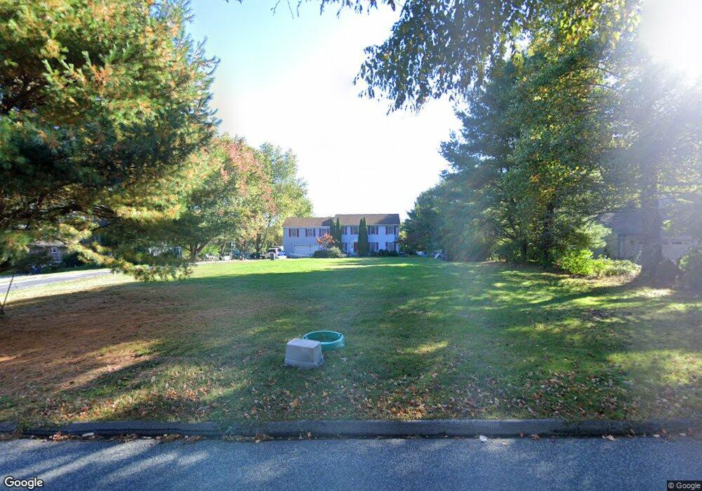
149 Bloomingdale Rd Quaker Hill, CT 06375
Estimated Value: $530,000 - $677,000
4
Beds
3
Baths
2,816
Sq Ft
$215/Sq Ft
Est. Value
About This Home
This home is located at 149 Bloomingdale Rd, Quaker Hill, CT 06375 and is currently estimated at $605,234, approximately $214 per square foot. 149 Bloomingdale Rd is a home located in New London County with nearby schools including Clark Lane Middle School, Waterford High School, and New London High School Multi-Magnet Campus.
Ownership History
Date
Name
Owned For
Owner Type
Purchase Details
Closed on
Dec 18, 1997
Sold by
Kane Angela R
Bought by
Keth Sotha and Keth Makadalin P
Current Estimated Value
Home Financials for this Owner
Home Financials are based on the most recent Mortgage that was taken out on this home.
Original Mortgage
$128,000
Outstanding Balance
$29,050
Interest Rate
7.14%
Mortgage Type
Purchase Money Mortgage
Estimated Equity
$576,184
Create a Home Valuation Report for This Property
The Home Valuation Report is an in-depth analysis detailing your home's value as well as a comparison with similar homes in the area
Home Values in the Area
Average Home Value in this Area
Purchase History
| Date | Buyer | Sale Price | Title Company |
|---|---|---|---|
| Keth Sotha | $160,000 | -- |
Source: Public Records
Mortgage History
| Date | Status | Borrower | Loan Amount |
|---|---|---|---|
| Open | Keth Sotha | $128,000 | |
| Previous Owner | Keth Sotha | $120,000 | |
| Previous Owner | Keth Sotha | $85,000 |
Source: Public Records
Tax History Compared to Growth
Tax History
| Year | Tax Paid | Tax Assessment Tax Assessment Total Assessment is a certain percentage of the fair market value that is determined by local assessors to be the total taxable value of land and additions on the property. | Land | Improvement |
|---|---|---|---|---|
| 2025 | $6,441 | $275,710 | $91,810 | $183,900 |
| 2024 | $6,148 | $275,710 | $91,810 | $183,900 |
| 2023 | $5,946 | $280,480 | $91,810 | $188,670 |
| 2022 | $6,460 | $234,400 | $65,340 | $169,060 |
| 2021 | $6,479 | $234,400 | $65,340 | $169,060 |
| 2020 | $6,533 | $234,400 | $65,340 | $169,060 |
| 2019 | $6,559 | $234,400 | $65,340 | $169,060 |
| 2018 | $6,427 | $234,400 | $65,340 | $169,060 |
| 2017 | $6,526 | $241,420 | $59,990 | $181,430 |
| 2016 | $6,465 | $241,420 | $59,990 | $181,430 |
| 2015 | $6,236 | $241,420 | $59,990 | $181,430 |
| 2014 | $6,236 | $241,420 | $59,990 | $181,430 |
Source: Public Records
Map
Nearby Homes
- 118 Bloomingdale Rd
- 114 Bloomingdale Rd
- 10 Hillcrest Dr
- 3 Milton Rd
- 625 Vauxhall Street Extension
- 20 Connshire Dr
- 11 Mamacoke Rd
- 1 Chapman Ave
- 34 Rogers Hill Rd
- 62 Benham Ave
- 13 Dayton Rd
- 62 Douglas Ln
- 14 N Phillips St
- 64 Scotch Cap Rd Unit 175
- 47 Phillips St
- 41 5th Ave
- 30 Margaret St
- 430 Vauxhall St
- 205 Old Norwich Rd
- 70 Morgan St
- 147 Bloomingdale Rd
- 151 Bloomingdale Rd
- 145 Bloomingdale Rd
- 146 Bloomingdale Rd
- 143 Bloomingdale Rd
- 141 Bloomingdale Rd
- 144 Bloomingdale Rd
- 157 Bloomingdale Rd
- 137 Bloomingdale Rd
- 138 Bloomingdale Rd
- 142 Bloomingdale Rd
- 135 Bloomingdale Rd
- 2 Applewood Dr
- 140 Bloomingdale Rd
- 4 Applewood Dr
- 6 Applewood Dr
- 8 Applewood Dr
- 168 Bloomingdale Rd
- 10 Applewood Dr
- 132 Bloomingdale Rd