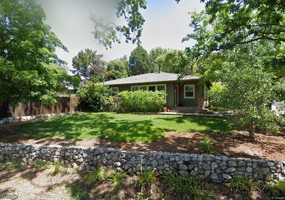
149 Brook Rd Auburn, CA 95603
Estimated Value: $508,705 - $637,000
2
Beds
2
Baths
1,541
Sq Ft
$381/Sq Ft
Est. Value
About This Home
This home is located at 149 Brook Rd, Auburn, CA 95603 and is currently estimated at $587,176, approximately $381 per square foot. 149 Brook Rd is a home located in Placer County with nearby schools including Skyridge Elementary School, Placer High School, and Alta Vista Community Charter.
Ownership History
Date
Name
Owned For
Owner Type
Purchase Details
Closed on
Feb 23, 2026
Sold by
Dunham and Dunham Molly
Bought by
Dunham Family 2025 Revocable Trust and Dunham
Current Estimated Value
Purchase Details
Closed on
Nov 23, 1998
Sold by
Grzywacki Alexander F
Bought by
Dunham George and Dunham Molly
Home Financials for this Owner
Home Financials are based on the most recent Mortgage that was taken out on this home.
Original Mortgage
$115,400
Interest Rate
6.84%
Create a Home Valuation Report for This Property
The Home Valuation Report is an in-depth analysis detailing your home's value as well as a comparison with similar homes in the area
Home Values in the Area
Average Home Value in this Area
Purchase History
| Date | Buyer | Sale Price | Title Company |
|---|---|---|---|
| Dunham Family 2025 Revocable Trust | -- | None Listed On Document | |
| Dunham George | $119,000 | Fidelity National Title Co |
Source: Public Records
Mortgage History
| Date | Status | Borrower | Loan Amount |
|---|---|---|---|
| Previous Owner | Dunham George | $115,400 |
Source: Public Records
Tax History
| Year | Tax Paid | Tax Assessment Tax Assessment Total Assessment is a certain percentage of the fair market value that is determined by local assessors to be the total taxable value of land and additions on the property. | Land | Improvement |
|---|---|---|---|---|
| 2025 | $3,161 | $219,582 | $62,695 | $156,887 |
| 2023 | $3,161 | $211,057 | $60,261 | $150,796 |
| 2022 | $3,123 | $206,920 | $59,080 | $147,840 |
| 2021 | $3,044 | $202,864 | $57,922 | $144,942 |
| 2020 | $3,028 | $200,785 | $57,329 | $143,456 |
| 2019 | $2,988 | $196,849 | $56,205 | $140,644 |
| 2018 | $2,876 | $192,990 | $55,103 | $137,887 |
| 2017 | $2,803 | $189,207 | $54,023 | $135,184 |
| 2016 | $2,726 | $185,498 | $52,964 | $132,534 |
| 2015 | $2,647 | $182,713 | $52,169 | $130,544 |
| 2014 | $2,585 | $179,135 | $51,148 | $127,987 |
Source: Public Records
Map
Nearby Homes
- 145 Wescott Ct
- 137 Harrison Ave
- 150 Center St
- 163 Pleasant Ave
- 124 Oakwood Dr
- 121 Aeolia Dr
- 228 Foresthill Ave Unit B
- 413 Orchard Ct
- 325 Union St
- 111 Electric St
- 119 Toyon Dr
- 160 Walker Dr
- 114 Pinecrest Ave
- 221 Sutter St
- 731 Mikkelsen Dr
- 90 Lincoln Way
- 55 Neils
- 13003 Sweetbriar Ct
- 200 Hidden Creek Dr
- 13035 Lincoln Way Unit 118
Your Personal Tour Guide
Ask me questions while you tour the home.