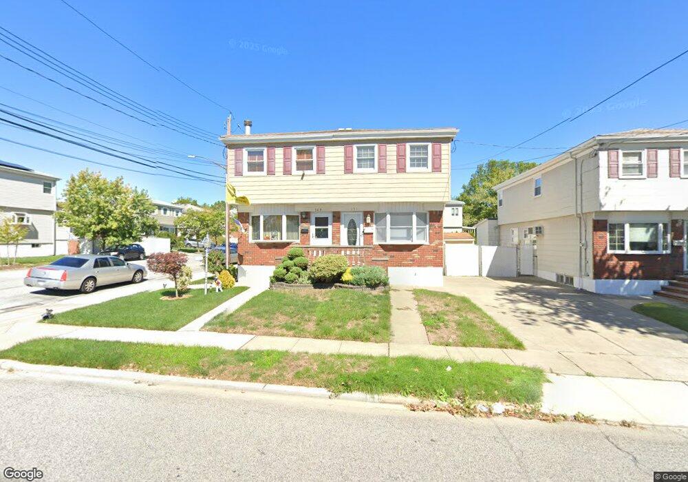
149 Buffalo St Staten Island, NY 10306
Bay Terrace NeighborhoodEstimated Value: $664,000 - $720,000
3
Beds
2
Baths
1,140
Sq Ft
$607/Sq Ft
Est. Value
About This Home
This home is located at 149 Buffalo St, Staten Island, NY 10306 and is currently estimated at $691,615, approximately $606 per square foot. 149 Buffalo St is a home located in Richmond County with nearby schools including P.S. 50 Frank Hankinson School, Myra S. Barnes Intermediate School 24, and New Dorp High School.
Ownership History
Date
Name
Owned For
Owner Type
Purchase Details
Closed on
Mar 16, 2001
Sold by
Milone Marie and Masula Donald
Bought by
Dirusso Christopher
Current Estimated Value
Home Financials for this Owner
Home Financials are based on the most recent Mortgage that was taken out on this home.
Original Mortgage
$143,000
Outstanding Balance
$51,876
Interest Rate
6.97%
Estimated Equity
$639,739
Purchase Details
Closed on
Apr 28, 2000
Sold by
Milone Marie and Masula Donald
Bought by
Milone Marie and Masula Donald
Create a Home Valuation Report for This Property
The Home Valuation Report is an in-depth analysis detailing your home's value as well as a comparison with similar homes in the area
Home Values in the Area
Average Home Value in this Area
Purchase History
| Date | Buyer | Sale Price | Title Company |
|---|---|---|---|
| Dirusso Christopher | $218,000 | -- | |
| Milone Marie | -- | -- |
Source: Public Records
Mortgage History
| Date | Status | Borrower | Loan Amount |
|---|---|---|---|
| Open | Dirusso Christopher | $143,000 |
Source: Public Records
Tax History Compared to Growth
Tax History
| Year | Tax Paid | Tax Assessment Tax Assessment Total Assessment is a certain percentage of the fair market value that is determined by local assessors to be the total taxable value of land and additions on the property. | Land | Improvement |
|---|---|---|---|---|
| 2025 | $6,036 | $42,360 | $7,381 | $34,979 |
| 2024 | $6,048 | $38,880 | $7,911 | $30,969 |
| 2023 | $5,731 | $29,932 | $6,990 | $22,942 |
| 2022 | $5,350 | $37,080 | $9,780 | $27,300 |
| 2021 | $5,303 | $30,840 | $9,780 | $21,060 |
| 2020 | $5,343 | $31,920 | $9,780 | $22,140 |
| 2019 | $5,190 | $31,320 | $9,780 | $21,540 |
| 2018 | $4,787 | $24,943 | $8,164 | $16,779 |
| 2017 | $4,497 | $23,532 | $9,111 | $14,421 |
| 2016 | $4,128 | $22,200 | $9,780 | $12,420 |
| 2015 | $3,887 | $22,248 | $7,758 | $14,490 |
| 2014 | $3,887 | $21,841 | $7,616 | $14,225 |
Source: Public Records
Map
Nearby Homes
- 148 Hopkins Ave
- 55 O'Gorman Ave
- 92 Twombly Ave
- 133 Durant Ave
- 238 Montreal Ave
- 2075 N Railroad Ave
- 276 Fairbanks Ave
- 26 Benton Ct
- 220 O'Gorman Ave
- 12 Benton Ct
- 158 Malone Ave
- 390 Montreal Ave
- 3438 Amboy Rd Unit 3438
- 1915 N Railroad Ave
- 56 Brook Ave
- 28 Bay Terrace Unit 2H
- 30 Greencroft Ave
- 100 Savoy St Unit 1, 39, 43, 45, 46
- 14 Savoy St Unit 14
- 16 Savoy St Unit 16
- 151 Buffalo St
- 153 Buffalo St
- 18 Hooper Ave
- 143 Buffalo St
- 157 Buffalo St
- 16 Hooper Ave
- 139 Buffalo St
- 12 Hooper Ave
- 137 Buffalo St
- 161 Buffalo St
- 17 Hooper Ave
- 15 Hooper Ave Unit 91
- 15-91 Hooper Ave
- 135 Buffalo St
- 165 Buffalo St
- 172 Emmet Ave
- 148 Buffalo St
- 11 Hooper Ave
- 150 Buffalo St
- 6 Hooper Ave