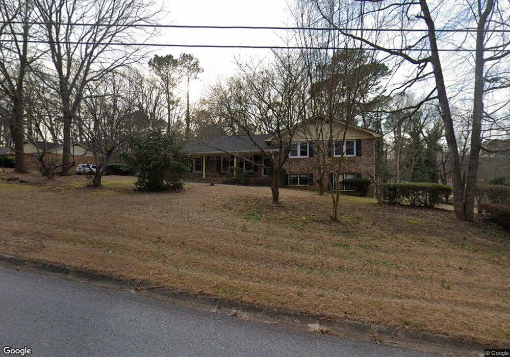
149 Bunker Dr Athens, GA 30607
Estimated Value: $325,000 - $373,000
3
Beds
2
Baths
2,374
Sq Ft
$147/Sq Ft
Est. Value
About This Home
This home is located at 149 Bunker Dr, Athens, GA 30607 and is currently estimated at $347,807, approximately $146 per square foot. 149 Bunker Dr is a home located in Clarke County with nearby schools including Burney-Harris-Lyons Middle School, Clarke Central High School, and Foothills Education Charter High School.
Ownership History
Date
Name
Owned For
Owner Type
Purchase Details
Closed on
Jan 7, 2005
Sold by
Rosser Richard Delano
Bought by
James Willie
Current Estimated Value
Home Financials for this Owner
Home Financials are based on the most recent Mortgage that was taken out on this home.
Original Mortgage
$64,000
Outstanding Balance
$31,576
Interest Rate
5.61%
Mortgage Type
New Conventional
Estimated Equity
$316,231
Purchase Details
Closed on
Jan 18, 1994
Sold by
Vanderpool Richard D and Vanderpool Judith A
Bought by
Rosser Richard Delano and Rosser Sammie L
Create a Home Valuation Report for This Property
The Home Valuation Report is an in-depth analysis detailing your home's value as well as a comparison with similar homes in the area
Home Values in the Area
Average Home Value in this Area
Purchase History
| Date | Buyer | Sale Price | Title Company |
|---|---|---|---|
| James Willie | $134,000 | -- | |
| Rosser Richard Delano | $91,000 | -- |
Source: Public Records
Mortgage History
| Date | Status | Borrower | Loan Amount |
|---|---|---|---|
| Open | James Willie | $64,000 |
Source: Public Records
Tax History Compared to Growth
Tax History
| Year | Tax Paid | Tax Assessment Tax Assessment Total Assessment is a certain percentage of the fair market value that is determined by local assessors to be the total taxable value of land and additions on the property. | Land | Improvement |
|---|---|---|---|---|
| 2025 | $1,881 | $113,492 | $16,000 | $97,492 |
| 2024 | $1,881 | $112,006 | $16,000 | $96,006 |
| 2023 | $573 | $106,066 | $16,000 | $90,066 |
| 2022 | $1,839 | $88,186 | $16,000 | $72,186 |
| 2021 | $1,668 | $68,482 | $12,000 | $56,482 |
| 2020 | $1,619 | $64,875 | $12,000 | $52,875 |
| 2019 | $1,568 | $60,222 | $12,000 | $48,222 |
| 2018 | $1,484 | $54,195 | $12,000 | $42,195 |
| 2017 | $1,480 | $53,976 | $12,000 | $41,976 |
| 2016 | $1,317 | $48,805 | $12,000 | $36,805 |
| 2015 | $1,353 | $49,842 | $12,000 | $37,842 |
| 2014 | $1,359 | $50,043 | $12,000 | $38,043 |
Source: Public Records
Map
Nearby Homes