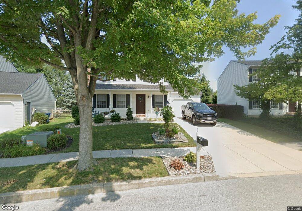
149 Colorado Ave Unit 25 Littlestown, PA 17340
Estimated Value: $295,581 - $313,000
3
Beds
2
Baths
1,248
Sq Ft
$245/Sq Ft
Est. Value
About This Home
This home is located at 149 Colorado Ave Unit 25, Littlestown, PA 17340 and is currently estimated at $306,145, approximately $245 per square foot. 149 Colorado Ave Unit 25 is a home located in Adams County with nearby schools including Rolling Acres El School, Maple Avenue Middle School, and Littlestown Senior High School.
Ownership History
Date
Name
Owned For
Owner Type
Purchase Details
Closed on
Jul 29, 1996
Bought by
Grundy Maury Renee
Current Estimated Value
Create a Home Valuation Report for This Property
The Home Valuation Report is an in-depth analysis detailing your home's value as well as a comparison with similar homes in the area
Home Values in the Area
Average Home Value in this Area
Purchase History
| Date | Buyer | Sale Price | Title Company |
|---|---|---|---|
| Grundy Maury Renee | $125,900 | -- |
Source: Public Records
Tax History Compared to Growth
Tax History
| Year | Tax Paid | Tax Assessment Tax Assessment Total Assessment is a certain percentage of the fair market value that is determined by local assessors to be the total taxable value of land and additions on the property. | Land | Improvement |
|---|---|---|---|---|
| 2025 | $4,549 | $197,900 | $35,000 | $162,900 |
| 2024 | $4,384 | $197,900 | $35,000 | $162,900 |
| 2023 | $4,214 | $197,900 | $35,000 | $162,900 |
| 2022 | $4,189 | $197,900 | $35,000 | $162,900 |
| 2021 | $4,065 | $197,900 | $35,000 | $162,900 |
| 2020 | $4,016 | $197,900 | $35,000 | $162,900 |
| 2019 | $3,896 | $197,900 | $35,000 | $162,900 |
| 2018 | $3,825 | $197,900 | $35,000 | $162,900 |
| 2017 | $3,726 | $197,900 | $35,000 | $162,900 |
| 2016 | -- | $197,900 | $35,000 | $162,900 |
| 2015 | -- | $197,900 | $35,000 | $162,900 |
| 2014 | -- | $197,900 | $35,000 | $162,900 |
Source: Public Records
Map
Nearby Homes
- 52 Stayman Way Unit 81
- 235 W Myrtle St
- 135 Apple Grove Ln Unit 438
- 58 N Gala Unit 397
- 22 Rita Marie Ave
- 440 N Queen St
- 129 W King St
- 61 Stoners Cir
- 317 Prince St
- 74 W King St
- 115 Charles St
- 117 Charles St
- 48 Windsor Ct
- 58 Windsor Ct
- 162 Newark St
- 118 Mount Carmel Dr Unit 192
- 20c Locust Dr
- 0 Locust Dr Unit PAAD2015910
- 20 Locust Dr
- 15 Brandywine Ct Unit 34
- 151 Colorado Ave Unit 26
- 153 Colorado Ave Unit 27
- 141 Colorado Ave Unit 22
- 148 Colorado Ave Unit 89
- 152 Colorado Ave Unit 88
- 155 Colorado Ave Unit 28
- 144 Colorado Ave Unit 90
- 156 Colorado Ave Unit 87
- 139 Colorado Ave Unit 21
- 26 Smokehouse Ct Unit 16
- 24 Smokehouse Ct Unit 17
- 140 Colorado Ave Unit 91
- 159 Colorado Ave Unit 29
- 160 Colorado Ave Unit 86
- 56 Stayman Way Unit 80
- 58 Stayman Way Unit 79
- 41 Appler Ct Unit 48
- 136 Colorado Ave Unit 92
- 161 Colorado Ave Unit 30
- 137 Colorado Ave