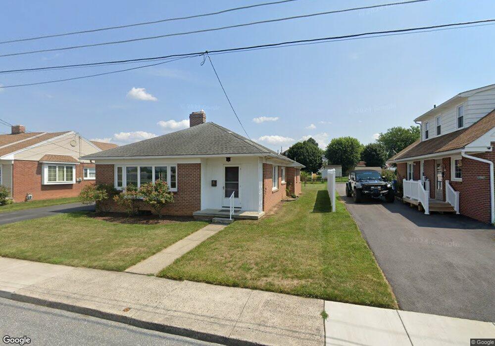
149 E Myrtle St Littlestown, PA 17340
Estimated Value: $206,000 - $227,191
3
Beds
1
Bath
1,053
Sq Ft
$203/Sq Ft
Est. Value
About This Home
This home is located at 149 E Myrtle St, Littlestown, PA 17340 and is currently estimated at $214,048, approximately $203 per square foot. 149 E Myrtle St is a home located in Adams County with nearby schools including Rolling Acres El School, Maple Avenue Middle School, and Littlestown Senior High School.
Ownership History
Date
Name
Owned For
Owner Type
Purchase Details
Closed on
Nov 7, 2024
Sold by
Klunk David R and Klunk Pamela B
Bought by
Naill Brandon T and Roth Sydni D
Current Estimated Value
Home Financials for this Owner
Home Financials are based on the most recent Mortgage that was taken out on this home.
Original Mortgage
$196,377
Outstanding Balance
$194,407
Interest Rate
6.08%
Mortgage Type
FHA
Estimated Equity
$19,641
Purchase Details
Closed on
Jan 2, 1997
Bought by
Klunk Pamela B and Klunk David R
Create a Home Valuation Report for This Property
The Home Valuation Report is an in-depth analysis detailing your home's value as well as a comparison with similar homes in the area
Home Values in the Area
Average Home Value in this Area
Purchase History
| Date | Buyer | Sale Price | Title Company |
|---|---|---|---|
| Naill Brandon T | $200,000 | None Listed On Document | |
| Klunk Pamela B | -- | -- |
Source: Public Records
Mortgage History
| Date | Status | Borrower | Loan Amount |
|---|---|---|---|
| Open | Naill Brandon T | $196,377 |
Source: Public Records
Tax History
| Year | Tax Paid | Tax Assessment Tax Assessment Total Assessment is a certain percentage of the fair market value that is determined by local assessors to be the total taxable value of land and additions on the property. | Land | Improvement |
|---|---|---|---|---|
| 2025 | $3,262 | $141,900 | $41,000 | $100,900 |
| 2024 | $3,144 | $141,900 | $41,000 | $100,900 |
| 2023 | $3,022 | $141,900 | $41,000 | $100,900 |
| 2022 | $3,003 | $141,900 | $41,000 | $100,900 |
| 2021 | $2,914 | $141,900 | $41,000 | $100,900 |
| 2020 | $2,880 | $141,900 | $41,000 | $100,900 |
| 2019 | $2,793 | $141,900 | $41,000 | $100,900 |
| 2018 | $2,742 | $141,900 | $41,000 | $100,900 |
| 2017 | $2,672 | $141,900 | $41,000 | $100,900 |
| 2016 | -- | $141,900 | $41,000 | $100,900 |
| 2015 | -- | $141,900 | $41,000 | $100,900 |
| 2014 | -- | $141,900 | $41,000 | $100,900 |
Source: Public Records
Map
Nearby Homes
- 41 Smith Cir
- 162 Newark St
- 102 N Queen St
- 115 Charles St
- 45 James Ave
- 117 Charles St
- 535 Lumber St
- 102 Cemetery St
- 559 Lumber St
- 567 Lumber St
- 230 M St
- 141 W King St
- 161 Cemetery St
- 13 Fieldcrest Dr Unit 154
- 484 S Columbus Ave Unit 19
- 61 Stoners Cir
- 0 Locust Dr Unit PAAD2015910
- 20c Locust Dr
- 7 Stoners Cir
- 20 Stedtle Ave
- 153 E Myrtle St
- 145 E Myrtle St
- 159 E Myrtle St
- 139 E Myrtle St
- 91 Playground Ave
- 74 Crouse Park
- 78 Crouse Park Unit 30
- 72 Crouse Park
- 85 Crouse Park
- 97 Park Ave
- 91 Park Ave
- 83 Crouse Park
- 70 Crouse Park
- 81 Crouse Park
- 68 Crouse Park
- 136 E Myrtle St
- 66 Crouse Park
- 79 Crouse Park
- 64 Crouse Park
- 75 Crouse Park
Your Personal Tour Guide
Ask me questions while you tour the home.