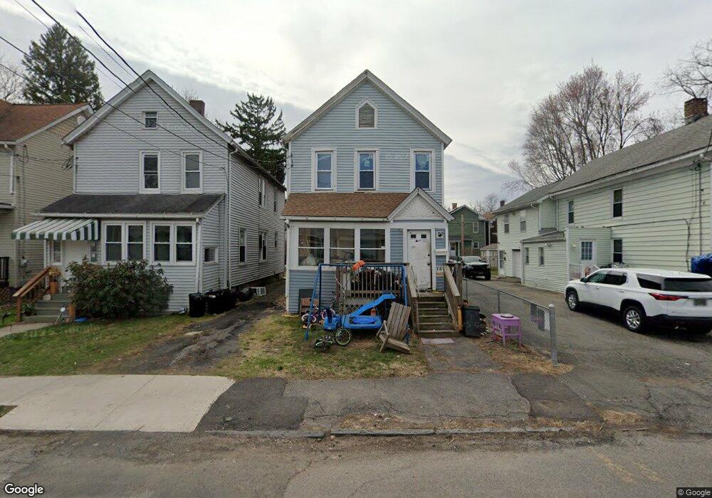
149 Hammond St Unit 2 Port Jervis, NY 12771
Estimated Value: $214,000 - $275,000
3
Beds
2
Baths
1,440
Sq Ft
$168/Sq Ft
Est. Value
About This Home
This home is located at 149 Hammond St Unit 2, Port Jervis, NY 12771 and is currently estimated at $242,590, approximately $168 per square foot. 149 Hammond St Unit 2 is a home located in Orange County with nearby schools including Port Jervis High School and New Life Christian Day School.
Ownership History
Date
Name
Owned For
Owner Type
Purchase Details
Closed on
Jun 26, 2019
Sold by
Us Bank Na Tr
Bought by
Liu Cui and Qian Zhizheng
Current Estimated Value
Purchase Details
Closed on
Nov 15, 2018
Sold by
Ferraro Antonio and Ferraro Lucia
Bought by
Us Bank Na Tr
Purchase Details
Closed on
May 8, 2018
Sold by
Reo Distribution Llc
Bought by
Miller Surie
Purchase Details
Closed on
Jan 22, 2013
Sold by
Us Bank
Bought by
Red Distribution Llc
Purchase Details
Closed on
Jul 18, 2012
Sold by
Howard Dallow As Referee
Bought by
Us Bank Na
Create a Home Valuation Report for This Property
The Home Valuation Report is an in-depth analysis detailing your home's value as well as a comparison with similar homes in the area
Home Values in the Area
Average Home Value in this Area
Purchase History
| Date | Buyer | Sale Price | Title Company |
|---|---|---|---|
| Liu Cui | $19,000 | -- | |
| Us Bank Na Tr | $102,608 | -- | |
| Us Bank Na Tr | $102,608 | -- | |
| Us Bank Na Tr | $102,608 | -- | |
| Miller Surie | $13,640 | -- | |
| Miller Surie | $13,640 | -- | |
| Miller Surie | $13,640 | -- | |
| Red Distribution Llc | $7,625 | -- | |
| Red Distribution Llc | $7,625 | -- | |
| Us Bank Na | -- | -- | |
| Us Bank Na | -- | -- |
Source: Public Records
Tax History
| Year | Tax Paid | Tax Assessment Tax Assessment Total Assessment is a certain percentage of the fair market value that is determined by local assessors to be the total taxable value of land and additions on the property. | Land | Improvement |
|---|---|---|---|---|
| 2024 | $2,872 | $40,000 | $2,250 | $37,750 |
| 2023 | $2,872 | $40,000 | $2,250 | $37,750 |
| 2022 | $3,669 | $40,000 | $2,250 | $37,750 |
| 2021 | $3,176 | $40,000 | $2,250 | $37,750 |
| 2020 | $3,257 | $40,000 | $2,250 | $37,750 |
| 2019 | $397 | $40,000 | $2,250 | $37,750 |
| 2018 | $3,999 | $40,000 | $2,250 | $37,750 |
| 2017 | $3,147 | $40,000 | $2,250 | $37,750 |
| 2016 | $4,085 | $40,000 | $2,250 | $37,750 |
| 2015 | -- | $40,000 | $2,250 | $37,750 |
| 2014 | -- | $25,000 | $2,250 | $22,750 |
Source: Public Records
Map
Nearby Homes
- 142 Ball St
- 172 Front St Unit 172
- 137 Ball St
- 138 Front St Unit 140
- 120 Jersey Ave
- 115 Hammond St
- 131 Front St
- 189 E Main St
- 178-180 Ball St
- 109 US Highway 6
- 122 Front St
- 87 Ball St
- 39 Church St Unit 3
- 39 Church St Unit 22
- 39 Church St Unit 4
- 44 Church St
- 1 High St
- 9 Carpenter Rd
- 10 Jones St
- 14 Division St
- 149 Hammond St
- 149 1/2 Hammond St
- 151 Hammond St
- 147 Hammond St
- 153 Hammond St
- 148 Ball St
- 150 Ball St
- 143 Hammond St Unit 145
- 146 Ball St
- 154 Ball St
- 144 Ball St
- 155 Hammond St
- 156 Ball St Unit 158
- 140 Hammond St
- 157 Hammond St
- 140 Ball St
- 162 Ball St
- 149 Ball St
- 153 Ball St Unit 153
- 153 Ball St Unit 3
Your Personal Tour Guide
Ask me questions while you tour the home.