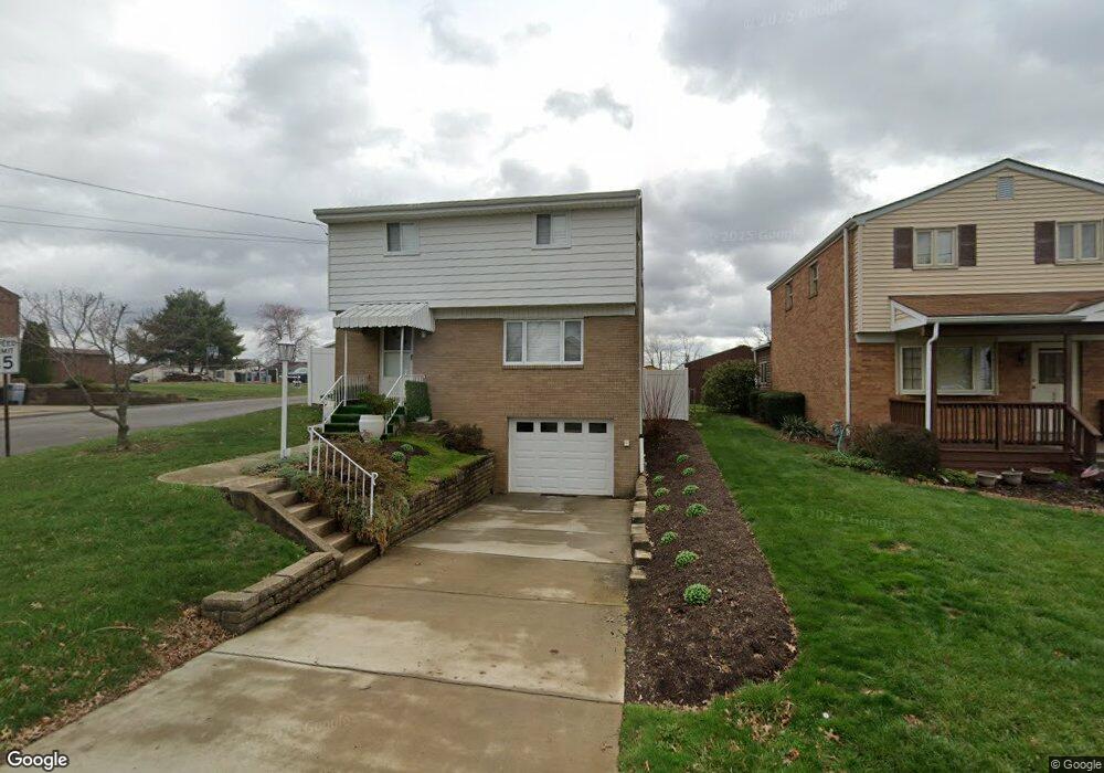
149 Speer St Mc Kees Rocks, PA 15136
Stowe Township NeighborhoodEstimated Value: $194,000 - $212,000
2
Beds
2
Baths
1,372
Sq Ft
$148/Sq Ft
Est. Value
About This Home
This home is located at 149 Speer St, Mc Kees Rocks, PA 15136 and is currently estimated at $203,181, approximately $148 per square foot. 149 Speer St is a home located in Allegheny County with nearby schools including Sto-Rox Upper Elementary School, Sto-Rox Primary Center, and Sto-Rox Junior/Senior High School.
Ownership History
Date
Name
Owned For
Owner Type
Purchase Details
Closed on
Dec 19, 2003
Sold by
Marselese James T
Bought by
Welsh Dolores Ann
Current Estimated Value
Home Financials for this Owner
Home Financials are based on the most recent Mortgage that was taken out on this home.
Original Mortgage
$40,000
Outstanding Balance
$18,639
Interest Rate
5.96%
Mortgage Type
New Conventional
Estimated Equity
$184,542
Purchase Details
Closed on
Jul 18, 2001
Sold by
Marsalese Rose
Bought by
Andrew Judith Ann Gallo and Marsalese Lorraine Marie
Create a Home Valuation Report for This Property
The Home Valuation Report is an in-depth analysis detailing your home's value as well as a comparison with similar homes in the area
Home Values in the Area
Average Home Value in this Area
Purchase History
| Date | Buyer | Sale Price | Title Company |
|---|---|---|---|
| Welsh Dolores Ann | $96,000 | -- | |
| Andrew Judith Ann Gallo | -- | -- |
Source: Public Records
Mortgage History
| Date | Status | Borrower | Loan Amount |
|---|---|---|---|
| Open | Welsh Dolores Ann | $40,000 |
Source: Public Records
Tax History Compared to Growth
Tax History
| Year | Tax Paid | Tax Assessment Tax Assessment Total Assessment is a certain percentage of the fair market value that is determined by local assessors to be the total taxable value of land and additions on the property. | Land | Improvement |
|---|---|---|---|---|
| 2025 | $3,128 | $72,400 | $19,600 | $52,800 |
| 2024 | $3,128 | $72,400 | $19,600 | $52,800 |
| 2023 | $3,007 | $72,400 | $19,600 | $52,800 |
| 2022 | $2,911 | $72,400 | $19,600 | $52,800 |
| 2021 | $342 | $72,400 | $19,600 | $52,800 |
| 2020 | $2,845 | $72,400 | $19,600 | $52,800 |
| 2019 | $2,845 | $72,400 | $19,600 | $52,800 |
| 2018 | $342 | $72,400 | $19,600 | $52,800 |
| 2017 | $2,780 | $72,400 | $19,600 | $52,800 |
| 2016 | $342 | $72,400 | $19,600 | $52,800 |
| 2015 | $342 | $72,400 | $19,600 | $52,800 |
| 2014 | $2,780 | $72,400 | $19,600 | $52,800 |
Source: Public Records
Map
Nearby Homes
- 179 William Cir
- 214 Barbara Dr
- 104 Thorncrest Dr
- 86 Thorncrest Dr
- 1550 Glenn Way
- 155 Roosevelt Ave
- 23 Castle View Dr
- 270 Wheeler Ave
- 1490 Island Ave
- 8 Court Place
- 1421 Fleming Ave
- 543 Elizabeth Ave
- 124 Pleasant Ridge Rd
- 1017 Mccoy Rd
- 1408 Broadway Ave
- 1406 Broadway Ave
- 1212 Woodward Ave
- 172 N Vireo Dr
- 932 Ridge Ave
- 809 11th St