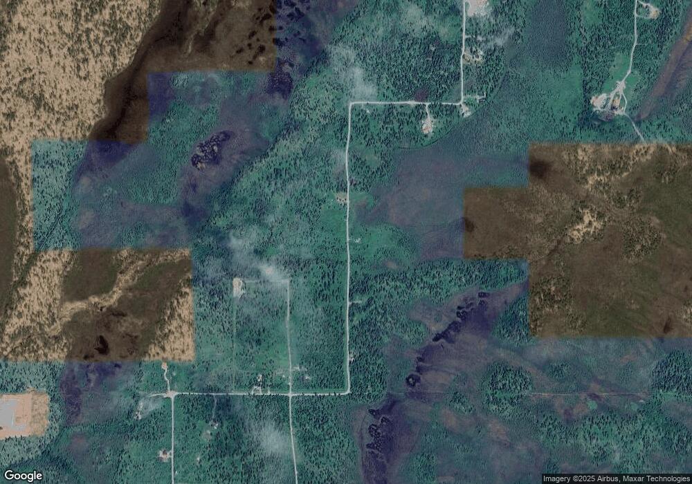
149 Spern Rd Anchor Point, AK 99556
Estimated Value: $130,000
3
Beds
--
Bath
180
Sq Ft
$722/Sq Ft
Est. Value
About This Home
This home is located at 149 Spern Rd, Anchor Point, AK 99556 and is currently estimated at $130,000, approximately $722 per square foot. 149 Spern Rd is a home located in Kenai Peninsula Borough with nearby schools including Chapman School and Homer High School.
Ownership History
Date
Name
Owned For
Owner Type
Purchase Details
Closed on
May 29, 2014
Sold by
Larson Bruce C and Larson Glenda A
Bought by
Wheeler Randy J and Wheeler Sharon Y
Current Estimated Value
Purchase Details
Closed on
May 16, 2013
Sold by
Larson Bruce C
Bought by
Larson Bruce C and Larson Glenda A
Purchase Details
Closed on
Oct 29, 2012
Sold by
Hollamon Douglas and Hollaman Douglas
Bought by
Larson Bruce C
Home Financials for this Owner
Home Financials are based on the most recent Mortgage that was taken out on this home.
Original Mortgage
$18,000
Interest Rate
3.5%
Mortgage Type
Seller Take Back
Purchase Details
Closed on
Jul 23, 2009
Sold by
Dillon Jeff
Bought by
Hollaman Douglas
Purchase Details
Closed on
May 7, 2007
Sold by
Riggs Jack Leroy
Bought by
Dillon Jeff
Purchase Details
Closed on
May 30, 2002
Sold by
Monster Properties Inc
Bought by
Riggs Jack Leroy
Create a Home Valuation Report for This Property
The Home Valuation Report is an in-depth analysis detailing your home's value as well as a comparison with similar homes in the area
Purchase History
| Date | Buyer | Sale Price | Title Company |
|---|---|---|---|
| Wheeler Randy J | -- | First American Title Ins Co | |
| Larson Bruce C | -- | None Available | |
| Larson Bruce C | -- | First American Title Ins Co | |
| Hollaman Douglas | -- | First American Title Ins Co | |
| Dillon Jeff | -- | First American Title Ins Co | |
| Riggs Jack Leroy | -- | None Available |
Source: Public Records
Mortgage History
| Date | Status | Borrower | Loan Amount |
|---|---|---|---|
| Previous Owner | Larson Bruce C | $18,000 |
Source: Public Records
Tax History
| Year | Tax Paid | Tax Assessment Tax Assessment Total Assessment is a certain percentage of the fair market value that is determined by local assessors to be the total taxable value of land and additions on the property. | Land | Improvement |
|---|---|---|---|---|
| 2025 | $317 | $43,200 | $39,000 | $4,200 |
| 2024 | $317 | $30,700 | $27,000 | $3,700 |
| 2023 | $284 | $26,400 | $22,500 | $3,900 |
| 2022 | $260 | $23,400 | $19,400 | $4,000 |
| 2021 | $215 | $22,900 | $18,800 | $4,100 |
| 2020 | $257 | $23,000 | $18,800 | $4,200 |
| 2019 | $213 | $19,100 | $14,800 | $4,300 |
| 2018 | $215 | $19,300 | $14,800 | $4,500 |
| 2017 | $221 | $20,200 | $14,800 | $5,400 |
| 2016 | $222 | $20,300 | $14,800 | $5,500 |
| 2015 | $248 | $19,500 | $14,800 | $4,700 |
| 2014 | $248 | $19,500 | $14,800 | $4,700 |
Source: Public Records
Map
Nearby Homes
- 000 Wild Cotton Rd
- TR 7 Haath Acres
- 30162 Right Bank St
- 69231 Tanners Trail Rd
- 27320 Cloyds Rd
- 70859 Tall Tree Ave
- 000 Tall Tree Ave
- 71265 Kallman Dr
- 31580 Hannah Rene Rd
- 31435 Rorath St
- 30035 Sterling Hwy
- 67280 Saint John Rd
- 30076 Whiskey Gulch Beach Rem SW
- Tract 20 Zeke St
- D23 Alaskan Wildwood Ranch(r)
- 25645 Stinkbug St
- 71776 Cape Ninilchik Ave
- Lts 8-12 Blain Dr (No Road)
- 34634 N Fork Rd
- 34725 N Fork Rd
Your Personal Tour Guide
Ask me questions while you tour the home.
