Estimated Value: $175,000 - $223,000
3
Beds
2
Baths
1,762
Sq Ft
$112/Sq Ft
Est. Value
About This Home
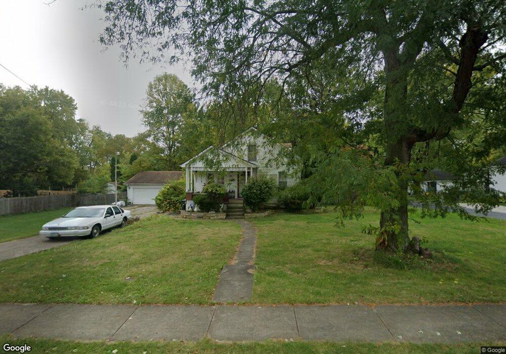
This home is located at 149 Stelton Rd, Xenia, OH 45385 and is currently estimated at $196,970, approximately $111 per square foot. 149 Stelton Rd is a home located in Greene County with nearby schools including Xenia High School, Summit Academy Community School for Alternative Learners - Xenia, and Legacy Christian Academy.
Ownership History
Date
Name
Owned For
Owner Type
Purchase Details
Closed on
Jun 17, 2014
Sold by
Williams Theodore
Bought by
Adkins Colleen O
Current Estimated Value
Purchase Details
Closed on
Mar 24, 2010
Sold by
Adkins Donald R and Adkins Colleen O
Bought by
Williams Theodore
Purchase Details
Closed on
Apr 30, 2007
Sold by
Maccormack Wanda R
Bought by
Adkins Donald R and Adkins Colleen O
Purchase Details
Closed on
Jul 1, 1996
Sold by
Musick Norma J
Bought by
Maccormack Ronald J and Maccormack R
Home Financials for this Owner
Home Financials are based on the most recent Mortgage that was taken out on this home.
Original Mortgage
$88,900
Interest Rate
8.13%
Mortgage Type
VA
Create a Home Valuation Report for This Property
The Home Valuation Report is an in-depth analysis detailing your home's value as well as a comparison with similar homes in the area
Home Values in the Area
Average Home Value in this Area
Purchase History
| Date | Buyer | Sale Price | Title Company |
|---|---|---|---|
| Adkins Colleen O | -- | None Available | |
| Williams Theodore | -- | None Available | |
| Adkins Donald R | $137,800 | Attorney | |
| Maccormack Ronald J | $88,900 | -- |
Source: Public Records
Mortgage History
| Date | Status | Borrower | Loan Amount |
|---|---|---|---|
| Previous Owner | Maccormack Ronald J | $88,900 |
Source: Public Records
Tax History Compared to Growth
Tax History
| Year | Tax Paid | Tax Assessment Tax Assessment Total Assessment is a certain percentage of the fair market value that is determined by local assessors to be the total taxable value of land and additions on the property. | Land | Improvement |
|---|---|---|---|---|
| 2024 | $1,730 | $51,290 | $5,910 | $45,380 |
| 2023 | $1,730 | $51,290 | $5,910 | $45,380 |
| 2022 | $1,450 | $38,400 | $4,730 | $33,670 |
| 2021 | $1,470 | $38,400 | $4,730 | $33,670 |
| 2020 | $1,406 | $38,400 | $4,730 | $33,670 |
| 2019 | $1,417 | $36,870 | $5,240 | $31,630 |
| 2018 | $1,423 | $36,870 | $5,240 | $31,630 |
| 2017 | $728 | $36,870 | $5,240 | $31,630 |
| 2016 | $1,328 | $34,520 | $5,240 | $29,280 |
| 2015 | $1,332 | $34,520 | $5,240 | $29,280 |
| 2014 | $1,755 | $34,520 | $5,240 | $29,280 |
Source: Public Records
Map
Nearby Homes
- 633 Xenia Ave
- 46 Lake St
- 55 Lake St
- 100 Prugh Ave
- 293 S Miami Ave
- 530 Cincinnati Ave
- 260 Pocahontas St
- 453 Walnut St
- 148 Home Ave
- 523 Newport Rd
- 400 S Detroit St
- 305-325 Bellbrook Ave
- 222 Washington St
- 36 Leaman St
- 75 W 2nd St
- 373 Hill St
- 0 W Church St
- 1208 Bellbrook Ave
- 214 Corwin Ave
- 1272 Bellbrook Ave