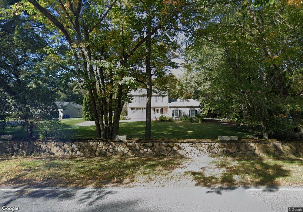
149 Tickle Rd Westport, MA 02790
North Westport NeighborhoodEstimated Value: $605,000 - $889,000
4
Beds
--
Bath
1,728
Sq Ft
$421/Sq Ft
Est. Value
About This Home
This home is located at 149 Tickle Rd, Westport, MA 02790 and is currently estimated at $728,349, approximately $421 per square foot. 149 Tickle Rd is a home located in Bristol County with nearby schools including Alice A. Macomber Primary School, Westport Elementary School, and Westport Middle-High School.
Ownership History
Date
Name
Owned For
Owner Type
Purchase Details
Closed on
Feb 24, 2011
Sold by
Azadnia Mehdi
Bought by
Azadnia Constance Flor
Current Estimated Value
Purchase Details
Closed on
Oct 1, 2001
Sold by
Nugent Anne M
Bought by
Azadnia Mehdi and Azadnia Constance F
Home Financials for this Owner
Home Financials are based on the most recent Mortgage that was taken out on this home.
Original Mortgage
$188,000
Interest Rate
6.91%
Mortgage Type
Purchase Money Mortgage
Create a Home Valuation Report for This Property
The Home Valuation Report is an in-depth analysis detailing your home's value as well as a comparison with similar homes in the area
Home Values in the Area
Average Home Value in this Area
Purchase History
| Date | Buyer | Sale Price | Title Company |
|---|---|---|---|
| Azadnia Constance Flor | -- | -- | |
| Azadnia Mehdi | $239,000 | -- |
Source: Public Records
Mortgage History
| Date | Status | Borrower | Loan Amount |
|---|---|---|---|
| Closed | Azadnia Mehdi | $0 | |
| Previous Owner | Azadnia Mehdi | $196,000 | |
| Previous Owner | Azadnia Mehdi | $188,000 |
Source: Public Records
Tax History Compared to Growth
Tax History
| Year | Tax Paid | Tax Assessment Tax Assessment Total Assessment is a certain percentage of the fair market value that is determined by local assessors to be the total taxable value of land and additions on the property. | Land | Improvement |
|---|---|---|---|---|
| 2025 | $3,343 | $448,700 | $195,100 | $253,600 |
| 2024 | $3,254 | $421,000 | $180,800 | $240,200 |
| 2023 | $3,152 | $386,300 | $158,400 | $227,900 |
| 2022 | $2,983 | $360,400 | $158,400 | $202,000 |
| 2021 | $2,983 | $346,000 | $144,000 | $202,000 |
| 2020 | $2,869 | $340,300 | $138,300 | $202,000 |
| 2019 | $2,551 | $308,500 | $120,300 | $188,200 |
| 2018 | $2,626 | $321,400 | $125,300 | $196,100 |
| 2017 | $2,537 | $318,300 | $125,300 | $193,000 |
| 2016 | $2,456 | $310,500 | $125,300 | $185,200 |
| 2015 | $2,218 | $279,700 | $125,300 | $154,400 |
Source: Public Records
Map
Nearby Homes
- 0 Tickle Rd Unit 73453134
- 51 Newton St
- 219 Tickle Rd
- 47 Devol Ave
- 329 Tickle Rd
- 440 Captains Cir
- 33 Moniz Dr
- 100 Corys Ln
- 45 Greenfield Rd
- 771 Sanford Rd
- 218 American Legion Hwy
- 75 Montgomery St
- 71 Blackbird St
- 9 Blackbird St
- 1023 Old Stafford Rd
- 3 Blackbird St
- 37 Bluejay St
- 84 Lark Ln
- 100 D Dr
- 82-84 O Dr
- 159 Tickle Rd
- 160 Tickle Rd
- 135 Tickle Rd
- 142 Tickle Rd
- 136 Tickle Rd
- 130 Tickle Rd
- 148 Tickle Rd
- 124 Tickle Rd
- 154 Tickle Rd
- 118 Tickle Rd
- 175 Tickle Rd
- 274 Tickle Rd
- Lot 1 Tickle Rd
- 112 Tickle Rd
- 0 Courtney Dr Unit 761349
- 0 Courtney Dr Unit 759952
- 0 Courtney Dr Unit 759956
- 0 Courtney Dr Unit 759941
- 0 Courtney Dr Unit 661773
- 0 Courtney Dr Unit 70692742