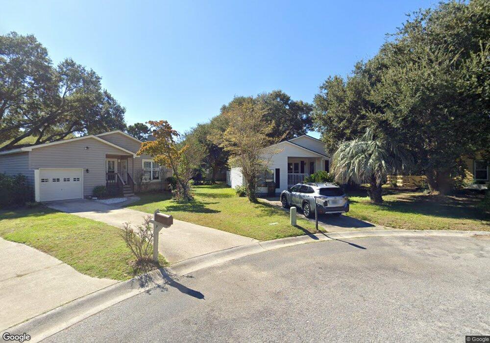
1490 Battery Kirby Ct Charleston, SC 29412
James Island NeighborhoodEstimated Value: $530,000 - $572,000
3
Beds
2
Baths
1,585
Sq Ft
$343/Sq Ft
Est. Value
About This Home
This home is located at 1490 Battery Kirby Ct, Charleston, SC 29412 and is currently estimated at $543,307, approximately $342 per square foot. 1490 Battery Kirby Ct is a home located in Charleston County with nearby schools including James Island Elementary School, Camp Road Middle, and James Island Charter High School.
Ownership History
Date
Name
Owned For
Owner Type
Purchase Details
Closed on
Dec 4, 2009
Sold by
Lyn Pamela Janice and Lyn David Anthony
Bought by
Macomson James B
Current Estimated Value
Home Financials for this Owner
Home Financials are based on the most recent Mortgage that was taken out on this home.
Original Mortgage
$72,500
Outstanding Balance
$49,585
Interest Rate
5.87%
Mortgage Type
New Conventional
Estimated Equity
$493,722
Purchase Details
Closed on
May 25, 2009
Sold by
Black Fannie L
Bought by
Lyn Pamela Janice
Create a Home Valuation Report for This Property
The Home Valuation Report is an in-depth analysis detailing your home's value as well as a comparison with similar homes in the area
Home Values in the Area
Average Home Value in this Area
Purchase History
| Date | Buyer | Sale Price | Title Company |
|---|---|---|---|
| Macomson James B | $172,500 | -- | |
| Lyn Pamela Janice | -- | -- | |
| Lyn Pamela Janice | -- | -- |
Source: Public Records
Mortgage History
| Date | Status | Borrower | Loan Amount |
|---|---|---|---|
| Open | Macomson James B | $72,500 |
Source: Public Records
Tax History Compared to Growth
Tax History
| Year | Tax Paid | Tax Assessment Tax Assessment Total Assessment is a certain percentage of the fair market value that is determined by local assessors to be the total taxable value of land and additions on the property. | Land | Improvement |
|---|---|---|---|---|
| 2024 | $1,131 | $7,950 | $0 | $0 |
| 2023 | $1,131 | $7,950 | $0 | $0 |
| 2022 | $1,030 | $7,950 | $0 | $0 |
| 2021 | $1,078 | $7,950 | $0 | $0 |
| 2020 | $1,116 | $7,950 | $0 | $0 |
| 2019 | $998 | $6,910 | $0 | $0 |
| 2017 | $965 | $6,910 | $0 | $0 |
| 2016 | $927 | $6,910 | $0 | $0 |
| 2015 | $957 | $6,910 | $0 | $0 |
| 2014 | $937 | $0 | $0 | $0 |
| 2011 | -- | $0 | $0 | $0 |
Source: Public Records
Map
Nearby Homes
- 114 Sea Cotton Cir
- 1344 Seaside Plantation Dr
- 632 Goodlet Cir
- 1445 Swamp Angel Ct
- 742 Majestic Oak Dr
- 1250 Seaside Plantation Dr
- 1370 Tidal Creek Cove
- 623 Majestic Oaks Dr
- 1028 Hills Plantation Dr
- 746 Goodlet Cir
- 1422 Wexford Sound Dr
- 1393 Secessionville Rd
- 1502 Westway Dr
- 1245 Lakefront Dr
- 1173 Sea Eagle Watch
- 1547 Seacroft Rd
- 1511 Westway Dr
- 1470 Eutaw Battalion Dr
- 1512 Seacroft Rd
- 1601 Secessionville Rd
- 1492 Battery Kirby Ct
- 1486 Battery Kirby Ct
- 1494 Battery Kirby Ct
- 1484 Battery Kirby Ct
- 1318 Battery Stevens Ct
- 1320 Battery Stevens Ct
- 0 Battery Stevens Ct
- 1322 Battery Stevens Ct
- 201 Cotton Planters Ct
- 1305 Stiles Bee Ave
- 1326 Battery Stevens Ct
- 1476 Battery Haig Ct
- 1485 Putnam Dr
- 1489 Putnam Dr
- 202 Cotton Planters Ct
- 1493 Putnam Dr
- 1481 Putnam Dr
- 1301 Stiles Bee Ave
- 1474 Battery Haig Ct
- 1328 Battery Stevens Ct