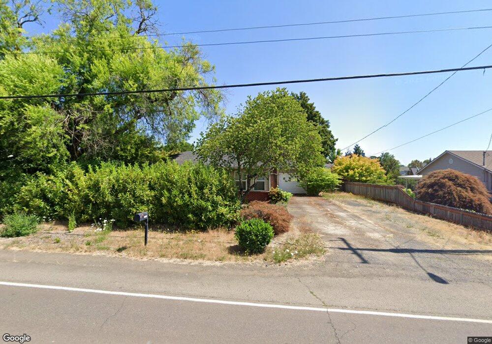
1490 Thatcher Rd Forest Grove, OR 97116
Estimated Value: $350,000 - $426,000
2
Beds
1
Bath
1,033
Sq Ft
$375/Sq Ft
Est. Value
About This Home
This home is located at 1490 Thatcher Rd, Forest Grove, OR 97116 and is currently estimated at $387,066, approximately $374 per square foot. 1490 Thatcher Rd is a home located in Washington County with nearby schools including Harvey Clarke Elementary School, Tom McCall Upper Elementary School, and Neil Armstrong Middle School.
Ownership History
Date
Name
Owned For
Owner Type
Purchase Details
Closed on
Oct 29, 2013
Sold by
Hutchins Michael
Bought by
Hutchins Michael and Hutchins Traci J
Current Estimated Value
Home Financials for this Owner
Home Financials are based on the most recent Mortgage that was taken out on this home.
Original Mortgage
$107,000
Outstanding Balance
$80,036
Interest Rate
4.46%
Mortgage Type
New Conventional
Estimated Equity
$307,030
Purchase Details
Closed on
Jul 29, 2003
Sold by
Kyle Ronald J and Kyle Ronald James
Bought by
Hutchins Michael
Home Financials for this Owner
Home Financials are based on the most recent Mortgage that was taken out on this home.
Original Mortgage
$71,100
Interest Rate
5.13%
Mortgage Type
Unknown
Purchase Details
Closed on
Jul 20, 1997
Sold by
Kyle Ronald J
Bought by
Kyle Ronald J
Purchase Details
Closed on
Nov 1, 1996
Sold by
Norway Skyline Llc
Bought by
Kyle Ronald James
Create a Home Valuation Report for This Property
The Home Valuation Report is an in-depth analysis detailing your home's value as well as a comparison with similar homes in the area
Home Values in the Area
Average Home Value in this Area
Purchase History
| Date | Buyer | Sale Price | Title Company |
|---|---|---|---|
| Hutchins Michael | -- | Wfg Title | |
| Hutchins Michael | $79,000 | Multiple | |
| Kyle Ronald J | -- | -- | |
| Kyle Ronald James | -- | First American |
Source: Public Records
Mortgage History
| Date | Status | Borrower | Loan Amount |
|---|---|---|---|
| Open | Hutchins Michael | $107,000 | |
| Closed | Hutchins Michael | $71,100 |
Source: Public Records
Tax History Compared to Growth
Tax History
| Year | Tax Paid | Tax Assessment Tax Assessment Total Assessment is a certain percentage of the fair market value that is determined by local assessors to be the total taxable value of land and additions on the property. | Land | Improvement |
|---|---|---|---|---|
| 2026 | $2,897 | $162,680 | -- | -- |
| 2025 | $2,897 | $157,950 | -- | -- |
| 2024 | $2,795 | $153,350 | -- | -- |
| 2023 | $2,795 | $148,890 | $0 | $0 |
| 2022 | $2,444 | $148,890 | $0 | $0 |
| 2021 | $2,412 | $140,350 | $0 | $0 |
| 2020 | $2,399 | $136,270 | $0 | $0 |
| 2019 | $2,346 | $132,310 | $0 | $0 |
| 2018 | $2,274 | $128,460 | $0 | $0 |
| 2017 | $2,204 | $124,720 | $0 | $0 |
| 2016 | $2,142 | $121,090 | $0 | $0 |
| 2015 | $2,059 | $117,570 | $0 | $0 |
| 2014 | $2,050 | $114,150 | $0 | $0 |
Source: Public Records
Map
Nearby Homes
- 1224 Alyssum Ave
- 1104 Magnolia Way
- 1425 Willamina Ave
- 922 Rosebud Ct
- 918 Rosebud Ct
- 911 Rosebud Ct
- 920 Rosebud Ct
- 924 Rosebud Ct
- 507-FH Plan at Parkview Terrace
- 504-STD Plan at Parkview Terrace
- Poppy - Plan 308C at Parkview Terrace
- 430A Plan at Parkview Terrace
- Plan 400 at Parkview Terrace
- 506-FH Plan at Parkview Terrace
- Plan 325 at Parkview Terrace
- 505-STD Plan at Parkview Terrace
- 508-MFH Plan at Parkview Terrace
- 3245 Butte Dr
- 504-FH Plan at Parkview Terrace
- 506-STD Plan at Parkview Terrace
- 1520 NW Thatcher Rd
- 1460 Thatcher Rd
- 1520 Thatcher Rd
- 3010 Twinflower St
- 2930 Twinflower St
- 3016 Twinflower St
- 1550 NW Thatcher Rd
- 2924 Twinflower St
- 1550 Thatcher Rd
- 2918 Twinflower St
- 3022 Twinflower St
- 1525 Thatcher Rd
- 2912 Twinflower St
- 3013 Twinflower St
- 1209 Snapdragon Ave
- 3007 Twinflower St
- 1140 Primrose Ln
- 3034 Twinflower St
- 1580 Thatcher Rd
- 1215 Snapdragon Ave