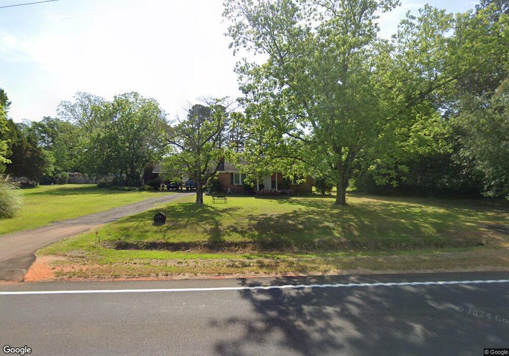
1491 Bloomville Rd Manning, SC 29102
Estimated Value: $144,831 - $219,000
3
Beds
2
Baths
1,600
Sq Ft
$118/Sq Ft
Est. Value
About This Home
This home is located at 1491 Bloomville Rd, Manning, SC 29102 and is currently estimated at $188,958, approximately $118 per square foot. 1491 Bloomville Rd is a home located in Clarendon County with nearby schools including Manning Early Childhood Center, Manning Primary School, and Manning Elementary School.
Ownership History
Date
Name
Owned For
Owner Type
Purchase Details
Closed on
Mar 5, 2009
Sold by
Jones Jonathan C and Jones Denise H
Bought by
Blake Earl W and Blake Valerie D
Current Estimated Value
Home Financials for this Owner
Home Financials are based on the most recent Mortgage that was taken out on this home.
Original Mortgage
$89,910
Outstanding Balance
$57,231
Interest Rate
5.15%
Mortgage Type
New Conventional
Estimated Equity
$131,727
Create a Home Valuation Report for This Property
The Home Valuation Report is an in-depth analysis detailing your home's value as well as a comparison with similar homes in the area
Home Values in the Area
Average Home Value in this Area
Purchase History
| Date | Buyer | Sale Price | Title Company |
|---|---|---|---|
| Blake Earl W | $99,900 | None Available |
Source: Public Records
Mortgage History
| Date | Status | Borrower | Loan Amount |
|---|---|---|---|
| Open | Blake Earl W | $89,910 |
Source: Public Records
Tax History Compared to Growth
Tax History
| Year | Tax Paid | Tax Assessment Tax Assessment Total Assessment is a certain percentage of the fair market value that is determined by local assessors to be the total taxable value of land and additions on the property. | Land | Improvement |
|---|---|---|---|---|
| 2024 | $303 | $3,244 | $300 | $2,944 |
| 2023 | $298 | $3,244 | $300 | $2,944 |
| 2022 | $295 | $3,244 | $300 | $2,944 |
| 2021 | $229 | $3,204 | $300 | $2,904 |
| 2020 | $229 | $3,204 | $300 | $2,904 |
| 2019 | $212 | $3,204 | $300 | $2,904 |
| 2018 | $199 | $3,204 | $0 | $0 |
| 2017 | $199 | $3,204 | $0 | $0 |
| 2016 | $193 | $3,204 | $0 | $0 |
| 2015 | $202 | $3,240 | $300 | $2,940 |
| 2014 | $199 | $3,240 | $300 | $2,940 |
| 2013 | -- | $3,240 | $300 | $2,940 |
Source: Public Records
Map
Nearby Homes
- 6880 Bloomville Rd
- TBD Bloomville Rd
- 1153 Cherokee Dr
- 1085 Birdie Ct
- 1100 Mulligan Dr
- 1092 Mulligan Dr
- 1162 Mulligan Dr
- CALI Plan at Huggins Hill
- BELHAVEN Plan at Huggins Hill
- GLENWOOD Plan at Huggins Hill
- ELSTON Plan at Huggins Hill
- BRANDON Plan at Huggins Hill
- 1116 Mulligan Dr
- 1156 Mulligan Dr
- 1107 Mulligan Dr
- 1200 Mulligan Dr
- 1052 Mulligan Dr
- 1130 Mulligan Dr
- 1064 Mulligan Dr
- 1047 Deberry Dr
- 2012 Bloomville Rd
- 2028 Bloomville Rd
- 2062 Bloomville Rd
- 2066 Bloomville Rd
- 0 Bloomville Rd
- 1465 Bloomville Rd
- 1519 Bloomville Rd
- 1077 Deberry Dr
- 1072 Deberry Dr
- 1441 Bloomville Rd
- 1083 Seminole Dr
- 1101 Deberry Dr
- 1010 Seminole Dr
- 1556 Bloomville Rd
- 0 Deberry Cir Lot 17
- 1114 Deberry Dr
- 1416 Bloomville Rd
- 1520 Deberry Dr
- 1123 Seminole Dr