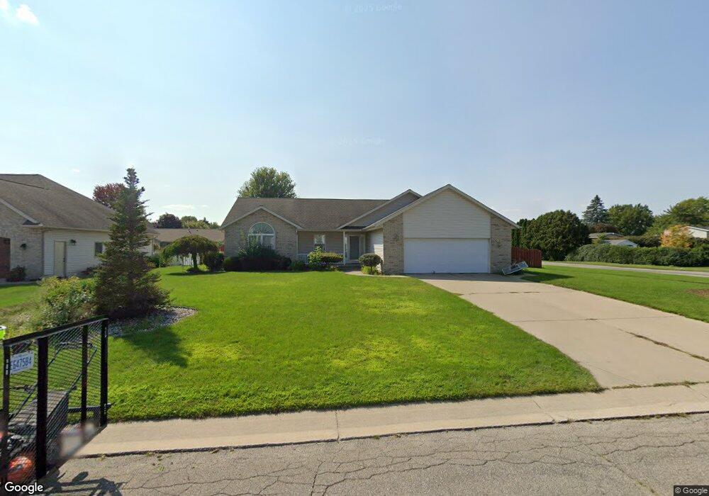
1491 Briarson Dr Saginaw, MI 48638
Estimated Value: $279,006 - $342,000
3
Beds
3
Baths
1,818
Sq Ft
$168/Sq Ft
Est. Value
About This Home
This home is located at 1491 Briarson Dr, Saginaw, MI 48638 and is currently estimated at $305,752, approximately $168 per square foot. 1491 Briarson Dr is a home located in Saginaw County with nearby schools including Arrowwood Elementary School, Westdale Elementary School, and White Pine Middle School.
Ownership History
Date
Name
Owned For
Owner Type
Purchase Details
Closed on
Jun 5, 2014
Sold by
Bentaneur Jessie F and Bentaneur Laura A
Bought by
Bentaneur Jessie F
Current Estimated Value
Purchase Details
Closed on
Oct 5, 2001
Sold by
Holbert Holbert R and Holbert M
Bought by
Bentancur J A and L A
Home Financials for this Owner
Home Financials are based on the most recent Mortgage that was taken out on this home.
Original Mortgage
$144,000
Interest Rate
6.62%
Mortgage Type
Purchase Money Mortgage
Create a Home Valuation Report for This Property
The Home Valuation Report is an in-depth analysis detailing your home's value as well as a comparison with similar homes in the area
Home Values in the Area
Average Home Value in this Area
Purchase History
| Date | Buyer | Sale Price | Title Company |
|---|---|---|---|
| Bentaneur Jessie F | -- | -- | |
| Bentancur J A | $26,000 | -- | |
| Bentancur Jessie F | $26,000 | -- |
Source: Public Records
Mortgage History
| Date | Status | Borrower | Loan Amount |
|---|---|---|---|
| Previous Owner | Bentancur Jessie F | $144,000 |
Source: Public Records
Tax History Compared to Growth
Tax History
| Year | Tax Paid | Tax Assessment Tax Assessment Total Assessment is a certain percentage of the fair market value that is determined by local assessors to be the total taxable value of land and additions on the property. | Land | Improvement |
|---|---|---|---|---|
| 2025 | $4,266 | $134,200 | $0 | $0 |
| 2024 | $2,250 | $128,600 | $0 | $0 |
| 2023 | $2,141 | $111,900 | $0 | $0 |
| 2022 | $3,683 | $104,800 | $0 | $0 |
| 2021 | $3,400 | $99,700 | $0 | $0 |
| 2020 | $3,321 | $92,600 | $0 | $0 |
| 2019 | $3,177 | $90,000 | $11,900 | $78,100 |
| 2018 | $1,593 | $90,900 | $0 | $0 |
| 2017 | $2,802 | $93,400 | $0 | $0 |
| 2016 | $2,768 | $94,400 | $0 | $0 |
| 2014 | $2,649 | $94,300 | $0 | $84,200 |
| 2013 | -- | $84,100 | $0 | $0 |
Source: Public Records
Map
Nearby Homes
- 1607 Cranbrook Dr
- 1299 Allendale Dr
- 5431 Willowbrook Dr
- 1839 Kingston Dr
- 5800 Dunrovin Dr
- 74 Foxwood Dr
- 76 Foxwood Dr
- 73 Foxwood Dr
- 75 Foxwood Dr
- 1449 Sauk Ln
- 58 Deer Trail
- 80 Deer Trail
- 79 Deer Trail
- 1900 Bunny Trail
- 5480 Pilgrim Dr
- 802 N Frost Dr
- 6235 Dewhirst Dr
- 70 Bunny Trail
- 1100 Sauk Ln
- 72 Bunny Trail
- 1471 Briarson Dr
- 1492 Kingston Dr
- 1468 Kingston Dr
- 1492 Briarson Dr
- 1521 Briarson Dr
- 1453 Briarson Dr
- 1476 Briarson Dr
- 1452 Kingston Dr
- 1520 Kingston Dr
- 1454 Briarson Dr
- 1439 Briarson Dr
- 1520 Briarson Dr
- 1539 Briarson Dr
- 1438 Kingston Dr
- 1465 Kingston Dr
- 1538 Kingston Dr
- 1489 Cranbrook Dr
- 1491 Kingston Dr
- 1440 Briarson Dr
- 1469 Cranbrook Dr