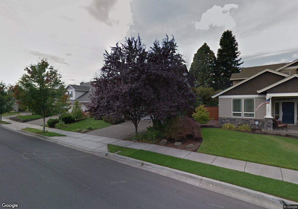
1491 SE 53rd Ave Hillsboro, OR 97123
Southeast Hillsboro NeighborhoodEstimated Value: $617,313 - $688,000
4
Beds
3
Baths
2,353
Sq Ft
$279/Sq Ft
Est. Value
About This Home
This home is located at 1491 SE 53rd Ave, Hillsboro, OR 97123 and is currently estimated at $656,328, approximately $278 per square foot. 1491 SE 53rd Ave is a home located in Washington County with nearby schools including Imlay Elementary School, R.A. Brown Middle School, and Century High School.
Ownership History
Date
Name
Owned For
Owner Type
Purchase Details
Closed on
Jul 18, 2019
Sold by
Warddrip Michael L and Warddrip Dawn N
Bought by
Warddrip Michael L and Warddrip Dawn N
Current Estimated Value
Purchase Details
Closed on
Sep 25, 2001
Sold by
Devland Inc
Bought by
Warddrip Michael L and Warddrip Dawn N
Home Financials for this Owner
Home Financials are based on the most recent Mortgage that was taken out on this home.
Original Mortgage
$227,836
Outstanding Balance
$89,314
Interest Rate
6.91%
Estimated Equity
$567,014
Create a Home Valuation Report for This Property
The Home Valuation Report is an in-depth analysis detailing your home's value as well as a comparison with similar homes in the area
Home Values in the Area
Average Home Value in this Area
Purchase History
| Date | Buyer | Sale Price | Title Company |
|---|---|---|---|
| Warddrip Michael L | -- | None Available | |
| Warddrip Michael L | $247,950 | Stewart Title |
Source: Public Records
Mortgage History
| Date | Status | Borrower | Loan Amount |
|---|---|---|---|
| Open | Warddrip Michael L | $227,836 |
Source: Public Records
Tax History Compared to Growth
Tax History
| Year | Tax Paid | Tax Assessment Tax Assessment Total Assessment is a certain percentage of the fair market value that is determined by local assessors to be the total taxable value of land and additions on the property. | Land | Improvement |
|---|---|---|---|---|
| 2025 | $5,939 | $363,330 | -- | -- |
| 2024 | $5,770 | $352,750 | -- | -- |
| 2023 | $5,770 | $342,480 | $0 | $0 |
| 2022 | $5,613 | $342,480 | $0 | $0 |
| 2021 | $5,501 | $322,830 | $0 | $0 |
| 2020 | $5,382 | $313,430 | $0 | $0 |
| 2019 | $5,227 | $304,310 | $0 | $0 |
| 2018 | $5,004 | $295,450 | $0 | $0 |
| 2017 | $4,822 | $286,850 | $0 | $0 |
| 2016 | $4,690 | $278,500 | $0 | $0 |
| 2015 | $4,501 | $270,390 | $0 | $0 |
| 2014 | $4,476 | $262,520 | $0 | $0 |
Source: Public Records
Map
Nearby Homes
- 5396 SE Frances Ct
- 1420 SE 51st Ave
- 5619 SE Lexington Dr
- 8431 SE Blanton St
- 1746 SE Brookwood Ave
- 5477 SE Rancho St
- 1734 SE Brookwood Ave
- 5728 SE Popes Place
- 5744 SE Popes Place
- 1801 SE Brookwood Ave
- 1935 SE 52nd Ave
- 1216 SE 47th St
- 1307 SE 61st Place
- 2130 SE 52nd Ave
- 184 SE 47th Ave
- 2073 SE 48th Ave
- 1974 SE 60th Ave
- 830 SE 59th Ave
- 5795 SE Drake Rd
- 4744 SE Maxwell St
- 1517 SE 53rd Ave
- 1475 SE 53rd Ave
- 1541 SE 53rd Ave
- 1457 SE 53rd Ave
- 5320 SE Frances Ct
- 1486 SE 53rd Ave
- 1512 SE 53rd Ave
- 1565 SE 53rd Ave
- 1538 SE 53rd Ave
- 5348 SE Frances Ct
- 5215 SE Golden Rd
- 1564 SE 53rd Ave
- 1593 SE 53rd Ave
- 5484 SE Frances Ct
- 5374 SE Frances Ct
- 1596 SE 53rd Ave
- 5307 SE Frances Ct
- 5299 SE Frances Ct
- 5283 SE Frances Ct
- 5498 SE Frances Ct