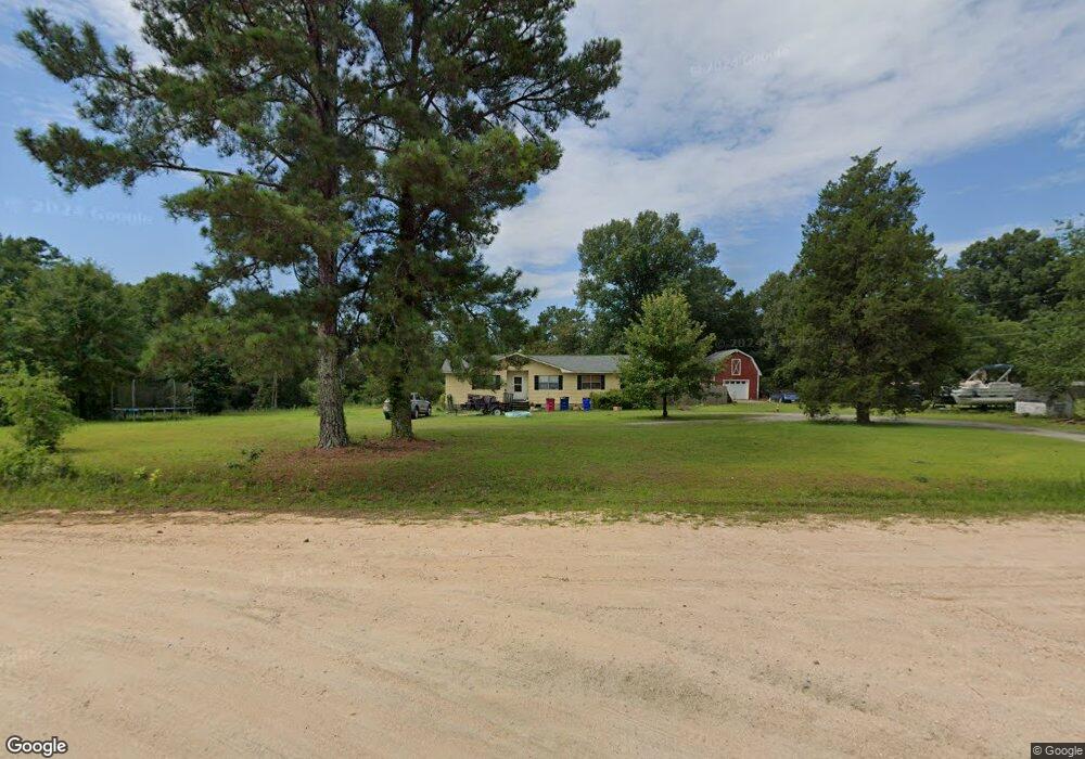
1492 MacGillicuddy Dr Macon, GA 31216
Estimated Value: $157,000 - $180,000
4
Beds
2
Baths
1,438
Sq Ft
$114/Sq Ft
Est. Value
About This Home
This home is located at 1492 MacGillicuddy Dr, Macon, GA 31216 and is currently estimated at $163,268, approximately $113 per square foot. 1492 MacGillicuddy Dr is a home located in Bibb County with nearby schools including Heard Elementary School, Rutland Middle School, and Rutland High School.
Ownership History
Date
Name
Owned For
Owner Type
Purchase Details
Closed on
Dec 10, 2024
Sold by
Osborne Jonathan T and Osborne Michelle D
Bought by
Mankowski David and Mankowski Randie
Current Estimated Value
Home Financials for this Owner
Home Financials are based on the most recent Mortgage that was taken out on this home.
Original Mortgage
$75,000
Outstanding Balance
$41,870
Interest Rate
6.72%
Mortgage Type
New Conventional
Estimated Equity
$121,398
Purchase Details
Closed on
Feb 24, 2012
Sold by
Osborne Jonathan T
Bought by
Osborne Jonathan T and Osborne Michelle D
Home Financials for this Owner
Home Financials are based on the most recent Mortgage that was taken out on this home.
Original Mortgage
$60,915
Interest Rate
4.37%
Mortgage Type
FHA
Purchase Details
Closed on
May 23, 2006
Sold by
Getrum Jackie J
Bought by
Getrum Donald E
Create a Home Valuation Report for This Property
The Home Valuation Report is an in-depth analysis detailing your home's value as well as a comparison with similar homes in the area
Purchase History
| Date | Buyer | Sale Price | Title Company |
|---|---|---|---|
| Mankowski David | $100,000 | None Listed On Document | |
| Mankowski David | $100,000 | None Listed On Document | |
| Osborne Jonathan T | -- | None Available | |
| Osborne Jonathan T | $62,500 | None Available | |
| Getrum Donald E | $25,000 | None Availabale |
Source: Public Records
Mortgage History
| Date | Status | Borrower | Loan Amount |
|---|---|---|---|
| Open | Mankowski David | $75,000 | |
| Closed | Mankowski David | $75,000 | |
| Previous Owner | Osborne Jonathan T | $60,915 |
Source: Public Records
Tax History
| Year | Tax Paid | Tax Assessment Tax Assessment Total Assessment is a certain percentage of the fair market value that is determined by local assessors to be the total taxable value of land and additions on the property. | Land | Improvement |
|---|---|---|---|---|
| 2025 | $1,567 | $63,770 | $9,602 | $54,168 |
| 2024 | $1,583 | $62,330 | $8,162 | $54,168 |
| 2023 | $1,583 | $62,330 | $8,162 | $54,168 |
| 2022 | $1,666 | $48,130 | $9,326 | $38,804 |
| 2021 | $1,418 | $37,322 | $8,228 | $29,094 |
| 2020 | $1,449 | $37,322 | $8,228 | $29,094 |
| 2019 | $1,461 | $37,322 | $8,228 | $29,094 |
| 2018 | $2,417 | $37,322 | $8,228 | $29,094 |
| 2017 | $1,398 | $37,322 | $8,228 | $29,094 |
| 2016 | $1,291 | $37,323 | $8,228 | $29,094 |
| 2015 | $1,828 | $37,323 | $8,228 | $29,094 |
| 2014 | $1,807 | $36,841 | $8,124 | $28,717 |
Source: Public Records
Map
Nearby Homes
- 1419 Griffin Rd
- 319 Hawk Ct
- 317 Hawk Ct
- 312 Hawk Ct
- 412 Gray Wolf Dr
- 7070 Sofkee Place
- 2165 Griffin Rd
- 1850 Barnes Ferry Rd
- 8410 Hawkinsville Rd Unit LOT 42
- 120 Abberley Ln
- 137 Abberley Ln
- 341 Stockton Cir
- 337 Stockton Cir
- 301 Stockton Cir
- 4057 Liberty Estates Dr
- 2154 Allen Rd
- 297 Amanda Dr
- 268 Amanda Dr
- 261 Amanda Dr
- 224 Liberty Trace
- 1516 Okelly Ct
- 1503 MacGillicuddy Dr
- 1049 Flaherty Dr
- 1508 MacGillicuddy Dr
- 1039 Flaherty Dr
- 1481 MacGillicuddy Dr
- 1476 MacGillicuddy Dr
- 1476 MacGillicuddy Dr Unit 7
- 1471 MacGillicuddy Dr
- 1520 Okelly Ct
- 1523 MacGillicuddy Dr
- 960 Killarney Cir
- 1010 Flaherty Dr
- 1533 MacGillicuddy Dr
- 1461 MacGillicuddy Dr
- 952 Killarney Cir
- 957 Killarney Cir
- 1504 Flanagan Dr
- 971 Killarney Cir
- 1556 Flanagan Dr
Your Personal Tour Guide
Ask me questions while you tour the home.