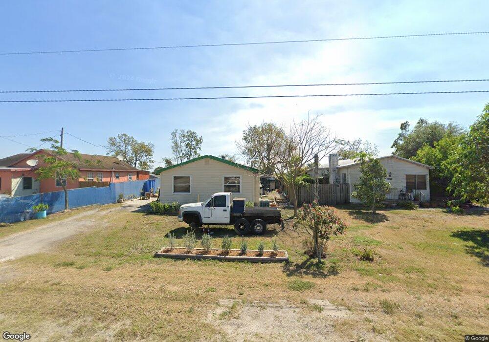
14924 Us Highway 441 Canal Point, FL 33438
Estimated Value: $135,439 - $215,000
--
Bed
1
Bath
1,288
Sq Ft
$128/Sq Ft
Est. Value
About This Home
This home is located at 14924 Us Highway 441, Canal Point, FL 33438 and is currently estimated at $164,360, approximately $127 per square foot. 14924 Us Highway 441 is a home located in Palm Beach County with nearby schools including K.E. Cunningham/Canal Point Elementary School and Pahokee Middle/Senior High School.
Ownership History
Date
Name
Owned For
Owner Type
Purchase Details
Closed on
Feb 28, 2007
Sold by
Mason Chad
Bought by
Miller Donald
Current Estimated Value
Purchase Details
Closed on
Nov 17, 1999
Sold by
Sears Glenda E
Bought by
Mason Judy I
Home Financials for this Owner
Home Financials are based on the most recent Mortgage that was taken out on this home.
Original Mortgage
$21,447
Interest Rate
7.81%
Mortgage Type
Credit Line Revolving
Purchase Details
Closed on
Dec 12, 1997
Sold by
Eldridge Glenda B
Bought by
Hobby Harold T
Create a Home Valuation Report for This Property
The Home Valuation Report is an in-depth analysis detailing your home's value as well as a comparison with similar homes in the area
Home Values in the Area
Average Home Value in this Area
Purchase History
| Date | Buyer | Sale Price | Title Company |
|---|---|---|---|
| Miller Donald | -- | Attorney | |
| Mason Judy I | $26,000 | -- | |
| Eldridge Glenda B | $26,000 | -- | |
| Hobby Harold T | $100 | -- |
Source: Public Records
Mortgage History
| Date | Status | Borrower | Loan Amount |
|---|---|---|---|
| Previous Owner | Hobby Harold T | $21,447 |
Source: Public Records
Tax History Compared to Growth
Tax History
| Year | Tax Paid | Tax Assessment Tax Assessment Total Assessment is a certain percentage of the fair market value that is determined by local assessors to be the total taxable value of land and additions on the property. | Land | Improvement |
|---|---|---|---|---|
| 2024 | $1,225 | $57,969 | -- | -- |
| 2023 | $1,168 | $54,069 | $0 | $0 |
| 2022 | $1,121 | $50,484 | $0 | $0 |
| 2021 | $1,045 | $54,552 | $0 | $0 |
| 2020 | $983 | $50,410 | $0 | $0 |
| 2019 | $912 | $42,192 | $0 | $0 |
| 2018 | $845 | $39,404 | $0 | $0 |
| 2017 | $746 | $39,074 | $0 | $0 |
| 2016 | $736 | $37,723 | $0 | $0 |
| 2015 | $752 | $37,923 | $0 | $0 |
| 2014 | $636 | $37,811 | $0 | $0 |
Source: Public Records
Map
Nearby Homes
- 12588 Us-441 S
- 13300 SW Conners Hwy
- 12537 Lakeshore Dr
- 2076 E Main St
- 1697 E Main St
- 491 W Jordan Blvd
- 1500 Rev Jesse Biggs Blvd
- 1311 Larrimore Rd
- 360 Kismet Ave
- 197 W Main St
- 176 Bacom Point Rd
- 334 S Barfield Hwy
- 398 Cypress Ave
- 33 Muck City Rd
- 875 Joe Louis Ave
- 0 S Lake Ave Unit R11061220
- 297 E 4th St
- 364 S Lake Ave
- 1450 Muck City Rd
- 353 S Lake Place
- 14942 Us Highway 441
- 14912 Us Highway 441
- 14960 Us Highway 441
- 14862 Us Highway 441
- 14830 Us Highway 441 Unit 258
- 14830 Us Highway 441
- 14818 Us Highway 441
- 14774 Us Highway 441
- 14672 Us Highway 441
- 14658 Us Highway 441
- 14568 Us Highway 441
- 14530 Us Highway 441
- 10011 Us-441 S
- 10753 Us-441 S
- 11055 Us-441 S