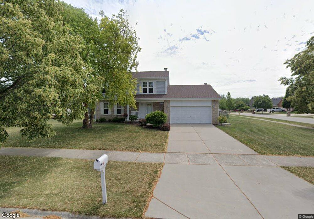
14927 Pheasant Ln Homer Glen, IL 60491
Estimated Value: $424,628 - $523,000
--
Bed
--
Bath
1,959
Sq Ft
$248/Sq Ft
Est. Value
About This Home
This home is located at 14927 Pheasant Ln, Homer Glen, IL 60491 and is currently estimated at $485,407, approximately $247 per square foot. 14927 Pheasant Ln is a home located in Will County with nearby schools including Hadley Middle School, Luther J Schilling School, and Homer Jr High School.
Ownership History
Date
Name
Owned For
Owner Type
Purchase Details
Closed on
Jun 16, 2008
Sold by
Barrett William J and Barrett Linda S
Bought by
Barrett William J and Barrett Linda S
Current Estimated Value
Purchase Details
Closed on
Aug 29, 1995
Sold by
Standard Bank & Trust Company
Bought by
Barrett William J and Barrett Linda S
Home Financials for this Owner
Home Financials are based on the most recent Mortgage that was taken out on this home.
Original Mortgage
$135,000
Interest Rate
7.81%
Create a Home Valuation Report for This Property
The Home Valuation Report is an in-depth analysis detailing your home's value as well as a comparison with similar homes in the area
Home Values in the Area
Average Home Value in this Area
Purchase History
| Date | Buyer | Sale Price | Title Company |
|---|---|---|---|
| Barrett William J | -- | None Available | |
| Barrett William J | $194,500 | Chicago Title Insurance Co |
Source: Public Records
Mortgage History
| Date | Status | Borrower | Loan Amount |
|---|---|---|---|
| Closed | Barrett William J | $135,000 |
Source: Public Records
Tax History Compared to Growth
Tax History
| Year | Tax Paid | Tax Assessment Tax Assessment Total Assessment is a certain percentage of the fair market value that is determined by local assessors to be the total taxable value of land and additions on the property. | Land | Improvement |
|---|---|---|---|---|
| 2024 | $8,189 | $130,791 | $28,086 | $102,705 |
| 2023 | $8,189 | $118,556 | $25,459 | $93,097 |
| 2022 | $7,612 | $110,696 | $23,771 | $86,925 |
| 2021 | $7,214 | $104,875 | $22,521 | $82,354 |
| 2020 | $7,213 | $101,016 | $21,692 | $79,324 |
| 2019 | $6,848 | $97,178 | $20,868 | $76,310 |
| 2018 | $6,981 | $92,810 | $20,629 | $72,181 |
| 2017 | $7,012 | $90,212 | $20,052 | $70,160 |
| 2016 | $6,838 | $87,203 | $19,383 | $67,820 |
| 2015 | $7,195 | $83,929 | $18,655 | $65,274 |
| 2014 | $7,195 | $81,521 | $18,270 | $63,251 |
| 2013 | $7,195 | $89,676 | $18,270 | $71,406 |
Source: Public Records
Map
Nearby Homes
- 12459 Rosewood Dr Unit 1
- Fremont Plan at Kingston Hills
- Briarcliffe Plan at Kingston Hills
- Danbury Plan at Kingston Hills
- Calysta Plan at Kingston Hills
- Eden Plan at Kingston Hills
- Amberwood Plan at Kingston Hills
- 15022 S Woodcrest Ave Unit 3
- 14748 S Carlton Ln
- 14715 S Woodcrest Ave
- 12222 Rambling Rd
- 14561 S Appaloosa Ln
- 14542 S Mustang Dr
- 14541 S Bell Rd
- 15328 Sharon Dr
- 14453 S Bell Rd
- 14325 S Bell Rd
- 15220 Arbor Dr
- 14225 Mallard Dr
- 15507 Willow Ct
- 14921 S Pheasant Ln
- 14913 Pheasant Ln
- 12454 Rosewood Dr Unit 1
- 12446 Rosewood Dr Unit 1
- 14913 S Pheasant Ln
- 12459 W Cedar Ridge Dr
- 12516 Rosewood Dr
- 12501 Rosewood Dr Unit 1
- 12453 Rosewood Dr
- 12436 Rosewood Dr
- 12519 Cedar Ridge Dr
- 12509 Rosewood Dr Unit 1
- 12445 Rosewood Dr Unit 1
- 12524 Rosewood Dr
- 12517 Rosewood Dr
- 12527 Cedar Ridge Dr
- 12426 Rosewood Dr
- 12437 Rosewood Dr Unit 1
- 12447 W Cedar Ridge Dr
- 12525 Rosewood Dr