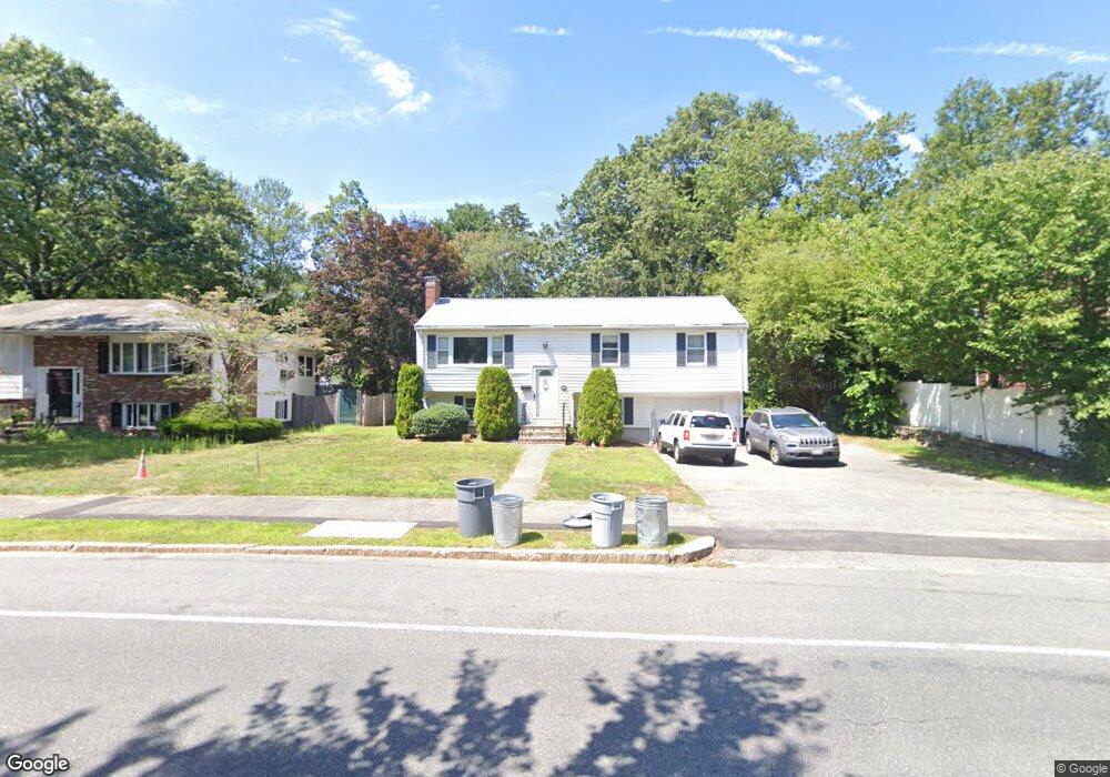
1493 Furnace Brook Pkwy Quincy, MA 02169
Estimated Value: $507,000 - $740,333
3
Beds
2
Baths
1,288
Sq Ft
$512/Sq Ft
Est. Value
About This Home
This home is located at 1493 Furnace Brook Pkwy, Quincy, MA 02169 and is currently estimated at $659,583, approximately $512 per square foot. 1493 Furnace Brook Pkwy is a home located in Norfolk County with nearby schools including South West Middle School, Lincoln-Hancock Community School, and Quincy High School.
Ownership History
Date
Name
Owned For
Owner Type
Purchase Details
Closed on
Jan 31, 2007
Sold by
Rizzi Beverly A and Rizzi Roy F
Bought by
Rizzi Christine and Rizzi John F
Current Estimated Value
Home Financials for this Owner
Home Financials are based on the most recent Mortgage that was taken out on this home.
Original Mortgage
$219,000
Outstanding Balance
$131,172
Interest Rate
6.16%
Mortgage Type
Purchase Money Mortgage
Estimated Equity
$528,411
Create a Home Valuation Report for This Property
The Home Valuation Report is an in-depth analysis detailing your home's value as well as a comparison with similar homes in the area
Home Values in the Area
Average Home Value in this Area
Purchase History
| Date | Buyer | Sale Price | Title Company |
|---|---|---|---|
| Rizzi Christine | $329,000 | -- |
Source: Public Records
Mortgage History
| Date | Status | Borrower | Loan Amount |
|---|---|---|---|
| Open | Rizzi Christine | $219,000 |
Source: Public Records
Tax History Compared to Growth
Tax History
| Year | Tax Paid | Tax Assessment Tax Assessment Total Assessment is a certain percentage of the fair market value that is determined by local assessors to be the total taxable value of land and additions on the property. | Land | Improvement |
|---|---|---|---|---|
| 2025 | $7,717 | $669,300 | $320,100 | $349,200 |
| 2024 | $7,275 | $645,500 | $305,300 | $340,200 |
| 2023 | $6,707 | $602,600 | $291,200 | $311,400 |
| 2022 | $6,371 | $531,800 | $234,500 | $297,300 |
| 2021 | $6,117 | $503,900 | $234,500 | $269,400 |
| 2020 | $5,760 | $463,400 | $234,500 | $228,900 |
| 2019 | $5,572 | $444,000 | $228,000 | $216,000 |
| 2018 | $5,648 | $423,400 | $211,700 | $211,700 |
| 2017 | $5,413 | $382,000 | $202,000 | $180,000 |
| 2016 | $5,069 | $353,000 | $184,400 | $168,600 |
| 2015 | $4,895 | $335,300 | $174,400 | $160,900 |
| 2014 | $4,775 | $321,300 | $174,400 | $146,900 |
Source: Public Records
Map
Nearby Homes
- 52 Bunker Hill Ln
- 63 Adele Rd
- 211 West St Unit 12B
- 2 Ricciuti Dr Unit 8
- 55 Station St Unit 1
- 57A West St
- 328 Copeland St Unit 3E
- 42 West St
- 36 Greystone St Unit 36
- 211 Copeland St
- 808 Willard St Unit F11
- 72 Centre St Unit J
- 57 Buckley St
- 145 Suomi Rd Unit C7
- 230 Willard St Unit 204
- 41 Filbert St
- 29 Oconnell Ave
- 203 Centre St
- 37 Wren Terrace Unit 2
- 14 Arthur Ave
- 1501 Furnace Brook Pkwy
- 1487 Furnace Brook Pkwy
- 10 Salem St
- 1485 Furnace Brook Pkwy
- 16 Salem St
- 60 Bunker Hill Ln
- 50 Bunker Hill Ln
- 20 Salem St
- 45 Ashland St
- 46 Bunker Hill Ln
- 38 Bunker Hill Ln
- 26 Salem St
- 41 Ashland St
- 1475 Furnace Brook Pkwy
- 55 Bunker Hill Ln
- 30 Salem St
- 49 Bunker Hill Ln
- 37 Bunker Hill Ln
- 37 Ashland St
- 3 Frederick St