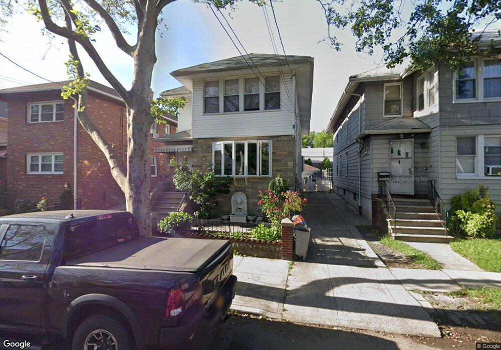
14933 15th Rd Whitestone, NY 11357
Whitestone NeighborhoodEstimated Value: $1,106,915 - $1,552,000
Studio
--
Bath
2,072
Sq Ft
$655/Sq Ft
Est. Value
About This Home
This home is located at 14933 15th Rd, Whitestone, NY 11357 and is currently estimated at $1,357,479, approximately $655 per square foot. 14933 15th Rd is a home located in Queens County with nearby schools including P.S. 79 - Francis Lewis, J.H.S. 194 William Carr, and Flushing High School.
Ownership History
Date
Name
Owned For
Owner Type
Purchase Details
Closed on
Dec 20, 2001
Sold by
Marullo Antoinette T
Bought by
Moros Elias
Current Estimated Value
Home Financials for this Owner
Home Financials are based on the most recent Mortgage that was taken out on this home.
Original Mortgage
$320,000
Interest Rate
7.08%
Purchase Details
Closed on
Nov 20, 2000
Sold by
Marullo Jerome J and Marullo Antoinette T
Bought by
Marullo Antoinette T
Create a Home Valuation Report for This Property
The Home Valuation Report is an in-depth analysis detailing your home's value as well as a comparison with similar homes in the area
Home Values in the Area
Average Home Value in this Area
Purchase History
| Date | Buyer | Sale Price | Title Company |
|---|---|---|---|
| Moros Elias | -- | -- | |
| Moros Elias | -- | -- | |
| Marullo Antoinette T | -- | -- | |
| Marullo Antoinette T | -- | -- |
Source: Public Records
Mortgage History
| Date | Status | Borrower | Loan Amount |
|---|---|---|---|
| Previous Owner | Moros Elias | $320,000 |
Source: Public Records
Tax History
| Year | Tax Paid | Tax Assessment Tax Assessment Total Assessment is a certain percentage of the fair market value that is determined by local assessors to be the total taxable value of land and additions on the property. | Land | Improvement |
|---|---|---|---|---|
| 2025 | $9,595 | $50,640 | $13,127 | $37,513 |
| 2024 | $9,595 | $47,774 | $11,636 | $36,138 |
| 2023 | $9,595 | $47,774 | $9,947 | $37,827 |
| 2022 | $9,178 | $65,760 | $16,440 | $49,320 |
| 2021 | $9,118 | $64,560 | $16,440 | $48,120 |
| 2020 | $8,636 | $64,380 | $16,440 | $47,940 |
| 2019 | $8,035 | $64,500 | $16,440 | $48,060 |
| 2018 | $7,818 | $39,812 | $9,748 | $30,064 |
| 2017 | $7,755 | $39,512 | $12,289 | $27,223 |
| 2016 | $7,142 | $39,512 | $12,289 | $27,223 |
| 2015 | $4,276 | $35,167 | $13,150 | $22,017 |
| 2014 | $4,276 | $33,177 | $13,854 | $19,323 |
Source: Public Records
Map
Nearby Homes
- 1527 149th St
- 1535 149th St
- 14940 15th Dr
- 149-16 14th Ave
- 16-11 149th St
- 14712 15th Dr
- 1620 150th St
- 150-29 16th Rd
- 149-20 17th Ave
- 15-27 159 Street 159 St Unit 619
- 162 20 9 Ave Unit 6C
- 15040 16th Rd
- 150-55 14th Rd
- 150-18 12th Rd
- 150-20 12th Rd
- 1228 150th St
- 150-12 12 Ave
- 150-22 12th Rd
- 15-59 150th Place
- 17-34 149th St
- 14935 15th Rd
- 14927 15th Rd
- 149-35 15th Rd Unit 2Fl
- 149-35 15th Rd
- 14939 15th Rd
- 14925 15th Rd
- 14934 Cross Island Pkwy
- 149-41 15th Rd Unit 2FL
- 14941 15th Rd
- 14930 15th Dr
- 14919 15th Rd
- 14926 Cross Island Pkwy
- 14926 Cross Island Pkwy Unit 1`
- 14943 15th Rd
- 14926 Cross Island Pkwy
- 149-26 Cross Island Par Pkwy
- 14942 Cross Island Pkwy
- 149-24 Cross Island Pkwy
- 14938 15th Rd Unit 2nd
- 14938 15th Rd
Your Personal Tour Guide
Ask me questions while you tour the home.