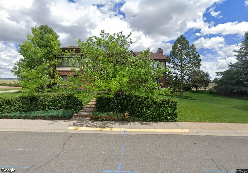
1495 Apache Dr Laramie, WY 82072
Estimated Value: $730,000 - $954,156
4
Beds
5
Baths
4,972
Sq Ft
$176/Sq Ft
Est. Value
About This Home
This home is located at 1495 Apache Dr, Laramie, WY 82072 and is currently estimated at $874,039, approximately $175 per square foot. 1495 Apache Dr is a home located in Albany County with nearby schools including Indian Paintbrush Elementary School, Laramie Middle School, and Laramie High School.
Ownership History
Date
Name
Owned For
Owner Type
Purchase Details
Closed on
Aug 5, 2024
Sold by
Nye Eric W and Frost Carol D
Bought by
Eric W Nye Revocable Trust and Carol D Frost Revocable Trust
Current Estimated Value
Purchase Details
Closed on
Apr 9, 2024
Sold by
Laramie Ridge Inc
Bought by
Frost Carol D and Nye Eric W
Purchase Details
Closed on
Aug 24, 2023
Sold by
Laramie Ridge Inc
Bought by
Nye Charles
Create a Home Valuation Report for This Property
The Home Valuation Report is an in-depth analysis detailing your home's value as well as a comparison with similar homes in the area
Home Values in the Area
Average Home Value in this Area
Purchase History
| Date | Buyer | Sale Price | Title Company |
|---|---|---|---|
| Eric W Nye Revocable Trust | -- | None Listed On Document | |
| Frost Carol D | -- | First American Title | |
| Nye Charles | -- | First American Title |
Source: Public Records
Tax History Compared to Growth
Tax History
| Year | Tax Paid | Tax Assessment Tax Assessment Total Assessment is a certain percentage of the fair market value that is determined by local assessors to be the total taxable value of land and additions on the property. | Land | Improvement |
|---|---|---|---|---|
| 2025 | $6,168 | $65,907 | $6,937 | $58,970 |
| 2024 | $6,168 | $84,496 | $8,893 | $75,603 |
| 2023 | $6,006 | $82,275 | $8,893 | $73,382 |
| 2022 | $5,120 | $70,133 | $8,893 | $61,240 |
| 2021 | $4,935 | $67,605 | $10,415 | $57,190 |
| 2020 | $4,843 | $66,342 | $10,415 | $55,927 |
| 2019 | $4,411 | $60,425 | $10,415 | $50,010 |
| 2018 | $4,293 | $58,815 | $10,038 | $48,777 |
| 2017 | $4,347 | $59,553 | $10,038 | $49,515 |
| 2016 | $4,343 | $59,494 | $10,038 | $49,456 |
| 2015 | $4,177 | $57,216 | $10,767 | $46,449 |
| 2014 | $4,215 | $57,733 | $0 | $0 |
Source: Public Records
Map
Nearby Homes
- 3734 Reynolds St
- 4106 Kiowa Dr
- TBD Hayford Ave
- 1050 N Indian Hills Dr
- 1772 Eaglecrest Ct
- 1071 Duna Dr
- 4324 Pueblo Dr
- 4421 Shoshone Dr
- 4341 E Crow Dr
- 1062 Bonita Dr
- 2611 Reynolds St Unit A
- 1766 N 23rd St
- 2122 E Curtis St
- 1554 Henry Dr
- 1150 N 18th St
- 417 Stetson Ct
- 1520 W Hill Rd
- 2167 N 16th St
- 1257 N 15th St Unit H
- 1259 N 15th St Unit G