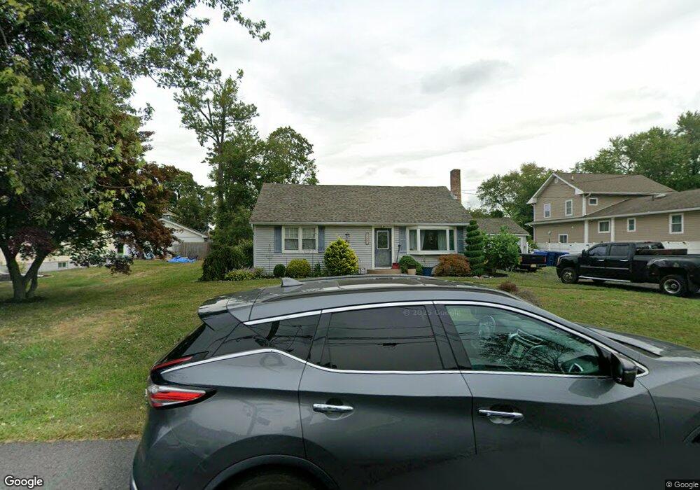
1495 Huron Rd North Brunswick, NJ 08902
Estimated Value: $361,242 - $429,000
--
Bed
--
Bath
999
Sq Ft
$407/Sq Ft
Est. Value
About This Home
This home is located at 1495 Huron Rd, North Brunswick, NJ 08902 and is currently estimated at $406,311, approximately $406 per square foot. 1495 Huron Rd is a home located in Middlesex County with nearby schools including John Adams Elementary School, Linwood Middle School, and North Brunswick Twp High School.
Ownership History
Date
Name
Owned For
Owner Type
Purchase Details
Closed on
May 14, 2012
Sold by
Shanahan Christine
Bought by
Shanahan Colin F
Current Estimated Value
Purchase Details
Closed on
Nov 12, 1999
Sold by
Padovano Thomas
Bought by
Shanahan Colin
Home Financials for this Owner
Home Financials are based on the most recent Mortgage that was taken out on this home.
Original Mortgage
$96,626
Interest Rate
7.9%
Mortgage Type
FHA
Create a Home Valuation Report for This Property
The Home Valuation Report is an in-depth analysis detailing your home's value as well as a comparison with similar homes in the area
Home Values in the Area
Average Home Value in this Area
Purchase History
| Date | Buyer | Sale Price | Title Company |
|---|---|---|---|
| Shanahan Colin F | $99 | -- | |
| Shanahan Colin | $135,000 | -- |
Source: Public Records
Mortgage History
| Date | Status | Borrower | Loan Amount |
|---|---|---|---|
| Previous Owner | Shanahan Colin | $96,626 |
Source: Public Records
Tax History Compared to Growth
Tax History
| Year | Tax Paid | Tax Assessment Tax Assessment Total Assessment is a certain percentage of the fair market value that is determined by local assessors to be the total taxable value of land and additions on the property. | Land | Improvement |
|---|---|---|---|---|
| 2025 | $7,521 | $118,700 | $72,400 | $46,300 |
| 2024 | $7,386 | $118,700 | $72,400 | $46,300 |
| 2023 | $7,386 | $118,700 | $72,400 | $46,300 |
| 2022 | $7,134 | $118,700 | $72,400 | $46,300 |
| 2021 | $5,198 | $118,700 | $72,400 | $46,300 |
| 2020 | $6,868 | $118,700 | $72,400 | $46,300 |
| 2019 | $6,728 | $118,700 | $72,400 | $46,300 |
| 2018 | $6,590 | $118,700 | $72,400 | $46,300 |
| 2017 | $6,474 | $118,700 | $72,400 | $46,300 |
| 2016 | $6,339 | $118,700 | $72,400 | $46,300 |
| 2015 | $6,231 | $118,700 | $72,400 | $46,300 |
| 2014 | $6,161 | $118,700 | $72,400 | $46,300 |
Source: Public Records
Map
Nearby Homes
- 1365 Sioux Rd
- 1499 La Rose Ave
- 1632 Hudson Ave
- 1209 Dakota Rd
- 1464 Columbia Dr
- 1899 Noah Dr
- 78 Churchill Ave
- 210 N Oaks Blvd Unit 210
- 1010 N Oaks Blvd
- 1133 Livingston Ave Unit 11C
- 139 Churchill Ave
- 5208 N Oaks Blvd
- 1008 Schmidt Ln
- 936 Patton St
- 1067 Grove St
- 1027 Schmidt Ln
- 1314 N Oaks Blvd
- 1074 Schmidt Ln
- 1 Michael Ct
- 1103 Schmidt Ln
- 1483 Huron Rd
- 1507 Huron Rd
- 1438 State Route 27
- 1496 Huron Rd
- 1500 Huron Rd
- 1473 Huron Rd
- 1430 State Route 27
- 1482 Huron Rd
- 1474 Huron Rd
- 1494 Omaha Rd
- 1486 Omaha Rd
- 1420 State Route 27
- 1465 Huron Rd
- 1480 State Route 27
- 1476 Omaha Rd
- 1460 Huron Rd
- 1481 Osage Rd
- 1472 Omaha Rd
- 1477 Osage Rd
- 1485 Osage Rd