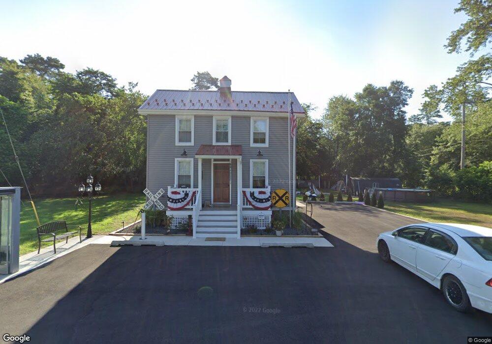
1495 Junction Rd Browns Mills, NJ 08015
Estimated Value: $187,000 - $284,000
--
Bed
--
Bath
924
Sq Ft
$248/Sq Ft
Est. Value
About This Home
This home is located at 1495 Junction Rd, Browns Mills, NJ 08015 and is currently estimated at $229,347, approximately $248 per square foot. 1495 Junction Rd is a home located in Burlington County.
Ownership History
Date
Name
Owned For
Owner Type
Purchase Details
Closed on
Feb 27, 2007
Sold by
Parker Robert and Kenyon Elizabeth
Bought by
Anderson William J and Anderson Leslie L
Current Estimated Value
Purchase Details
Closed on
May 19, 2005
Sold by
Foster Joseph C and Nichols Hannah M
Bought by
Parker Robert and Kenyon Elizabeth
Purchase Details
Closed on
Mar 31, 1995
Sold by
Haws John J
Bought by
Foster Joseph C
Create a Home Valuation Report for This Property
The Home Valuation Report is an in-depth analysis detailing your home's value as well as a comparison with similar homes in the area
Home Values in the Area
Average Home Value in this Area
Purchase History
| Date | Buyer | Sale Price | Title Company |
|---|---|---|---|
| Anderson William J | $100,000 | None Available | |
| Parker Robert | $58,000 | -- | |
| Foster Joseph C | $34,000 | Supreme Title Agency Inc | |
| Haws John J | -- | Supreme Title Agency Inc |
Source: Public Records
Tax History Compared to Growth
Tax History
| Year | Tax Paid | Tax Assessment Tax Assessment Total Assessment is a certain percentage of the fair market value that is determined by local assessors to be the total taxable value of land and additions on the property. | Land | Improvement |
|---|---|---|---|---|
| 2025 | $3,378 | $110,200 | $34,700 | $75,500 |
| 2024 | $3,169 | $110,200 | $34,700 | $75,500 |
| 2023 | $3,169 | $110,200 | $34,700 | $75,500 |
| 2022 | $2,934 | $110,200 | $34,700 | $75,500 |
| 2021 | $2,813 | $110,200 | $34,700 | $75,500 |
| 2020 | $2,708 | $110,200 | $34,700 | $75,500 |
| 2019 | $2,593 | $110,200 | $34,700 | $75,500 |
| 2018 | $2,505 | $110,200 | $34,700 | $75,500 |
| 2017 | $2,453 | $110,200 | $34,700 | $75,500 |
| 2016 | $2,228 | $59,600 | $20,000 | $39,600 |
| 2015 | $2,210 | $59,600 | $20,000 | $39,600 |
| 2014 | $2,113 | $59,600 | $20,000 | $39,600 |
Source: Public Records
Map
Nearby Homes
- 3610 Weymouth Rd
- 3394 Liberty St
- 3620 Weymouth Rd
- 204 Scammell Dr
- 3399 Liberty St
- 20 Coville Dr
- 511 Laurel Blvd
- 3594 Nashua St
- 3698 A Nashua St
- 3561 Weymouth Rd
- 601 Concord Dr
- 28 Scammell Dr
- 42 Monroe Ave
- 215 Coville Dr
- 25 Railroad St
- 217 Coville Dr
- 55 Columbus Ave
- 111 Huckleberry Ln
- 30 Press Ave
- 304 Otter Ave
- 711 Rancocas Ln
- 709 Rancocas Ln
- 707 Rancocas Ln
- 295 Mount Misery Rd
- 703 Rancocas Ln
- 1444 Junction Rd
- 287 Mount Misery Rd
- 701 Rancocas Ln
- 279 Rancocas Ln
- 277 Mount Misery Rd
- 0 Mt Misery Unit NJBL2073018
- 281 Rancocas Ln
- 271 Mount Misery Rd
- 270 Mount Misery Rd
- 261 Mount Misery Rd
- 263 Mount Misery Rd
- 268 Mount Misery Rd
- 266 Mount Misery Rd
- 262 Mount Misery Rd
- 258 Mount Misery Rd