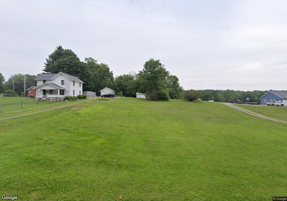
1495 Mowery Rd Perrysville, OH 44864
Estimated Value: $353,000 - $429,000
3
Beds
2
Baths
1,928
Sq Ft
$208/Sq Ft
Est. Value
About This Home
This home is located at 1495 Mowery Rd, Perrysville, OH 44864 and is currently estimated at $400,992, approximately $207 per square foot. 1495 Mowery Rd is a home with nearby schools including Lucas Elementary School, Lucas Heritage Middle School, and Lucas High School.
Ownership History
Date
Name
Owned For
Owner Type
Purchase Details
Closed on
Jan 18, 2021
Sold by
Thomas Melinda K
Bought by
Thomas Brian D and Thomas Andrea D
Current Estimated Value
Purchase Details
Closed on
Nov 5, 2020
Sold by
Thomas Melinda K
Bought by
Thomas Melinda K
Home Financials for this Owner
Home Financials are based on the most recent Mortgage that was taken out on this home.
Original Mortgage
$85,000
Interest Rate
2.8%
Mortgage Type
Future Advance Clause Open End Mortgage
Create a Home Valuation Report for This Property
The Home Valuation Report is an in-depth analysis detailing your home's value as well as a comparison with similar homes in the area
Home Values in the Area
Average Home Value in this Area
Purchase History
| Date | Buyer | Sale Price | Title Company |
|---|---|---|---|
| Thomas Brian D | -- | None Available | |
| Thomas Melinda K | -- | Chicago Title |
Source: Public Records
Mortgage History
| Date | Status | Borrower | Loan Amount |
|---|---|---|---|
| Closed | Thomas Melinda K | $85,000 |
Source: Public Records
Tax History Compared to Growth
Tax History
| Year | Tax Paid | Tax Assessment Tax Assessment Total Assessment is a certain percentage of the fair market value that is determined by local assessors to be the total taxable value of land and additions on the property. | Land | Improvement |
|---|---|---|---|---|
| 2024 | $3,959 | $97,500 | $16,310 | $81,190 |
| 2023 | $3,959 | $97,500 | $16,310 | $81,190 |
| 2022 | $63 | $7,250 | $7,250 | $0 |
| 2021 | $63 | $7,250 | $7,250 | $0 |
| 2020 | $130 | $18,520 | $18,520 | $0 |
| 2019 | $268 | $15,440 | $15,440 | $0 |
| 2018 | $276 | $15,440 | $15,440 | $0 |
| 2017 | $278 | $15,440 | $15,440 | $0 |
| 2016 | $644 | $13,480 | $13,480 | $0 |
| 2015 | $644 | $13,480 | $13,480 | $0 |
| 2014 | $647 | $13,480 | $13,480 | $0 |
| 2012 | $109 | $11,240 | $11,240 | $0 |
Source: Public Records
Map
Nearby Homes
- 0 Applegate Rd
- 2428 Applegate Rd
- 968 Township Road 2506
- 0 Township Road 925
- 1048 Township Road 2156
- 0 Mount Zion Rd Unit 9069748
- 3386 Trumpower Rd
- 68.40 Acres Trumpower Rd
- 0 Trumpower Rd
- 0 Moffett Rd
- 1183 County Road 30a
- 1106 County Road 30a
- 19 Maine St
- 174 W Main St
- 136 Bridge St
- 3261 Moffett Rd
- 2750 Lutz Ave
- 945 Pike Dr
- 2905 Tucker Rd
- 0 Peterson Rd
- 1579 Mowery Rd
- 1491 Mowery Rd
- 4537 Frontz Rd
- 1458 Mowery Rd
- 1490 Mowery Rd
- 1570 Weil Rd
- 1680 Mowery Rd
- 2374 Weil Rd
- 1874 Weil Rd
- 4689 Frontz Rd
- 1886 Weil Rd
- 1433 State Route 603
- 1788 Mowery Rd
- 1922 Weil Rd
- 1264 Mowery Rd
- 1434 Weil Rd
- 2353 Twp Rd 1097
- 1848 Weil Rd
- 2407 Twp Rd 1097
- 4601 State Route 39