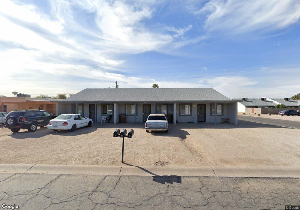
1497 E 26th Ln Apache Junction, AZ 85119
Estimated Value: $483,000 - $544,000
Studio
--
Bath
2,904
Sq Ft
$178/Sq Ft
Est. Value
About This Home
This home is located at 1497 E 26th Ln, Apache Junction, AZ 85119 and is currently estimated at $518,333, approximately $178 per square foot. 1497 E 26th Ln is a home located in Pinal County with nearby schools including Peralta Trail Elementary School, Cactus Canyon Junior High School, and Apache Junction High School.
Ownership History
Date
Name
Owned For
Owner Type
Purchase Details
Closed on
Mar 16, 2004
Sold by
Hughes Nathan P
Bought by
Rosebud Management Llc
Current Estimated Value
Purchase Details
Closed on
May 7, 2001
Sold by
Cossette Mike and Cossette Linda
Bought by
Hughes Nathan P
Purchase Details
Closed on
Nov 27, 1999
Sold by
Crisifulli Allen W
Bought by
Cossette Mike and Cossette Linda
Purchase Details
Closed on
Jul 31, 1998
Sold by
Crisifulli Deanne A
Bought by
Crisifulli Allen W
Purchase Details
Closed on
May 20, 1998
Sold by
Troiani Raymond
Bought by
Crisifulli Allen W and Crisifulli Deanne A King
Home Financials for this Owner
Home Financials are based on the most recent Mortgage that was taken out on this home.
Original Mortgage
$9,000
Interest Rate
7.1%
Mortgage Type
Seller Take Back
Create a Home Valuation Report for This Property
The Home Valuation Report is an in-depth analysis detailing your home's value as well as a comparison with similar homes in the area
Home Values in the Area
Average Home Value in this Area
Purchase History
| Date | Buyer | Sale Price | Title Company |
|---|---|---|---|
| Rosebud Management Llc | -- | -- | |
| Hughes Nathan P | $20,000 | First American Title | |
| Cossette Mike | $13,500 | Ati Title Agency | |
| Crisifulli Allen W | -- | -- | |
| Crisifulli Allen W | $12,000 | Ati Title Agency | |
| Troiani Raymond | -- | Ati Title Company |
Source: Public Records
Mortgage History
| Date | Status | Borrower | Loan Amount |
|---|---|---|---|
| Previous Owner | Crisifulli Allen W | $9,000 |
Source: Public Records
Tax History
| Year | Tax Paid | Tax Assessment Tax Assessment Total Assessment is a certain percentage of the fair market value that is determined by local assessors to be the total taxable value of land and additions on the property. | Land | Improvement |
|---|---|---|---|---|
| 2025 | $2,574 | $41,484 | -- | -- |
| 2024 | $2,429 | $42,238 | -- | -- |
| 2023 | $2,534 | $34,736 | $0 | $0 |
| 2022 | $2,429 | $21,172 | $2,903 | $18,269 |
| 2021 | $2,475 | $20,745 | $0 | $0 |
| 2020 | $2,411 | $18,735 | $0 | $0 |
| 2019 | $2,313 | $18,223 | $0 | $0 |
| 2018 | $2,266 | $16,252 | $0 | $0 |
| 2017 | $2,206 | $16,073 | $0 | $0 |
| 2016 | $2,151 | $16,426 | $1,100 | $15,326 |
| 2014 | $2,038 | $11,917 | $1,100 | $10,817 |
Source: Public Records
Map
Nearby Homes
- 2560 S Yavapai Rd
- 2605 S Tomahawk Rd Unit 10
- 1373 E 23rd Ave
- 1315 E 29th Ave
- 2890 S Mariposa Rd
- 1111 E Santa Cruz Ln
- 2756 S Powell Rd
- 1370 E 21st Ave
- 2046 S Mariposa Rd
- 1835 E 20th Ave
- 1050 E Osage Ave
- 1755 E Mesquite Ave
- 3405 S Tomahawk Rd Unit 301
- 3405 S Tomahawk Rd Unit 215
- 3273 S Chaparral Rd
- 1815 S Hayley Rd
- 3500 S Tomahawk Unit 142 Rd
- 2328 E Greenlee Ave
- 1792 S Hayley Rd
- 3500 S Tomahawk Rd Unit 188
- 1497 E 26th Ln Unit 2
- 1497 E 26th Ln Unit 1
- 1497 E 26th Ln Unit 3
- 1515 E 26th Ln
- 1515 E 26th Ln Unit 4
- 1490 E 27th Ave
- 2692 S Yavapai Rd Unit 3
- 2692 S Yavapai Rd
- 2692 S Yavapai Rd Unit 2
- 2692 S Yavapai Rd Unit 1
- 1478 E 26th Ln
- 1520 E 27th Ave
- 2682 S Yavapai Rd Unit 2
- 2682 S Yavapai Rd Unit 3
- 2682 S Yavapai Rd
- 2682 S Yavapai Rd Unit 1
- 1510 E 26th Ln Unit 3
- 1510 E 26th Ln Unit 2
- 1510 E 26th Ln Unit 1
- 1510 E 26th Ln Unit A
Your Personal Tour Guide
Ask me questions while you tour the home.