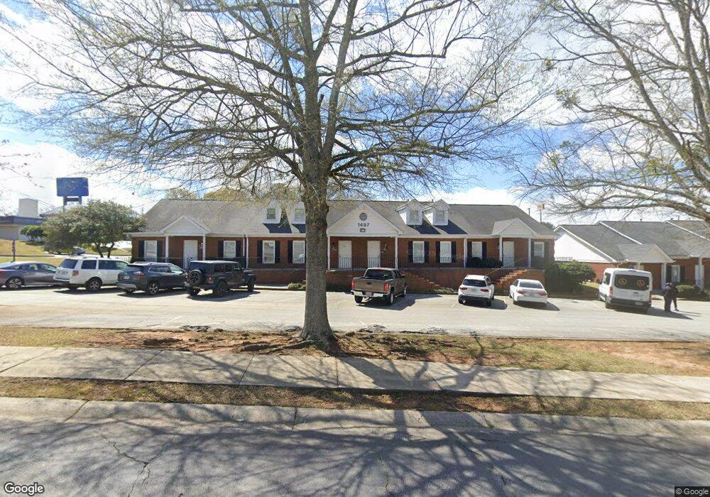
1497 John Robert Dr Unit A Morrow, GA 30260
Estimated Value: $1,150,100
Studio
--
Bath
5,130
Sq Ft
$224/Sq Ft
Est. Value
About This Home
This home is located at 1497 John Robert Dr Unit A, Morrow, GA 30260 and is currently estimated at $1,150,100, approximately $224 per square foot. 1497 John Robert Dr Unit A is a home located in Clayton County with nearby schools including Morrow Elementary School, Babb Middle School, and Charles R. Drew High School.
Ownership History
Date
Name
Owned For
Owner Type
Purchase Details
Closed on
Mar 20, 2014
Sold by
Bay Willow Llc
Bought by
Hths Grp Llc
Current Estimated Value
Purchase Details
Closed on
Nov 21, 2013
Sold by
United Community Bank
Bought by
Bay Willow Llc
Home Financials for this Owner
Home Financials are based on the most recent Mortgage that was taken out on this home.
Original Mortgage
$257,125
Interest Rate
4.16%
Mortgage Type
New Conventional
Purchase Details
Closed on
Sep 4, 2012
Sold by
Snap Investors Inc
Bought by
United Community Bank
Purchase Details
Closed on
Mar 13, 1997
Sold by
Heritage Group Inc
Bought by
Camp Lovell E
Create a Home Valuation Report for This Property
The Home Valuation Report is an in-depth analysis detailing your home's value as well as a comparison with similar homes in the area
Home Values in the Area
Average Home Value in this Area
Purchase History
| Date | Buyer | Sale Price | Title Company |
|---|---|---|---|
| Hths Grp Llc | $450,000 | -- | |
| Bay Willow Llc | $302,500 | -- | |
| United Community Bank | $760,000 | -- | |
| Camp Lovell E | $600,000 | -- |
Source: Public Records
Mortgage History
| Date | Status | Borrower | Loan Amount |
|---|---|---|---|
| Previous Owner | Bay Willow Llc | $257,125 |
Source: Public Records
Tax History
| Year | Tax Paid | Tax Assessment Tax Assessment Total Assessment is a certain percentage of the fair market value that is determined by local assessors to be the total taxable value of land and additions on the property. | Land | Improvement |
|---|---|---|---|---|
| 2025 | $21,370 | $677,800 | $33,640 | $644,160 |
| 2024 | $21,736 | $512,880 | $33,640 | $479,240 |
| 2023 | $11,842 | $300,000 | $33,640 | $266,360 |
| 2022 | $18,594 | $432,480 | $33,640 | $398,840 |
| 2021 | $12,868 | $392,080 | $33,640 | $358,440 |
| 2020 | $10,302 | $293,600 | $33,600 | $260,000 |
| 2019 | $10,451 | $458,800 | $33,600 | $425,200 |
| 2018 | $8,187 | $230,000 | $33,600 | $196,400 |
| 2017 | $8,209 | $230,000 | $33,600 | $196,400 |
| 2016 | $8,470 | $279,200 | $33,600 | $245,600 |
| 2015 | $6,301 | $0 | $0 | $0 |
| 2014 | $4,208 | $121,000 | $33,600 | $87,400 |
Source: Public Records
Map
Nearby Homes
- 6425 Woodstone Way
- 6429 Woodstone Way
- 6430 Oakleaf Way
- 6411 Northridge Dr Unit 6411
- 6446 Oakleaf Way
- 1394 Wood Cir S
- 6428 Pinebark Way
- 6440 Woodstone Terrace
- 6436 Stone Terrace Unit J10
- 1329 Woodstone Trace
- 1331 Woodstone Trace
- 1337 Woodstone Trace
- 6250 Graceland Cir
- 6433 Stone Way
- 1217 Dove Ct
- 0 SE Old Rex Morrow Rd Unit 142 8001665
- 6553 Meadowbrook Ln
- 2275 Santa fe St Unit 25
- 1902 Mural Cir Unit 5
- 6186 Deans Way
- 1483 John Robert Dr Unit SUITE B,C&D
- 1483 John Robert Dr
- 1467 John Robert Dr
- 1329 Woodstone Terrace
- 1337 Woodstone Terrace
- 1473 Hammack Dr
- 1479 Hammack Dr
- 1473 Hammack Dr
- 1465 Hammack Dr
- 1457 Hammack Dr
- 6400 S Lee St
- 1447 Hammack Dr
- 1483 Hammack Dr
- 1437 Hammack Dr
- 1415 John Robert Dr
- 6397 Magnolia Ln Unit 6397
- 6389 Magnolia Ln
- 6391 Magnolia Ln
- 6395 Magnolia Ln Unit 6395
- 6392 Arbor Ln