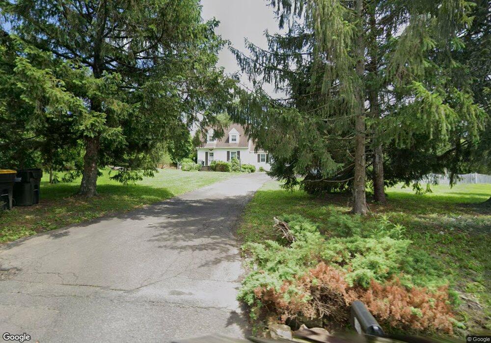
1497 Lower State Rd Doylestown, PA 18901
Estimated Value: $503,000 - $812,000
3
Beds
1
Bath
1,830
Sq Ft
$364/Sq Ft
Est. Value
About This Home
This home is located at 1497 Lower State Rd, Doylestown, PA 18901 and is currently estimated at $666,806, approximately $364 per square foot. 1497 Lower State Rd is a home located in Bucks County with nearby schools including Mill Creek Elementary School, Unami Middle School, and Central Bucks High School - South.
Ownership History
Date
Name
Owned For
Owner Type
Purchase Details
Closed on
May 3, 2022
Sold by
Timothy Daley
Bought by
Moy-Daley Alva V
Current Estimated Value
Purchase Details
Closed on
Jul 21, 2006
Sold by
Braun Frank E and Braun Jayne L
Bought by
Daley Timothy and Moy Daley Alva
Home Financials for this Owner
Home Financials are based on the most recent Mortgage that was taken out on this home.
Original Mortgage
$333,600
Interest Rate
7.5%
Mortgage Type
Purchase Money Mortgage
Purchase Details
Closed on
Jul 10, 1972
Bought by
Braun Frank E and Braun Jayne L
Create a Home Valuation Report for This Property
The Home Valuation Report is an in-depth analysis detailing your home's value as well as a comparison with similar homes in the area
Home Values in the Area
Average Home Value in this Area
Purchase History
| Date | Buyer | Sale Price | Title Company |
|---|---|---|---|
| Moy-Daley Alva V | -- | Williams Family Law Pc | |
| Daley Timothy | $417,000 | None Available | |
| Braun Frank E | -- | -- |
Source: Public Records
Mortgage History
| Date | Status | Borrower | Loan Amount |
|---|---|---|---|
| Previous Owner | Daley Timothy | $333,600 |
Source: Public Records
Tax History Compared to Growth
Tax History
| Year | Tax Paid | Tax Assessment Tax Assessment Total Assessment is a certain percentage of the fair market value that is determined by local assessors to be the total taxable value of land and additions on the property. | Land | Improvement |
|---|---|---|---|---|
| 2025 | $5,663 | $32,000 | $11,760 | $20,240 |
| 2024 | $5,663 | $32,000 | $11,760 | $20,240 |
| 2023 | $5,400 | $32,000 | $11,760 | $20,240 |
| 2022 | $5,340 | $32,000 | $11,760 | $20,240 |
| 2021 | $5,230 | $32,000 | $11,760 | $20,240 |
| 2020 | $5,206 | $32,000 | $11,760 | $20,240 |
| 2019 | $5,150 | $32,000 | $11,760 | $20,240 |
| 2018 | $5,134 | $32,000 | $11,760 | $20,240 |
| 2017 | $5,094 | $32,000 | $11,760 | $20,240 |
| 2016 | $5,062 | $32,000 | $11,760 | $20,240 |
| 2015 | -- | $32,000 | $11,760 | $20,240 |
| 2014 | -- | $32,000 | $11,760 | $20,240 |
Source: Public Records
Map
Nearby Homes
- 52 Tradesville Dr Unit 83
- Vetri Plan at Doylestown Walk
- 52 Tradesville Dr
- 73 Tradesville Dr
- 73 Tradesville Dr Unit 80
- 2 Mill Creek Dr
- 2 Mill Creek Dr Unit 137
- 6 Mill Creek Dr
- 1 Mill Creek Dr
- 47 Mill Creek Dr Unit 32
- 47 Mill Creek Dr
- 20 Woodstone Dr
- 21 Mill Creek Dr Unit 11
- 21 Mill Creek Dr
- 23 Mill Creek Dr
- 25 Mill Creek Dr
- 25 Mill Creek Dr Unit 13
- 1101 Deerfield Ln
- 242 Snapdragon St
- 803 Sweet Cherry St
- 1485 Lower State Rd
- 1509 Lower State Rd
- 1502 Lower State Rd
- 1514 Lower State Rd
- 1526 Lower State Rd
- 1469 Lower State Rd
- 1463 Lower State Rd
- 1538 Lower State Rd
- 1451 Lower State Rd
- 1541 Lower State Rd
- 1523 Lower State Rd
- 1550 Lower State Rd
- 1553 Lower State Rd
- 1439 Lower State Rd
- 1467 Lower State Rd
- 27 Tradesville Dr
- 1560 Lower State Rd
- 25 Tradesville Dr
- 1425 Lower State Rd
- 23 Tradesville Dr