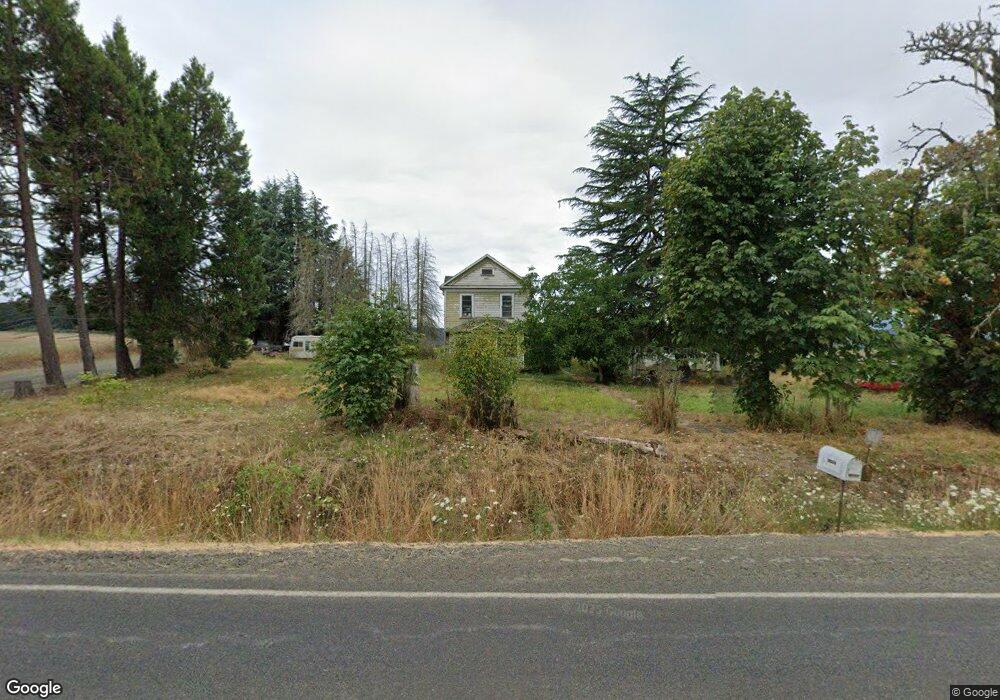
14970 Airlie Rd Monmouth, OR 97361
Estimated Value: $378,303 - $879,000
4
Beds
1
Bath
1,764
Sq Ft
$366/Sq Ft
Est. Value
About This Home
This home is located at 14970 Airlie Rd, Monmouth, OR 97361 and is currently estimated at $644,768, approximately $365 per square foot. 14970 Airlie Rd is a home located in Polk County with nearby schools including Monmouth Elementary School, Talmadge Middle School, and Central High School.
Ownership History
Date
Name
Owned For
Owner Type
Purchase Details
Closed on
Apr 29, 2024
Sold by
Crouch Joanne D
Bought by
Crouch Todd D
Current Estimated Value
Purchase Details
Closed on
Mar 14, 2016
Sold by
Focus On The Family
Bought by
Crouch Stephen D and Crouch Joanne D
Purchase Details
Closed on
Jun 16, 2015
Sold by
Pennie Christina
Bought by
Focus On The Family
Purchase Details
Closed on
Jul 30, 2004
Sold by
Pennie Glenn
Bought by
Pennie Glenn
Create a Home Valuation Report for This Property
The Home Valuation Report is an in-depth analysis detailing your home's value as well as a comparison with similar homes in the area
Home Values in the Area
Average Home Value in this Area
Purchase History
| Date | Buyer | Sale Price | Title Company |
|---|---|---|---|
| Crouch Todd D | -- | None Listed On Document | |
| Crouch Stephen D | $75,000 | First American | |
| Focus On The Family | -- | None Available | |
| Pennie Glenn | -- | -- |
Source: Public Records
Tax History Compared to Growth
Tax History
| Year | Tax Paid | Tax Assessment Tax Assessment Total Assessment is a certain percentage of the fair market value that is determined by local assessors to be the total taxable value of land and additions on the property. | Land | Improvement |
|---|---|---|---|---|
| 2025 | $2,654 | $213,830 | $176,740 | $37,090 |
| 2024 | $2,654 | $207,610 | $171,600 | $36,010 |
| 2023 | $2,825 | $201,570 | $166,610 | $34,960 |
| 2022 | $2,480 | $195,700 | $161,760 | $33,940 |
| 2021 | $2,463 | $190,000 | $157,050 | $32,950 |
| 2020 | $2,392 | $184,470 | $152,480 | $31,990 |
| 2019 | $2,248 | $179,100 | $148,040 | $31,060 |
| 2018 | $2,097 | $173,890 | $143,740 | $30,150 |
| 2017 | $2,329 | $175,500 | $102,460 | $73,040 |
| 2016 | $7,027 | $170,390 | $99,470 | $70,920 |
| 2015 | $2,292 | $165,430 | $96,580 | $68,850 |
| 2014 | $2,241 | $160,620 | $93,780 | $66,840 |
Source: Public Records
Map
Nearby Homes
- 0 Airlie Rd
- 14060 Simpson Rd
- 12700 Maxfield Creek Rd
- 0 Next To Airlie Rd Unit 220204700
- 0 Next To Airlie Rd Unit 830692
- 11090 Simpson Rd
- 11660 Simpson Rd
- 16000 Airlie Rd
- 000 Kings Valley Hwy
- 0 Westview Ln Unit 24100906
- 0 Westview Ln Unit 822683
- 12676 Kings Valley Hwy
- 12621 Meadow Lane Rd
- 0 (Next To) Airlie Rd
- 7340/7350 Smith Rd
- 7350 Smith Rd
- 11050 Elkins (Next To) Rd
- 7465 Kings Valley Hwy
- 11495 Helmick Rd
- 13100 Rd
- 14965 Airlie Rd
- 14935 Airlie Rd
- 15040 Airlie Rd
- 14995 Airlie Rd
- 14995 Airlie Rd
- 14995 Airlie Rd
- 15075 Airlie Rd
- 14855 Airlie Rd
- 15400 Tarter Rd
- 14850 Airlie Rd
- 15150 Airlie Rd
- 15175 Airlie Rd
- 14830 Airlie Rd
- 15255 Airlie Rd
- 14800 Airlie Rd
- 12775 Maxfield Creek Rd
- 14740 Airlie Rd
- 14685 Airlie Rd
- 14675 Hazel St
- 14680 Airlie Rd