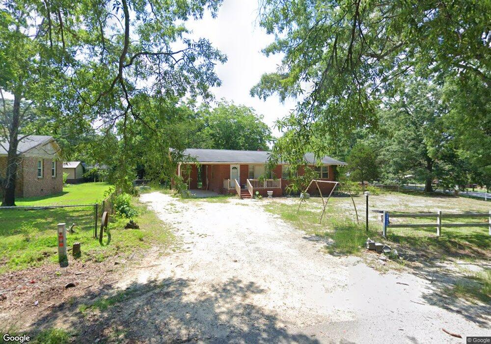
14980 Phillip Dr Laurinburg, NC 28352
Estimated Value: $97,000 - $109,000
3
Beds
1
Bath
1,144
Sq Ft
$88/Sq Ft
Est. Value
About This Home
This home is located at 14980 Phillip Dr, Laurinburg, NC 28352 and is currently estimated at $100,935, approximately $88 per square foot. 14980 Phillip Dr is a home located in Scotland County with nearby schools including I E Johnson Elementary, Spring Hill Middle School, and Scotland High School.
Ownership History
Date
Name
Owned For
Owner Type
Purchase Details
Closed on
Jun 12, 2018
Sold by
Parham Larry W
Bought by
Ivey Cathy L and Ivey Jeffrey F
Current Estimated Value
Home Financials for this Owner
Home Financials are based on the most recent Mortgage that was taken out on this home.
Original Mortgage
$45,900
Outstanding Balance
$39,696
Interest Rate
4.5%
Mortgage Type
New Conventional
Estimated Equity
$61,239
Purchase Details
Closed on
Sep 22, 2009
Sold by
Wallace Judy Herring
Bought by
Parham Larry W
Home Financials for this Owner
Home Financials are based on the most recent Mortgage that was taken out on this home.
Original Mortgage
$56,610
Interest Rate
5.11%
Mortgage Type
New Conventional
Create a Home Valuation Report for This Property
The Home Valuation Report is an in-depth analysis detailing your home's value as well as a comparison with similar homes in the area
Home Values in the Area
Average Home Value in this Area
Purchase History
| Date | Buyer | Sale Price | Title Company |
|---|---|---|---|
| Ivey Cathy L | $54,000 | None Available | |
| Parham Larry W | $27,500 | None Available |
Source: Public Records
Mortgage History
| Date | Status | Borrower | Loan Amount |
|---|---|---|---|
| Open | Ivey Cathy L | $45,900 | |
| Previous Owner | Parham Larry W | $56,610 |
Source: Public Records
Tax History Compared to Growth
Tax History
| Year | Tax Paid | Tax Assessment Tax Assessment Total Assessment is a certain percentage of the fair market value that is determined by local assessors to be the total taxable value of land and additions on the property. | Land | Improvement |
|---|---|---|---|---|
| 2025 | $591 | $54,190 | $6,500 | $47,690 |
| 2024 | $586 | $54,190 | $6,500 | $47,690 |
| 2023 | $591 | $54,190 | $6,500 | $47,690 |
| 2022 | $591 | $54,190 | $6,500 | $47,690 |
| 2021 | $597 | $54,190 | $6,500 | $47,690 |
| 2020 | $591 | $54,190 | $6,500 | $47,690 |
| 2019 | $597 | $54,190 | $6,500 | $47,690 |
| 2018 | $636 | $58,060 | $6,500 | $51,560 |
| 2017 | $641 | $58,060 | $6,500 | $51,560 |
| 2016 | $647 | $58,060 | $6,500 | $51,560 |
| 2015 | $653 | $58,060 | $6,500 | $51,560 |
| 2014 | $598 | $0 | $0 | $0 |
Source: Public Records
Map
Nearby Homes
- 14120 Kiser Rd
- 17090 Old Lumberton Rd
- 105 Sanford Rd
- 22 3rd St
- 20 3rd St
- 512 Produce Market Rd
- 0 Queensdale St
- 914 Cliffdale Dr
- 13241 Highland Rd
- 0 Produce Market Rd Unit LotWP001 16910819
- 0 Produce Market Rd
- 201 2nd St
- 0 Hall St
- 622 E Vance St
- 421 Mckay St
- 804 Durso St
- 514 E Covington St
- 411 Mckay St
- 00 Stewartsville Rd
- 411 E Church St
- 14980 Phillips Dr
- 14960 Phillips Dr
- 14960 Phillip Dr
- 17020 Morgan Cir
- 14200 Kiser Rd
- 14981 Phillip Dr
- 14981 Phillips Dr
- 17081 Morgan Cir
- 17061 Morgan Cir
- 14920 Phillip Dr
- 14920 Phillips Dr
- 14180 Kiser Rd
- 17041 Morgan Cir
- 17101 Morgan Cir
- 17080 Morgan Cir
- 14961 Phillip Dr
- 17121 Morgan Cir
- 17100 Morgan Cir
- 17001 Morgan Cir
- 14281 Kiser Rd