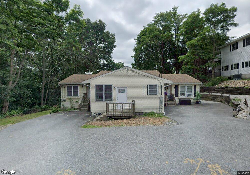
15-17 Peacedale Ave Worcester, MA 01607
North Quinsigamond Village NeighborhoodEstimated Value: $590,000 - $725,000
5
Beds
3
Baths
2,328
Sq Ft
$290/Sq Ft
Est. Value
About This Home
This home is located at 15-17 Peacedale Ave, Worcester, MA 01607 and is currently estimated at $674,333, approximately $289 per square foot. 15-17 Peacedale Ave is a home located in Worcester County with nearby schools including Quinsigamond School, Jacob Hiatt Magnet School, and Chandler Magnet.
Ownership History
Date
Name
Owned For
Owner Type
Purchase Details
Closed on
Jul 9, 2015
Sold by
Gwatirisa Justin J
Bought by
Tetteh David A
Current Estimated Value
Purchase Details
Closed on
Mar 30, 2000
Sold by
Payne Marilyn P
Bought by
Gwatirisa Justin J
Home Financials for this Owner
Home Financials are based on the most recent Mortgage that was taken out on this home.
Original Mortgage
$126,400
Interest Rate
8.4%
Mortgage Type
Purchase Money Mortgage
Purchase Details
Closed on
Apr 30, 1998
Sold by
Real Kathleen M and Cook Carolyn J
Bought by
Payne Marilyn P
Home Financials for this Owner
Home Financials are based on the most recent Mortgage that was taken out on this home.
Original Mortgage
$150,563
Interest Rate
7.04%
Mortgage Type
Purchase Money Mortgage
Create a Home Valuation Report for This Property
The Home Valuation Report is an in-depth analysis detailing your home's value as well as a comparison with similar homes in the area
Home Values in the Area
Average Home Value in this Area
Purchase History
| Date | Buyer | Sale Price | Title Company |
|---|---|---|---|
| Tetteh David A | $70,000 | -- | |
| Gwatirisa Justin J | $158,000 | -- | |
| Payne Marilyn P | $155,000 | -- |
Source: Public Records
Mortgage History
| Date | Status | Borrower | Loan Amount |
|---|---|---|---|
| Previous Owner | Payne Marilyn P | $126,000 | |
| Previous Owner | Payne Marilyn P | $126,400 | |
| Previous Owner | Payne Marilyn P | $150,563 |
Source: Public Records
Tax History Compared to Growth
Tax History
| Year | Tax Paid | Tax Assessment Tax Assessment Total Assessment is a certain percentage of the fair market value that is determined by local assessors to be the total taxable value of land and additions on the property. | Land | Improvement |
|---|---|---|---|---|
| 2025 | $7,324 | $555,300 | $117,900 | $437,400 |
| 2024 | $7,165 | $521,100 | $117,900 | $403,200 |
| 2023 | $6,622 | $461,800 | $102,500 | $359,300 |
| 2022 | $6,060 | $398,400 | $82,000 | $316,400 |
| 2021 | $5,827 | $357,900 | $65,600 | $292,300 |
| 2020 | $5,476 | $322,100 | $65,600 | $256,500 |
| 2019 | $5,679 | $315,500 | $59,000 | $256,500 |
| 2018 | $5,153 | $272,500 | $59,000 | $213,500 |
| 2017 | $5,351 | $278,400 | $59,000 | $219,400 |
| 2016 | $3,376 | $163,800 | $43,000 | $120,800 |
| 2015 | $3,287 | $163,800 | $43,000 | $120,800 |
| 2014 | -- | $163,800 | $43,000 | $120,800 |
Source: Public Records
Map
Nearby Homes
- 15 Peacedale Ave Unit 17
- 17 Peacedale Ave
- 33 Steele St
- 31 Steele St
- 13 Peacedale Ave
- 18 Keach Ave
- 0 Keach Ave
- 28 Keach Ave
- 35 Steele St
- 18 Peacedale Ave
- 16 Peacedale Ave
- 16 Peacedale Ave Unit ,16
- 15 Keach Ave
- 21 Peacedale Ave
- 13 Keach Ave
- 41 Steele St Unit 41
- 36 Steele St
- 39 Steele St
- 57 Tatman St
- 59 Tatman St