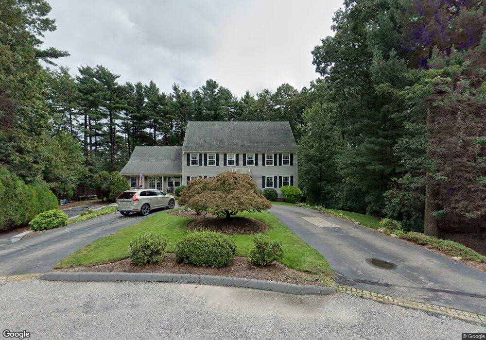
15 Arrowhead Rd Walpole, MA 02081
Estimated Value: $1,163,127 - $1,463,000
4
Beds
3
Baths
3,264
Sq Ft
$385/Sq Ft
Est. Value
About This Home
This home is located at 15 Arrowhead Rd, Walpole, MA 02081 and is currently estimated at $1,257,782, approximately $385 per square foot. 15 Arrowhead Rd is a home located in Norfolk County with nearby schools including Old Post Road School, Walpole Middle School, and Walpole High School.
Ownership History
Date
Name
Owned For
Owner Type
Purchase Details
Closed on
Aug 19, 1997
Sold by
David Stephen T
Bought by
Scales David A
Current Estimated Value
Home Financials for this Owner
Home Financials are based on the most recent Mortgage that was taken out on this home.
Original Mortgage
$260,000
Outstanding Balance
$39,040
Interest Rate
7.56%
Mortgage Type
Purchase Money Mortgage
Estimated Equity
$1,218,742
Create a Home Valuation Report for This Property
The Home Valuation Report is an in-depth analysis detailing your home's value as well as a comparison with similar homes in the area
Home Values in the Area
Average Home Value in this Area
Purchase History
| Date | Buyer | Sale Price | Title Company |
|---|---|---|---|
| Scales David A | $355,000 | -- |
Source: Public Records
Mortgage History
| Date | Status | Borrower | Loan Amount |
|---|---|---|---|
| Open | Scales David A | $260,000 |
Source: Public Records
Tax History
| Year | Tax Paid | Tax Assessment Tax Assessment Total Assessment is a certain percentage of the fair market value that is determined by local assessors to be the total taxable value of land and additions on the property. | Land | Improvement |
|---|---|---|---|---|
| 2025 | $12,770 | $995,300 | $390,400 | $604,900 |
| 2024 | $12,336 | $933,100 | $375,700 | $557,400 |
| 2023 | $11,662 | $839,600 | $326,900 | $512,700 |
| 2022 | $10,900 | $753,800 | $302,300 | $451,500 |
| 2021 | $10,717 | $722,200 | $284,900 | $437,300 |
| 2020 | $10,165 | $678,100 | $269,100 | $409,000 |
| 2019 | $9,851 | $652,400 | $259,900 | $392,500 |
| 2018 | $9,777 | $640,300 | $247,900 | $392,400 |
| 2017 | $9,511 | $620,400 | $238,600 | $381,800 |
| 2016 | $9,282 | $596,500 | $232,100 | $364,400 |
| 2015 | $8,952 | $570,200 | $222,700 | $347,500 |
| 2014 | $8,596 | $545,400 | $222,700 | $322,700 |
Source: Public Records
Map
Nearby Homes
- 1 Palace Ct
- 1 Providence Hwy
- 635 Old Post Rd Unit 303
- 635 Old Post Rd Unit 302
- 635 Old Post Rd Unit 2-203
- 486 Washington St
- 37 Alice Ave
- 363 - 367 Washington St
- 587 Common St
- 0 U S Route 1
- 6 Eleanor Rd
- Unit 11 Powder House Ln Unit 11
- 8 Powder House Ln Unit 2
- Unit 12 Powder House Ln Unit 12
- Unit 3 Powder House Ln Unit 3
- 277 Everett St
- 224 School St Unit 9
- 222 School St Unit 9
- 50 Riverside Place
- 145 South St Unit 5
- 12 Arrowhead Rd
- 7 Palomino Way
- 11 Arrowhead Rd
- 23 Saboites Way
- 24 Cherokee Ln
- 7 Arrowhead Rd
- 8 Arrowhead Rd
- 28 Cherokee Ln
- 19 Saboites Way
- 19 Saboites Way
- 20 Cherokee Ln
- 4 Arrowhead Rd
- 8 Palomino Way
- 3 Arrowhead Rd
- 15 Saboites Way
- 15 Saboites Way
- 23 Cherokee Ln
- 27 Cherokee Ln
- 27 Cherokee Ln Unit 27
- 458 Old Post Rd
Your Personal Tour Guide
Ask me questions while you tour the home.