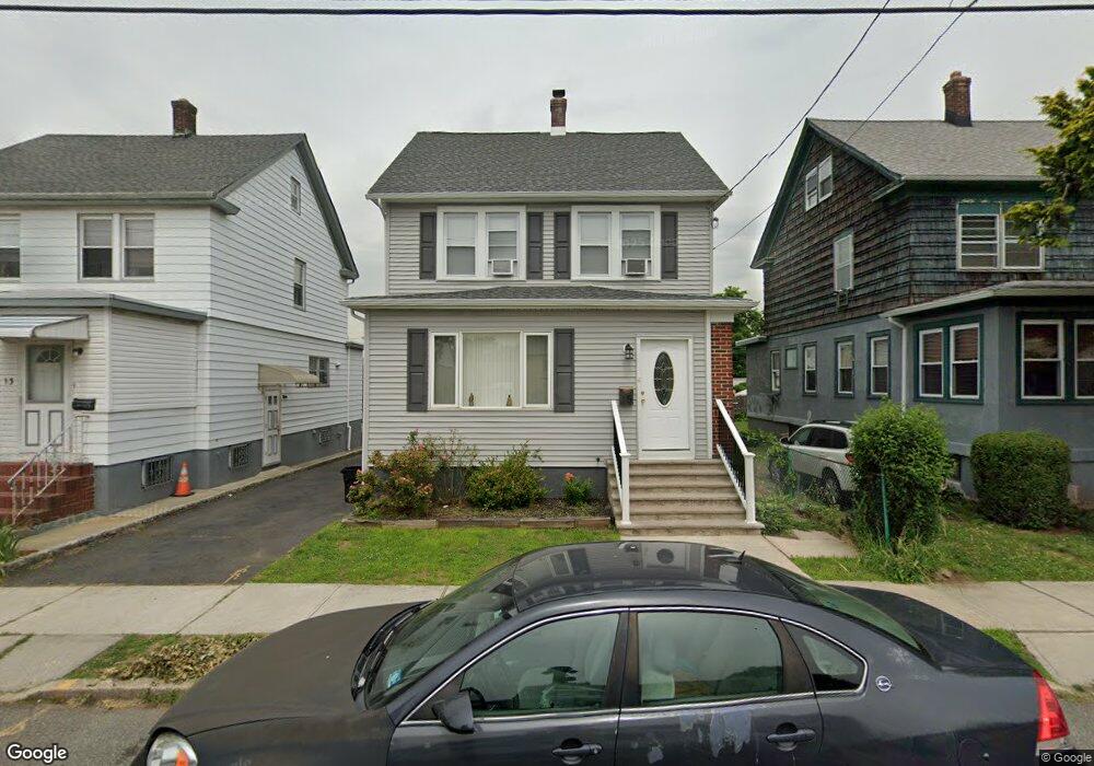
15 Atlantic St Carteret, NJ 07008
Estimated Value: $470,000 - $615,000
3
Beds
2
Baths
1,903
Sq Ft
$288/Sq Ft
Est. Value
About This Home
This home is located at 15 Atlantic St, Carteret, NJ 07008 and is currently estimated at $548,589, approximately $288 per square foot. 15 Atlantic St is a home located in Middlesex County with nearby schools including Carteret High School and St Joseph School.
Ownership History
Date
Name
Owned For
Owner Type
Purchase Details
Closed on
May 9, 2019
Sold by
Dover Avenue Realty Llc
Bought by
Rodriguez Norma and Fuller Daniel M
Current Estimated Value
Home Financials for this Owner
Home Financials are based on the most recent Mortgage that was taken out on this home.
Original Mortgage
$309,294
Outstanding Balance
$274,868
Interest Rate
4.75%
Mortgage Type
FHA
Estimated Equity
$273,721
Purchase Details
Closed on
Dec 15, 2017
Sold by
Donofrio Gabriel
Bought by
Dover Avenue Realty Llc
Purchase Details
Closed on
Jun 19, 1998
Sold by
Andriani Donna
Bought by
Donofrio Gabriel
Home Financials for this Owner
Home Financials are based on the most recent Mortgage that was taken out on this home.
Original Mortgage
$102,752
Interest Rate
6.92%
Mortgage Type
FHA
Create a Home Valuation Report for This Property
The Home Valuation Report is an in-depth analysis detailing your home's value as well as a comparison with similar homes in the area
Home Values in the Area
Average Home Value in this Area
Purchase History
| Date | Buyer | Sale Price | Title Company |
|---|---|---|---|
| Rodriguez Norma | $315,000 | Elitte Team Title Llc | |
| Dover Avenue Realty Llc | $133,000 | None Available | |
| Donofrio Gabriel | $103,000 | -- |
Source: Public Records
Mortgage History
| Date | Status | Borrower | Loan Amount |
|---|---|---|---|
| Open | Rodriguez Norma | $309,294 | |
| Previous Owner | Donofrio Gabriel | $102,752 |
Source: Public Records
Tax History Compared to Growth
Tax History
| Year | Tax Paid | Tax Assessment Tax Assessment Total Assessment is a certain percentage of the fair market value that is determined by local assessors to be the total taxable value of land and additions on the property. | Land | Improvement |
|---|---|---|---|---|
| 2025 | $7,425 | $561,900 | $287,200 | $274,700 |
| 2024 | $7,234 | $232,900 | $63,500 | $169,400 |
| 2023 | $7,234 | $232,900 | $63,500 | $169,400 |
| 2022 | $7,034 | $232,900 | $63,500 | $169,400 |
| 2021 | $4,718 | $213,200 | $63,500 | $149,700 |
| 2020 | $6,132 | $213,200 | $63,500 | $149,700 |
| 2019 | $5,955 | $213,200 | $63,500 | $149,700 |
| 2018 | $5,814 | $213,200 | $63,500 | $149,700 |
| 2017 | $5,607 | $213,200 | $63,500 | $149,700 |
| 2016 | $6,660 | $210,300 | $68,500 | $141,800 |
| 2015 | $6,563 | $210,300 | $68,500 | $141,800 |
| 2014 | $6,277 | $210,300 | $68,500 | $141,800 |
Source: Public Records
Map
Nearby Homes
- 42 Pulaski Ave
- 128 Pershing Ave
- 82 Pulaski Ave
- 68 Atlantic St
- 160 Pershing Ave
- 88 Lowell St
- 14 Linden St
- 84-86 Washington Ave
- 12 Hudson St
- 4 Somerset St
- 114 Washington Ave
- 3 Jessie St
- 36 E Laurel St
- 141 Emerson St
- 54 Bergen St
- 12 Edwin St
- 22 N Whittier St Unit B
- 118 Holly St
- 245 Carteret Ave
- 76 Daniel St
- 13 Atlantic St
- 21 Atlantic St
- 86 Pershing Ave
- 88 Pershing Ave
- 90 Pershing Ave
- 23 Atlantic St
- 20 Atlantic St
- 18 Atlantic St
- 27 Atlantic St
- 22 Atlantic St
- 16 Atlantic St
- 24 Atlantic St
- 26 Atlantic St
- 31 Atlantic St
- 14 Atlantic St
- 33 Terminal Ave
- 28 Atlantic St
- 100 Pershing Ave Unit 3fl
- 100 Pershing Ave Unit 11
- 100 Pershing Ave Unit 2