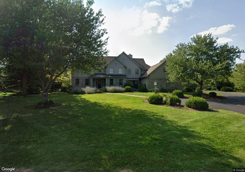
15 Barrow Cir Lititz, PA 17543
Kissel Hill NeighborhoodEstimated Value: $1,131,000 - $1,315,636
5
Beds
5
Baths
4,396
Sq Ft
$281/Sq Ft
Est. Value
About This Home
This home is located at 15 Barrow Cir, Lititz, PA 17543 and is currently estimated at $1,236,909, approximately $281 per square foot. 15 Barrow Cir is a home located in Lancaster County with nearby schools including Reidenbaugh Elementary School, Landis Run Intermediate School, and Manheim Township Middle School.
Ownership History
Date
Name
Owned For
Owner Type
Purchase Details
Closed on
Jun 29, 2006
Sold by
Stull Mark W and Stull Carla L
Bought by
Stull Carla L
Current Estimated Value
Home Financials for this Owner
Home Financials are based on the most recent Mortgage that was taken out on this home.
Original Mortgage
$306,000
Interest Rate
6.71%
Mortgage Type
New Conventional
Create a Home Valuation Report for This Property
The Home Valuation Report is an in-depth analysis detailing your home's value as well as a comparison with similar homes in the area
Home Values in the Area
Average Home Value in this Area
Purchase History
| Date | Buyer | Sale Price | Title Company |
|---|---|---|---|
| Stull Carla L | -- | First American Title Ins Co |
Source: Public Records
Mortgage History
| Date | Status | Borrower | Loan Amount |
|---|---|---|---|
| Closed | Stull Carla L | $306,000 |
Source: Public Records
Tax History
| Year | Tax Paid | Tax Assessment Tax Assessment Total Assessment is a certain percentage of the fair market value that is determined by local assessors to be the total taxable value of land and additions on the property. | Land | Improvement |
|---|---|---|---|---|
| 2025 | $18,751 | $866,600 | $165,500 | $701,100 |
| 2024 | $18,751 | $866,600 | $165,500 | $701,100 |
| 2023 | $18,262 | $866,600 | $165,500 | $701,100 |
| 2022 | $17,954 | $866,600 | $165,500 | $701,100 |
| 2021 | $17,553 | $866,600 | $165,500 | $701,100 |
| 2020 | $17,553 | $866,600 | $165,500 | $701,100 |
| 2019 | $17,383 | $866,600 | $165,500 | $701,100 |
| 2018 | $12,989 | $866,600 | $165,500 | $701,100 |
| 2017 | $17,733 | $696,900 | $143,100 | $553,800 |
| 2016 | $17,733 | $696,900 | $143,100 | $553,800 |
| 2015 | $4,457 | $696,900 | $143,100 | $553,800 |
| 2014 | $12,883 | $696,900 | $143,100 | $553,800 |
Source: Public Records
Map
Nearby Homes
- 649 Dorset St
- 617 Dorset St
- 1221 Brighton Ave
- 505 Northampton Dr Unit 2
- 131 Milton Cir
- 297 Sarsen Dr
- 421 Southampton Dr
- 512 Northampton Dr Unit 43
- 1021 Suffolk Dr
- 168 Olde Field Dr
- 504 Cheltenham Ct
- 701 Woodfield Dr
- LOT 12 Bent Creek Dr
- 660 Woodfield Dr
- LOT 34 Honey Farm Rd
- 30 Farmview Ln
- LOT 35 Honey Farm Rd
- 152 Kings Gate Dr
- 634 Northfield Rd
- 66 Farmview Ln
- 507 Stonehenge Dr
- 11 Barrow Cir
- 7 Barrow Cir
- 3 Barrow Cir
- 0 Barrow Cir
- 494 Wheatfield Dr
- 498 Wheatfield Dr
- 509 Stonehenge Dr
- 508 Stonehenge Dr
- 502 Wheatfield Dr
- 490 Wheatfield Dr
- 504 Dorset St
- 1061 Bluestone Dr
- 506 Wheatfield Dr
- 486 Wheatfield Dr
- 508 Dorset St
- 1508 Wheatfield Dr
- 0 Wheatfield Dr
- 482 Wheatfield Dr
- 1051 Bluestone Dr
Your Personal Tour Guide
Ask me questions while you tour the home.