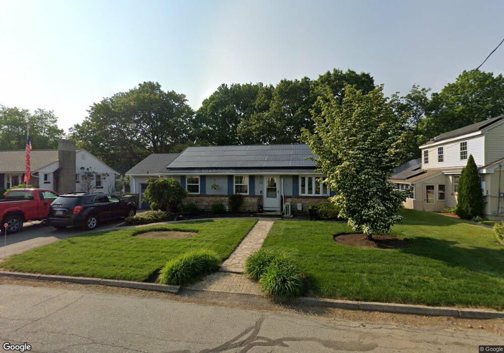
15 Beverly Ave Uxbridge, MA 01569
Estimated Value: $400,000 - $444,000
2
Beds
1
Bath
1,080
Sq Ft
$383/Sq Ft
Est. Value
About This Home
This home is located at 15 Beverly Ave, Uxbridge, MA 01569 and is currently estimated at $413,978, approximately $383 per square foot. 15 Beverly Ave is a home located in Worcester County with nearby schools including Uxbridge High School, Our Lady of the Valley Regional School, and Whitinsville Christian School.
Ownership History
Date
Name
Owned For
Owner Type
Purchase Details
Closed on
Feb 22, 2021
Sold by
Benoit Christopher J and Benoit Emily
Bought by
Voda Samantha E and Demichele Anthony J
Current Estimated Value
Home Financials for this Owner
Home Financials are based on the most recent Mortgage that was taken out on this home.
Original Mortgage
$252,000
Outstanding Balance
$225,191
Interest Rate
2.65%
Mortgage Type
Purchase Money Mortgage
Estimated Equity
$188,787
Purchase Details
Closed on
Jun 5, 2007
Sold by
Grimala Paul E
Bought by
Grimala Bonnie J and Grimala Paul L
Create a Home Valuation Report for This Property
The Home Valuation Report is an in-depth analysis detailing your home's value as well as a comparison with similar homes in the area
Home Values in the Area
Average Home Value in this Area
Purchase History
| Date | Buyer | Sale Price | Title Company |
|---|---|---|---|
| Voda Samantha E | $280,000 | None Available | |
| Grimala Bonnie J | -- | -- |
Source: Public Records
Mortgage History
| Date | Status | Borrower | Loan Amount |
|---|---|---|---|
| Open | Voda Samantha E | $252,000 |
Source: Public Records
Tax History Compared to Growth
Tax History
| Year | Tax Paid | Tax Assessment Tax Assessment Total Assessment is a certain percentage of the fair market value that is determined by local assessors to be the total taxable value of land and additions on the property. | Land | Improvement |
|---|---|---|---|---|
| 2025 | $48 | $363,100 | $128,400 | $234,700 |
| 2024 | $4,293 | $332,300 | $117,700 | $214,600 |
| 2023 | $4,012 | $287,600 | $107,000 | $180,600 |
| 2022 | $3,890 | $256,600 | $97,000 | $159,600 |
| 2021 | $3,993 | $252,400 | $92,800 | $159,600 |
| 2020 | $3,828 | $228,700 | $96,300 | $132,400 |
| 2019 | $3,798 | $218,900 | $89,200 | $129,700 |
| 2018 | $3,578 | $208,400 | $89,200 | $119,200 |
| 2017 | $3,346 | $197,300 | $77,300 | $120,000 |
| 2016 | $3,503 | $199,400 | $69,200 | $130,200 |
| 2015 | $3,430 | $197,100 | $69,200 | $127,900 |
Source: Public Records
Map
Nearby Homes
- 36 Elm St
- 307 N Main St
- 129 Elm St Unit Lot 7
- 0 Homestead Ave
- 113 Rogerson Crossing Unit 113
- 7 Jefferson Ct Unit 7
- 3 Strathmore Shire Unit A
- 235 Rivulet St
- 48 Homeward Ave
- 35 Highland Park Unit 35
- 72 Homeward Ave
- 50 Carrington Ln
- 60 Tyler Dr
- 75 Lake St
- 99 Country Club Dr
- 94 Heritage Dr Unit 94
- 0 Louis St
- 44 Arthur Dr Unit 44
- Layla Plan at Pine Ridge
- Ashley Plan at Pine Ridge
- 11 Beverly Ave
- 19 Beverly Ave
- 117 Saint Andre Dr
- 117 St Andre Dr
- 123 St Andre Dr
- 115 St Andre Dr
- 115 Saint Andre Dr
- 115 Saint Andre Dr Unit 115
- 125 St Andre Dr
- 14 Beverly Ave
- 23 Beverly Ave
- 109 St Andre Dr
- 12 Beverly Ave
- 18 Beverly Ave
- 107 St Andre Dr
- 107 Saint Andre Dr
- 107 Saint Andre Dr Unit 107
- 8 Beverly Ave
- 20 Beverly Ave
- 82 Rivulet St