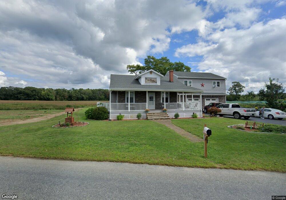
15 Blossom Rd Westport, MA 02790
Estimated Value: $401,000 - $677,081
3
Beds
1
Bath
1,735
Sq Ft
$304/Sq Ft
Est. Value
About This Home
This home is located at 15 Blossom Rd, Westport, MA 02790 and is currently estimated at $526,770, approximately $303 per square foot. 15 Blossom Rd is a home located in Bristol County with nearby schools including Alice A. Macomber Primary School, Westport Elementary School, and Westport Middle-High School.
Ownership History
Date
Name
Owned For
Owner Type
Purchase Details
Closed on
May 4, 2007
Sold by
Est Bishop Eugene J and Silvia Emily K
Bought by
Rebello Christine and Rebello David I
Current Estimated Value
Home Financials for this Owner
Home Financials are based on the most recent Mortgage that was taken out on this home.
Original Mortgage
$255,000
Outstanding Balance
$155,616
Interest Rate
6.23%
Mortgage Type
Purchase Money Mortgage
Estimated Equity
$371,154
Create a Home Valuation Report for This Property
The Home Valuation Report is an in-depth analysis detailing your home's value as well as a comparison with similar homes in the area
Home Values in the Area
Average Home Value in this Area
Purchase History
| Date | Buyer | Sale Price | Title Company |
|---|---|---|---|
| Rebello Christine | $255,000 | -- |
Source: Public Records
Mortgage History
| Date | Status | Borrower | Loan Amount |
|---|---|---|---|
| Open | Rebello Christine | $255,000 |
Source: Public Records
Tax History Compared to Growth
Tax History
| Year | Tax Paid | Tax Assessment Tax Assessment Total Assessment is a certain percentage of the fair market value that is determined by local assessors to be the total taxable value of land and additions on the property. | Land | Improvement |
|---|---|---|---|---|
| 2025 | $3,860 | $518,100 | $162,100 | $356,000 |
| 2024 | $3,876 | $501,400 | $150,200 | $351,200 |
| 2023 | $3,897 | $477,600 | $136,800 | $340,800 |
| 2022 | $3,612 | $425,900 | $124,400 | $301,500 |
| 2021 | $123 | $385,800 | $113,000 | $272,800 |
| 2020 | $3,466 | $381,300 | $108,500 | $272,800 |
| 2019 | $2,981 | $360,400 | $108,500 | $251,900 |
| 2018 | $3,492 | $345,200 | $109,700 | $235,500 |
| 2017 | $117 | $335,900 | $106,200 | $229,700 |
| 2016 | $2,592 | $327,700 | $102,700 | $225,000 |
| 2015 | $1,665 | $209,900 | $105,100 | $104,800 |
Source: Public Records
Map
Nearby Homes
- 128 Old Bedford Rd
- 3 Diane Way
- 33 William St
- 6 Beaulieu St
- 25 Beaulieu St
- 9 Register Ave
- 125 Angell St
- 34 Alsop St
- 219 Earle St Unit 3
- 217 Earle St Unit 2
- 215 Earle St Unit 1
- 85 Reney St
- 37 Eaton St
- 172 Earle St
- 89 Lafayette St
- 1792 Pleasant St Unit 1808
- 23 Donna St
- 20 Faulkner St
- 10 Choate St
- 92 Benoit St
- 248 Old Bedford Rd
- 0 Blossom Rd
- 256 Old Bedford Rd
- 256 Old Bedford Rd Unit 1
- 256 Old Bedford Rd Unit 256
- 48 Blossom Rd
- 209 Old Bedford Rd
- 262 Old Bedford Rd
- 46 Blossom Rd Unit 46A
- 44 Blossom Rd
- 265 Old Bedford Rd
- 58 Blossom Rd
- 268 Old Bedford Rd
- 203 Old Bedford Rd
- 68 Blossom Rd
- 191 Old Bedford Rd
- 66 Blossom Rd
- 186 Old Bedford Rd
- 185 Old Bedford Rd
- 174 Old Bedford Rd