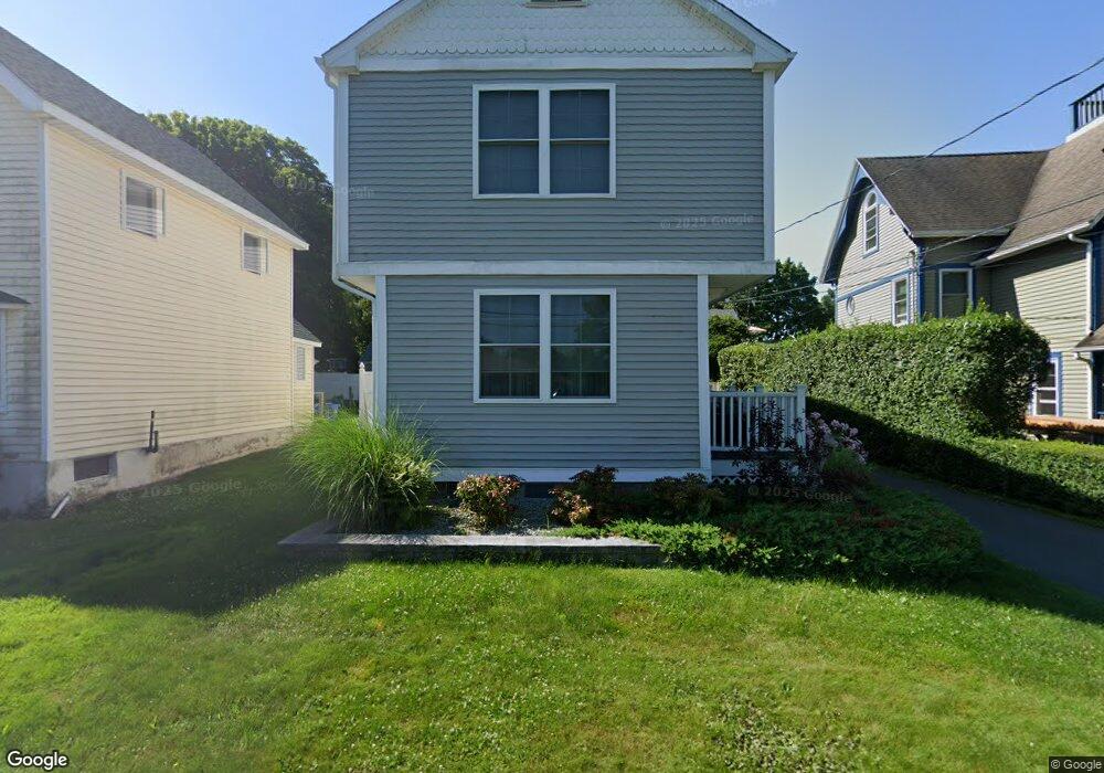
15 Bowhay Hill Rd Branford, CT 06405
Estimated Value: $500,000 - $728,000
3
Beds
3
Baths
1,688
Sq Ft
$370/Sq Ft
Est. Value
About This Home
This home is located at 15 Bowhay Hill Rd, Branford, CT 06405 and is currently estimated at $624,352, approximately $369 per square foot. 15 Bowhay Hill Rd is a home located in New Haven County with nearby schools including Francis Walsh Intermediate School and Branford High School.
Ownership History
Date
Name
Owned For
Owner Type
Purchase Details
Closed on
Nov 4, 2020
Sold by
Lepre Joseph
Bought by
Palluzzi John and Palluzzi Marci
Current Estimated Value
Home Financials for this Owner
Home Financials are based on the most recent Mortgage that was taken out on this home.
Original Mortgage
$380,800
Outstanding Balance
$339,466
Interest Rate
2.9%
Mortgage Type
New Conventional
Estimated Equity
$284,886
Purchase Details
Closed on
Nov 7, 2019
Sold by
Lepre Joseph
Bought by
Lepre Joseph
Create a Home Valuation Report for This Property
The Home Valuation Report is an in-depth analysis detailing your home's value as well as a comparison with similar homes in the area
Home Values in the Area
Average Home Value in this Area
Purchase History
| Date | Buyer | Sale Price | Title Company |
|---|---|---|---|
| Palluzzi John | $476,000 | None Available | |
| Lepre Joseph | -- | -- |
Source: Public Records
Mortgage History
| Date | Status | Borrower | Loan Amount |
|---|---|---|---|
| Open | Palluzzi John | $380,800 |
Source: Public Records
Tax History Compared to Growth
Tax History
| Year | Tax Paid | Tax Assessment Tax Assessment Total Assessment is a certain percentage of the fair market value that is determined by local assessors to be the total taxable value of land and additions on the property. | Land | Improvement |
|---|---|---|---|---|
| 2025 | $7,349 | $343,400 | $96,500 | $246,900 |
| 2024 | $5,983 | $196,300 | $84,200 | $112,100 |
| 2023 | $5,867 | $196,300 | $84,200 | $112,100 |
| 2022 | $5,781 | $196,300 | $84,200 | $112,100 |
| 2021 | $5,528 | $187,700 | $84,200 | $103,500 |
| 2020 | $4,552 | $157,400 | $70,100 | $87,300 |
| 2019 | $7,666 | $167,600 | $74,900 | $92,700 |
| 2018 | $4,800 | $167,600 | $74,900 | $92,700 |
| 2017 | $4,772 | $167,600 | $74,900 | $92,700 |
| 2016 | $4,594 | $167,600 | $74,900 | $92,700 |
| 2015 | $4,513 | $167,600 | $74,900 | $92,700 |
| 2014 | $4,282 | $163,200 | $74,900 | $88,300 |
Source: Public Records
Map
Nearby Homes
- 12 Bowhay Hill Rd
- 0 Reel Island Unit 24071393
- 0 Burr Island
- 55-69 Sawmill Rd
- 294 Thimble Island Rd
- 312 Leetes Island Rd
- 0 Belden Island Unit 24090225
- 8 Gaylea Dr
- 155 Stony Creek Rd
- 33 Thimble Farms Rd
- 0 Rogers Island
- 0 Rogers Island Unit 122749
- 0 Potato Island Unit 24032744
- 3 Ashman Ct
- 12 Wellesley Dr
- 29 Blackstone Ave
- 10 Island View Ave
- 48 Andrews Rd
- 0 Beechwood Rd
- 52 Leighton Trail
- 5 Bowhay Hill Rd
- 17 Bowhay Hill Rd
- 7 Bowhay Hill Rd Unit A
- 7 Bowhay Hill Rd Unit RD
- 19 Bowhay Hill Rd
- 102 Thimble Island Rd
- 8 Bowhay Hill Rd
- 9 Bowhay Hill Rd
- 1 Bowhay Hill Rd
- 23 Bowhay Hill Rd
- 27 Bowhay Hill Rd
- 25 Bowhay Hill Rd
- 94 Thimble Island Rd
- 22 Bowhay Hill Rd Unit 22
- 34 Bowhay Hill Rd
- 42 School St
- 29 Bowhay Hill Rd
- 48 School St
- 20 Bowhay Hill Rd
- 24 Bowhay Hill Rd